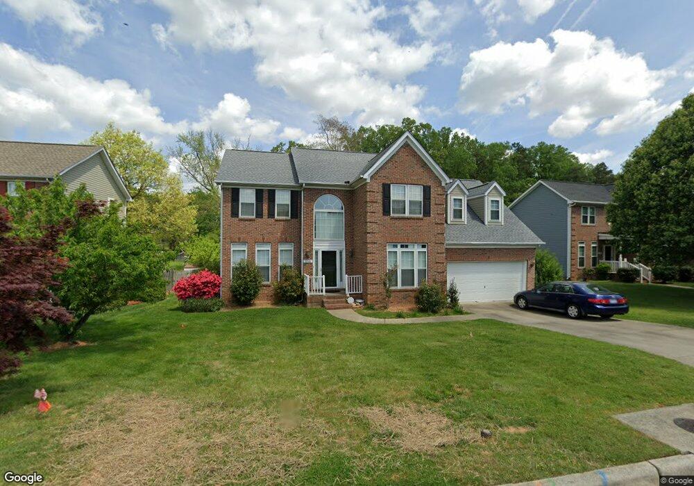
3305 Dairy Point Dr High Point, NC 27265
Sandy Ridge NeighborhoodEstimated Value: $403,000 - $462,000
4
Beds
3
Baths
3,012
Sq Ft
$142/Sq Ft
Est. Value
About This Home
This home is located at 3305 Dairy Point Dr, High Point, NC 27265 and is currently estimated at $427,054, approximately $141 per square foot. 3305 Dairy Point Dr is a home located in Guilford County with nearby schools including Colfax Elementary School, Southwest Guilford Middle School, and Southwest Guilford High School.
Ownership History
Date
Name
Owned For
Owner Type
Purchase Details
Closed on
Jan 23, 2017
Sold by
Jou Shin Shan and Jou Jeanette Bik
Bought by
Jou Shin Shan and Jou Jeanette B
Current Estimated Value
Purchase Details
Closed on
Nov 26, 2008
Sold by
Jou Jason P
Bought by
Jou Shin Shan and Jou Jeanette Bik
Purchase Details
Closed on
Aug 13, 1999
Sold by
Westminster Homes Inc
Bought by
Jou Jeanette and Jou Shin
Home Financials for this Owner
Home Financials are based on the most recent Mortgage that was taken out on this home.
Original Mortgage
$174,900
Interest Rate
7%
Create a Home Valuation Report for This Property
The Home Valuation Report is an in-depth analysis detailing your home's value as well as a comparison with similar homes in the area
Home Values in the Area
Average Home Value in this Area
Purchase History
| Date | Buyer | Sale Price | Title Company |
|---|---|---|---|
| Jou Shin Shan | -- | None Available | |
| Jou Shin Shan | -- | None Available | |
| Jou Jeanette | $219,000 | -- |
Source: Public Records
Mortgage History
| Date | Status | Borrower | Loan Amount |
|---|---|---|---|
| Closed | Jou Jeanette | $174,900 |
Source: Public Records
Tax History
| Year | Tax Paid | Tax Assessment Tax Assessment Total Assessment is a certain percentage of the fair market value that is determined by local assessors to be the total taxable value of land and additions on the property. | Land | Improvement |
|---|---|---|---|---|
| 2025 | $3,904 | $283,300 | $65,000 | $218,300 |
| 2024 | $3,904 | $283,300 | $65,000 | $218,300 |
| 2023 | $3,904 | $283,300 | $65,000 | $218,300 |
| 2022 | $3,819 | $283,300 | $65,000 | $218,300 |
| 2021 | $3,205 | $232,600 | $40,000 | $192,600 |
| 2020 | $3,205 | $232,600 | $40,000 | $192,600 |
| 2019 | $3,205 | $232,600 | $0 | $0 |
| 2018 | $3,189 | $232,600 | $0 | $0 |
| 2017 | $3,205 | $232,600 | $0 | $0 |
| 2016 | $3,231 | $230,400 | $0 | $0 |
| 2015 | $3,249 | $230,400 | $0 | $0 |
| 2014 | $3,304 | $230,400 | $0 | $0 |
Source: Public Records
Map
Nearby Homes
- 3321 Dairy Point Dr
- 4728 Sandy Camp Rd
- 8774 Bame Rd
- 802 Quailmeadow Ln
- 5006 Harness Ln
- 5710 Washburn Ln
- 1341 Grant Haven Ct
- 5614 Edgartown St
- 5627 Edgartown St
- 1351 Grant Haven Ct
- 2459 Tannin Ct
- 4630 White Beard Rd
- 1569 Oakbluffs Dr
- 1560 Barnstable Ct
- 1563 Oakbluffs Dr
- 1558 Oakbluffs Dr
- 1553 Barnstable Ct
- 1557 Oakbluffs Dr
- 1556 Oakbluffs Dr
- 2304 Rockland Cir
- 3309 Dairy Point Dr
- 3301 Dairy Point Dr
- 4918 Devane Ct
- 3313 Dairy Point Dr
- 3300 Dairy Point Dr
- 3308 Dairy Point Dr
- 3317 Dairy Point Dr
- 4914 Devane Ct
- 3312 Dairy Point Dr
- 4915 Devane Ct
- 4910 Devane Ct
- 3316 Dairy Point Dr
- 4911 Devane Ct
- 3325 Dairy Point Dr
- 3320 Dairy Point Dr
- 2505 Sandy Ridge Rd
- 4907 Brian Hollars Ct
- 3329 Dairy Point Dr
- 4903 Brian Hollars Ct
- 2521 Sandy Ridge Rd
Your Personal Tour Guide
Ask me questions while you tour the home.