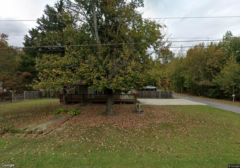
331 Pine Tree Rd Townsend, DE 19734
Estimated Value: $189,000 - $342,000
3
Beds
1
Bath
1,120
Sq Ft
$254/Sq Ft
Est. Value
About This Home
This home is located at 331 Pine Tree Rd, Townsend, DE 19734 and is currently estimated at $284,719, approximately $254 per square foot. 331 Pine Tree Rd is a home located in New Castle County with nearby schools including Townsend Elementary School, Everett Meredith Middle School, and Odessa High School.
Ownership History
Date
Name
Owned For
Owner Type
Purchase Details
Closed on
Sep 1, 2005
Sold by
Taffy Inc
Bought by
Eaddy John C and Eaddy Tracey L
Current Estimated Value
Home Financials for this Owner
Home Financials are based on the most recent Mortgage that was taken out on this home.
Original Mortgage
$104,000
Outstanding Balance
$54,122
Interest Rate
5.81%
Mortgage Type
Fannie Mae Freddie Mac
Estimated Equity
$230,597
Create a Home Valuation Report for This Property
The Home Valuation Report is an in-depth analysis detailing your home's value as well as a comparison with similar homes in the area
Home Values in the Area
Average Home Value in this Area
Purchase History
| Date | Buyer | Sale Price | Title Company |
|---|---|---|---|
| Eaddy John C | $130,000 | -- |
Source: Public Records
Mortgage History
| Date | Status | Borrower | Loan Amount |
|---|---|---|---|
| Open | Eaddy John C | $104,000 |
Source: Public Records
Tax History
| Year | Tax Paid | Tax Assessment Tax Assessment Total Assessment is a certain percentage of the fair market value that is determined by local assessors to be the total taxable value of land and additions on the property. | Land | Improvement |
|---|---|---|---|---|
| 2024 | $1,996 | $47,700 | $10,000 | $37,700 |
| 2023 | $1,696 | $47,700 | $10,000 | $37,700 |
| 2022 | $1,708 | $47,700 | $10,000 | $37,700 |
| 2021 | $1,688 | $47,700 | $10,000 | $37,700 |
| 2020 | $1,668 | $47,700 | $10,000 | $37,700 |
| 2019 | $1,545 | $47,700 | $10,000 | $37,700 |
| 2018 | $1,487 | $47,700 | $10,000 | $37,700 |
| 2017 | $1,424 | $47,700 | $10,000 | $37,700 |
| 2016 | $1,301 | $47,700 | $10,000 | $37,700 |
| 2015 | $1,265 | $47,700 | $10,000 | $37,700 |
| 2014 | $1,262 | $47,700 | $10,000 | $37,700 |
Source: Public Records
Map
Nearby Homes
- 195 Case Rd
- 199 Case Rd
- 203 Case Rd
- 202 Case Rd
- 206 Case Rd
- 208 Case Rd
- 212 Case Rd
- 1038 Fieldsboro Rd
- 1063 Robinson Rd Unit WHITFIELD PLAN
- 1065 Robinson Rd Unit WHITFIELD RANCH PLAN
- 1071 Robinson Rd Unit DELRAY PLAN
- 1067 Robinson Rd Unit LAKELAND PLAN
- 4076 Willey Dr
- 1069 Robinson Rd Unit PEMBROOK PLAN
- 1308 Gibraltar Ct
- 112 Hidden Creek Blvd
- 1027 Robinson Rd
- 1020 Robinson Rd
- 1019 Robinson Rd
- 413 Janets Way
- 327 Pine Tree Rd
- 321 Pine Tree Rd
- 341 Pine Tree Rd
- 311 Pine Tree Rd
- 357 Pine Tree Rd
- 352 Pine Tree Rd
- 352 Pine Tree Rd
- 3821 Dupont Pkwy
- 3829 Dupont Pkwy
- 3681 Harris Rd
- 3835 Dupont Pkwy
- 3839 Dupont Pkwy
- 3845 Dupont Pkwy
- 3859 Dupont Pkwy
- 247 Pine Tree Rd
- 0 Dupont Pkwy
- 3838 Dupont Pkwy
- 3838 Dupont Pkwy
- 3828 Dupont Pkwy
- S Rr 1
Your Personal Tour Guide
Ask me questions while you tour the home.