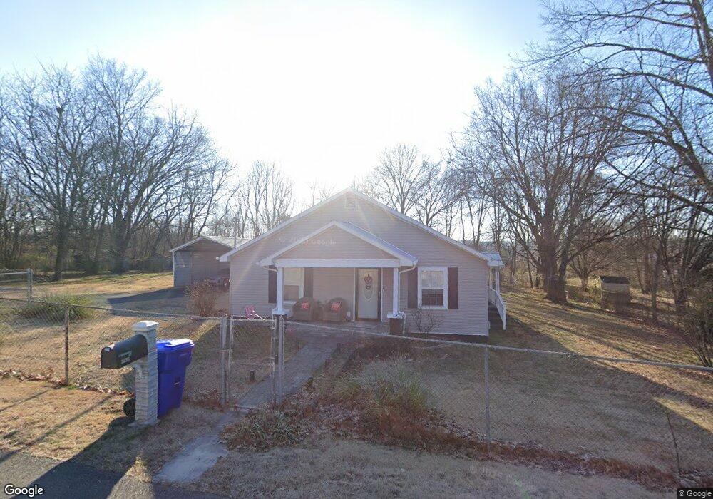
3311 Cedar Ave Strawberry Plains, TN 37871
Estimated Value: $153,148 - $222,000
--
Bed
1
Bath
1,632
Sq Ft
$114/Sq Ft
Est. Value
About This Home
This home is located at 3311 Cedar Ave, Strawberry Plains, TN 37871 and is currently estimated at $185,787, approximately $113 per square foot. 3311 Cedar Ave is a home located in Jefferson County.
Ownership History
Date
Name
Owned For
Owner Type
Purchase Details
Closed on
Dec 28, 2007
Sold by
Hackerson Robert D
Bought by
Steven Houk
Current Estimated Value
Home Financials for this Owner
Home Financials are based on the most recent Mortgage that was taken out on this home.
Original Mortgage
$74,900
Outstanding Balance
$48,783
Interest Rate
6.05%
Estimated Equity
$137,004
Purchase Details
Closed on
Dec 20, 1989
Bought by
Hackerson Robert D and Hackerson Barbara L
Purchase Details
Closed on
Feb 24, 1989
Bought by
Watkins Johnny and Watkins Paula
Purchase Details
Closed on
Jun 1, 1950
Bought by
Stansberry Stansberry L and Stansberry Effie
Create a Home Valuation Report for This Property
The Home Valuation Report is an in-depth analysis detailing your home's value as well as a comparison with similar homes in the area
Home Values in the Area
Average Home Value in this Area
Purchase History
| Date | Buyer | Sale Price | Title Company |
|---|---|---|---|
| Steven Houk | $74,900 | -- | |
| Hackerson Robert D | $28,500 | -- | |
| Watkins Johnny | $34,000 | -- | |
| Stansberry Stansberry L | -- | -- |
Source: Public Records
Mortgage History
| Date | Status | Borrower | Loan Amount |
|---|---|---|---|
| Open | Stansberry Stansberry L | $74,900 |
Source: Public Records
Tax History Compared to Growth
Tax History
| Year | Tax Paid | Tax Assessment Tax Assessment Total Assessment is a certain percentage of the fair market value that is determined by local assessors to be the total taxable value of land and additions on the property. | Land | Improvement |
|---|---|---|---|---|
| 2025 | $473 | $33,075 | $4,750 | $28,325 |
| 2023 | $393 | $17,100 | $0 | $0 |
| 2022 | $374 | $17,100 | $4,250 | $12,850 |
| 2021 | $374 | $17,100 | $4,250 | $12,850 |
| 2020 | $374 | $17,100 | $4,250 | $12,850 |
| 2019 | $374 | $17,100 | $4,250 | $12,850 |
| 2018 | $384 | $16,325 | $4,250 | $12,075 |
| 2017 | $384 | $16,325 | $4,250 | $12,075 |
| 2016 | $384 | $16,325 | $4,250 | $12,075 |
| 2015 | $384 | $16,325 | $4,250 | $12,075 |
| 2014 | $384 | $16,325 | $4,250 | $12,075 |
Source: Public Records
Map
Nearby Homes
- 3136 W Old A J Hwy W
- 174 Big Bend Rd
- 2993 W Old A J Hwy W
- Lots 14&15 W View Dr
- 17-22 & 55 Elm St
- 2928 Bluegrass Ln
- Lots 14-15 W View Dr
- lots 13-16 Elm St
- 3119 Cherokee Ln
- 638 Carrie Cir
- 22 Laura Boling Loop Rd
- 20 Laura Boling Loop Rd
- 10 Laura Boling Loop Rd
- 2 Laura Boling Loop Rd
- 375 Old Dandridge Pike
- Lot 9 Laura Boling Loop Rd
- 13 Laura Boling Loop Rd
- 21 Laura Boling Loop Rd
- 9832 Clift Rd
- 0 Clift Rd