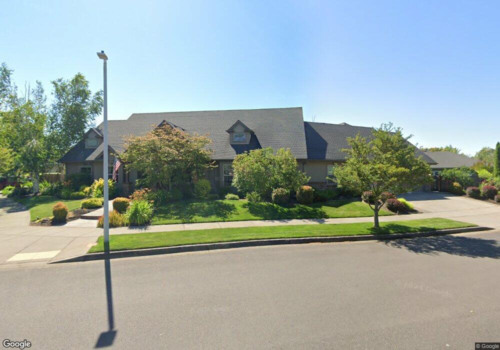
3311 Stony Brook Way Eugene, OR 97408
Harlow NeighborhoodEstimated Value: $952,448 - $1,160,000
4
Beds
3
Baths
2,806
Sq Ft
$375/Sq Ft
Est. Value
About This Home
This home is located at 3311 Stony Brook Way, Eugene, OR 97408 and is currently estimated at $1,053,112, approximately $375 per square foot. 3311 Stony Brook Way is a home located in Lane County with nearby schools including Gilham Elementary School, Cal Young Middle School, and Sheldon High School.
Ownership History
Date
Name
Owned For
Owner Type
Purchase Details
Closed on
Apr 14, 2017
Sold by
Zenke Randall C and Zenke Nancy M
Bought by
Strickland Jeremy and Strickland Sheena
Current Estimated Value
Purchase Details
Closed on
Sep 28, 2005
Sold by
Future B Inc
Bought by
Zenke Randall C and Zenke Nancy M
Purchase Details
Closed on
Aug 31, 2005
Sold by
Gjs Land Co Llc
Bought by
Future B Inc
Create a Home Valuation Report for This Property
The Home Valuation Report is an in-depth analysis detailing your home's value as well as a comparison with similar homes in the area
Home Values in the Area
Average Home Value in this Area
Purchase History
| Date | Buyer | Sale Price | Title Company |
|---|---|---|---|
| Strickland Jeremy | $705,000 | Western Title & Escrow Co | |
| Zenke Randall C | $120,000 | Cascade Title Co | |
| Future B Inc | $120,000 | Cascade Title Co |
Source: Public Records
Tax History
| Year | Tax Paid | Tax Assessment Tax Assessment Total Assessment is a certain percentage of the fair market value that is determined by local assessors to be the total taxable value of land and additions on the property. | Land | Improvement |
|---|---|---|---|---|
| 2025 | $9,651 | $495,353 | -- | -- |
| 2024 | $9,531 | $480,926 | -- | -- |
| 2023 | $9,531 | $466,919 | $0 | $0 |
| 2022 | $8,929 | $453,320 | $0 | $0 |
| 2021 | $8,387 | $440,117 | $0 | $0 |
| 2020 | $8,416 | $427,299 | $0 | $0 |
| 2019 | $8,128 | $414,854 | $0 | $0 |
| 2018 | $7,651 | $391,040 | $0 | $0 |
| 2017 | $7,309 | $391,040 | $0 | $0 |
| 2016 | $7,127 | $379,650 | $0 | $0 |
| 2015 | $6,923 | $368,592 | $0 | $0 |
| 2014 | $6,783 | $357,856 | $0 | $0 |
Source: Public Records
Map
Nearby Homes
- 1794 Kings St N
- 2889 Kinney Loop
- 1993 Best Ln
- 3425 Coburg Rd
- 1564 Regency Dr
- 3090 Willakenzie Rd
- 89805 Sprague Rd
- 2707 Dayna Ln
- 2611 Erin Way
- 1491 Victorian Way
- 2776 Dayna Ln
- 2527 Park View Dr
- 0 Sprig Ln Unit Lot 3
- 0 Sprig Ln Unit Lot 3 766109892
- 2752 Dayna Ln
- 2461 Mountain Terrace
- 2577 Elysium Ave
- 2645 Chuckanut St
- 2915 Chuckanut St
- 1271 Arcadia Dr
- 3345 Stony Brook Way
- 3355 Cape Hatteras Dr
- 2624 Chesapeake Dr
- 3361 Cape Hatteras Dr
- 3349 Roanoke Ave
- 3320 Stony Brook Way
- 3387 Stony Brook Way
- 2640 Chesapeake Dr
- 3346 Roanoke Ave
- 3373 Cape Hatteras Dr
- 2628 Valley Forge Dr
- 2653 Chesapeake Dr
- 3327 Roanoke Ave
- 3352 Cape Hatteras Dr
- 3358 Cape Hatteras Dr
- 3344 Wilmington Ct
- 2658 Chesapeake Dr
- 3330 Roanoke Ave
- 2640 Valley Forge Dr
Your Personal Tour Guide
Ask me questions while you tour the home.