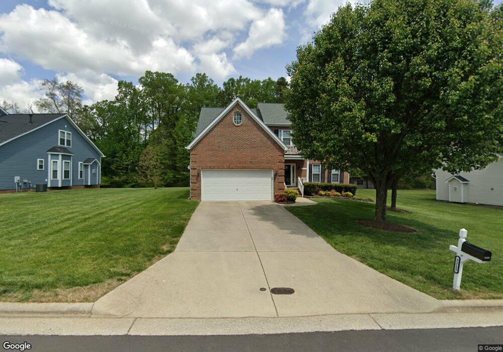
3313 Dairy Point Dr High Point, NC 27265
Sandy Ridge NeighborhoodEstimated Value: $407,000 - $449,000
4
Beds
3
Baths
2,821
Sq Ft
$151/Sq Ft
Est. Value
About This Home
This home is located at 3313 Dairy Point Dr, High Point, NC 27265 and is currently estimated at $424,711, approximately $150 per square foot. 3313 Dairy Point Dr is a home located in Guilford County with nearby schools including Colfax Elementary School, Southwest Guilford Middle School, and Southwest Guilford High School.
Ownership History
Date
Name
Owned For
Owner Type
Purchase Details
Closed on
Dec 14, 1999
Sold by
Westminster Homes Inc
Bought by
Purcell Alex and Purcell Sallie M
Current Estimated Value
Home Financials for this Owner
Home Financials are based on the most recent Mortgage that was taken out on this home.
Original Mortgage
$184,000
Outstanding Balance
$56,818
Interest Rate
7.68%
Estimated Equity
$367,893
Create a Home Valuation Report for This Property
The Home Valuation Report is an in-depth analysis detailing your home's value as well as a comparison with similar homes in the area
Home Values in the Area
Average Home Value in this Area
Purchase History
| Date | Buyer | Sale Price | Title Company |
|---|---|---|---|
| Purcell Alex | $195,000 | -- |
Source: Public Records
Mortgage History
| Date | Status | Borrower | Loan Amount |
|---|---|---|---|
| Open | Purcell Alex | $184,000 |
Source: Public Records
Tax History Compared to Growth
Tax History
| Year | Tax Paid | Tax Assessment Tax Assessment Total Assessment is a certain percentage of the fair market value that is determined by local assessors to be the total taxable value of land and additions on the property. | Land | Improvement |
|---|---|---|---|---|
| 2025 | $3,823 | $277,400 | $65,000 | $212,400 |
| 2024 | $3,823 | $277,400 | $65,000 | $212,400 |
| 2023 | $3,823 | $277,400 | $65,000 | $212,400 |
| 2022 | $3,739 | $277,400 | $65,000 | $212,400 |
| 2021 | $3,145 | $228,200 | $40,000 | $188,200 |
| 2020 | $3,145 | $228,200 | $40,000 | $188,200 |
| 2019 | $3,145 | $228,200 | $0 | $0 |
| 2018 | $3,129 | $228,200 | $0 | $0 |
| 2017 | $3,145 | $228,200 | $0 | $0 |
| 2016 | $3,168 | $225,900 | $0 | $0 |
| 2015 | $3,185 | $225,900 | $0 | $0 |
| 2014 | $3,239 | $225,900 | $0 | $0 |
Source: Public Records
Map
Nearby Homes
- 8045 Clinard Farms Rd
- 8316 Lakedale Cir
- 8314 Lakedale Cir
- 4603 Owls View Ct
- 4728 Sandy Camp Rd
- 2212 Alamar Ct
- 8774 Bame Rd
- 1341 Grant Haven Ct
- 5705 Marblehead Dr
- 1350 Grant Haven Ct
- 1351 Grant Haven Ct
- 1569 Oakbluffs Dr
- 4743 Willowstone Dr
- 1563 Oakbluffs Dr
- 2304 Rockland Cir
- 4725 Willowstone Dr
- 1558 Oakbluffs Dr
- 4723 Willowstone Dr
- 1556 Oakbluffs Dr
- 4717 Willowstone Dr
- 3317 Dairy Point Dr
- 3309 Dairy Point Dr
- 3321 Dairy Point Dr
- 3305 Dairy Point Dr
- 3312 Dairy Point Dr
- 3316 Dairy Point Dr
- 3308 Dairy Point Dr
- 4918 Devane Ct
- 3325 Dairy Point Dr
- 3301 Dairy Point Dr
- 3320 Dairy Point Dr
- 4907 Brian Hollars Ct
- 4914 Devane Ct
- 3329 Dairy Point Dr
- 4903 Brian Hollars Ct
- 3300 Dairy Point Dr
- 4910 Devane Ct
- 4915 Devane Ct
- 4904 Brian Hollars Ct
- 4900 Brian Hollars Ct