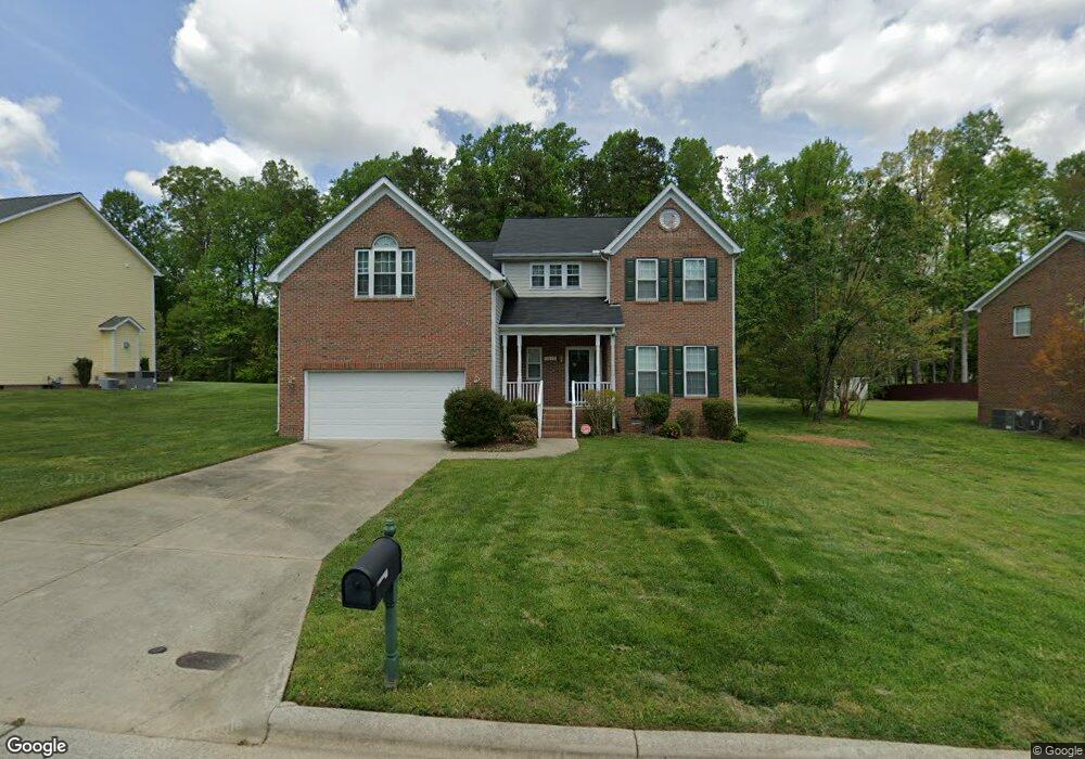
3317 Dairy Point Dr High Point, NC 27265
Sandy Ridge NeighborhoodEstimated Value: $393,000 - $456,000
4
Beds
3
Baths
2,749
Sq Ft
$151/Sq Ft
Est. Value
About This Home
This home is located at 3317 Dairy Point Dr, High Point, NC 27265 and is currently estimated at $416,123, approximately $151 per square foot. 3317 Dairy Point Dr is a home located in Guilford County with nearby schools including Colfax Elementary School, Southwest Guilford Middle School, and Southwest Guilford High School.
Ownership History
Date
Name
Owned For
Owner Type
Purchase Details
Closed on
Aug 2, 2005
Bought by
Hall Carl J
Current Estimated Value
Purchase Details
Closed on
May 23, 2005
Sold by
Irwin Christopher D and Irwin Susan Maree
Bought by
Hall Carl J and Hall Angie R
Home Financials for this Owner
Home Financials are based on the most recent Mortgage that was taken out on this home.
Original Mortgage
$222,183
Interest Rate
5.74%
Mortgage Type
Fannie Mae Freddie Mac
Purchase Details
Closed on
Jan 10, 2000
Sold by
Westminster Homes Inc
Bought by
Irwin Christopher D and Irwin Susan Maree
Home Financials for this Owner
Home Financials are based on the most recent Mortgage that was taken out on this home.
Original Mortgage
$159,200
Interest Rate
7.9%
Create a Home Valuation Report for This Property
The Home Valuation Report is an in-depth analysis detailing your home's value as well as a comparison with similar homes in the area
Home Values in the Area
Average Home Value in this Area
Purchase History
| Date | Buyer | Sale Price | Title Company |
|---|---|---|---|
| Hall Carl J | $218,900 | -- | |
| Hall Carl J | $219,000 | -- | |
| Irwin Christopher D | $203,000 | -- |
Source: Public Records
Mortgage History
| Date | Status | Borrower | Loan Amount |
|---|---|---|---|
| Previous Owner | Hall Carl J | $222,183 | |
| Previous Owner | Irwin Christopher D | $159,200 |
Source: Public Records
Tax History Compared to Growth
Tax History
| Year | Tax Paid | Tax Assessment Tax Assessment Total Assessment is a certain percentage of the fair market value that is determined by local assessors to be the total taxable value of land and additions on the property. | Land | Improvement |
|---|---|---|---|---|
| 2025 | $3,745 | $271,800 | $65,000 | $206,800 |
| 2024 | $3,745 | $271,800 | $65,000 | $206,800 |
| 2023 | $3,745 | $271,800 | $65,000 | $206,800 |
| 2022 | $3,664 | $271,800 | $65,000 | $206,800 |
| 2021 | $3,088 | $224,100 | $40,000 | $184,100 |
| 2020 | $3,088 | $224,100 | $40,000 | $184,100 |
| 2019 | $2,964 | $215,100 | $0 | $0 |
| 2018 | $2,949 | $215,100 | $0 | $0 |
| 2017 | $2,949 | $215,100 | $0 | $0 |
| 2016 | $2,975 | $212,100 | $0 | $0 |
| 2015 | $2,991 | $212,100 | $0 | $0 |
| 2014 | $3,042 | $212,100 | $0 | $0 |
Source: Public Records
Map
Nearby Homes
- 4603 Owls View Ct
- 4728 Sandy Camp Rd
- 2150 Alamar Dr
- 5012 Rosemont Ct
- 2156 Rosemont Dr
- 8774 Bame Rd
- 1341 Grant Haven Ct
- 5707 Washburn Ln
- 1350 Grant Haven Ct
- 2403 Hammock Dr
- 1351 Grant Haven Ct
- 5705 Marblehead Dr
- Devon Plan at Trellises
- Greenwich Plan at Trellises
- Franklin Plan at Trellises
- Bermuda Plan at Trellises
- Cayman X Plan at Trellises
- Cayman Plan at Trellises
- Essex Plan at Trellises
- Kingston Plan at Trellises
- 3321 Dairy Point Dr
- 3313 Dairy Point Dr
- 3325 Dairy Point Dr
- 3309 Dairy Point Dr
- 3316 Dairy Point Dr
- 3312 Dairy Point Dr
- 4907 Brian Hollars Ct
- 3320 Dairy Point Dr
- 3329 Dairy Point Dr
- 3305 Dairy Point Dr
- 3308 Dairy Point Dr
- 4918 Devane Ct
- 4903 Brian Hollars Ct
- 3301 Dairy Point Dr
- 4914 Devane Ct
- 4904 Brian Hollars Ct
- 4908 Brian Hollars Ct
- 4900 Brian Hollars Ct
- 3405 Dairy Point Dr
- 4910 Devane Ct