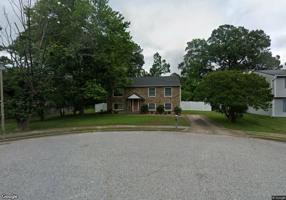
332 Bromsgrove Dr Hampton, VA 23666
Northampton NeighborhoodEstimated Value: $350,334 - $367,000
4
Beds
2
Baths
2,094
Sq Ft
$171/Sq Ft
Est. Value
About This Home
This home is located at 332 Bromsgrove Dr, Hampton, VA 23666 and is currently estimated at $357,584, approximately $170 per square foot. 332 Bromsgrove Dr is a home located in Hampton City with nearby schools including Christopher C. Kraft Elementary School, Cesar Tarrant Middle School, and Bethel High School.
Ownership History
Date
Name
Owned For
Owner Type
Purchase Details
Closed on
Aug 14, 2003
Sold by
Gardner Michael
Bought by
Wilkes Lisa
Current Estimated Value
Home Financials for this Owner
Home Financials are based on the most recent Mortgage that was taken out on this home.
Original Mortgage
$123,405
Outstanding Balance
$51,884
Interest Rate
5.46%
Mortgage Type
New Conventional
Estimated Equity
$305,700
Create a Home Valuation Report for This Property
The Home Valuation Report is an in-depth analysis detailing your home's value as well as a comparison with similar homes in the area
Home Values in the Area
Average Home Value in this Area
Purchase History
| Date | Buyer | Sale Price | Title Company |
|---|---|---|---|
| Wilkes Lisa | $129,900 | -- |
Source: Public Records
Mortgage History
| Date | Status | Borrower | Loan Amount |
|---|---|---|---|
| Open | Wilkes Lisa | $123,405 |
Source: Public Records
Tax History
| Year | Tax Paid | Tax Assessment Tax Assessment Total Assessment is a certain percentage of the fair market value that is determined by local assessors to be the total taxable value of land and additions on the property. | Land | Improvement |
|---|---|---|---|---|
| 2025 | $3,799 | $322,400 | $65,000 | $257,400 |
| 2024 | $3,627 | $315,400 | $65,000 | $250,400 |
| 2023 | $3,509 | $290,300 | $65,000 | $225,300 |
| 2022 | $3,132 | $265,400 | $60,000 | $205,400 |
| 2021 | $3,065 | $236,700 | $56,000 | $180,700 |
| 2020 | $2,748 | $221,600 | $56,000 | $165,600 |
| 2019 | $2,321 | $187,200 | $49,700 | $137,500 |
| 2018 | $2,359 | $187,200 | $49,700 | $137,500 |
| 2017 | $2,415 | $0 | $0 | $0 |
| 2016 | $2,415 | $187,200 | $0 | $0 |
| 2015 | $2,304 | $0 | $0 | $0 |
| 2014 | $2,294 | $178,200 | $49,700 | $128,500 |
Source: Public Records
Map
Nearby Homes
- 25 Madrone Place
- 9 Madrone Place
- 5 Frankie P Engel St
- 13 Golden Willow Cir
- 512 Concord Dr
- 146 Lynnhaven Dr
- 119 Cape Dorey Dr Unit 3A
- 17 Cape Dorey Dr Unit 3A
- 15 Woodsman Rd
- 73 Wells Ct
- 130 Wells Ct
- 204 Springdale Way
- 56 Wells Ct
- 58 Wells Ct Unit 2
- 96 Wells Ct Unit 2
- 113 Davenport Ct Unit 2
- 4 Verde Quay Unit F
- 15 Woodrose Place
- 109 Hampton Club Dr Unit 3
- 314 Pacific Dr
- 330 Bromsgrove Dr
- 340 Bromsgrove Dr
- 327 Lynnhaven Dr
- 328 Bromsgrove Dr
- 325 Lynnhaven Dr
- 342 Bromsgrove Dr
- 333 Bromsgrove Dr
- 331 Bromsgrove Dr
- 335 Bromsgrove Dr
- 326 Bromsgrove Dr
- 323 Lynnhaven Dr
- 328 Lynnhaven Dr
- 329 Bromsgrove Dr
- 344 Bromsgrove Dr
- 337 Bromsgrove Dr
- 321 Lynnhaven Dr
- 324 Bromsgrove Dr
- 327 Bromsgrove Dr
- 339 Bromsgrove Dr
- 341 Bromsgrove Dr
Your Personal Tour Guide
Ask me questions while you tour the home.