Estimated Value: $479,000 - $604,000
3
Beds
4
Baths
2,062
Sq Ft
$264/Sq Ft
Est. Value
About This Home
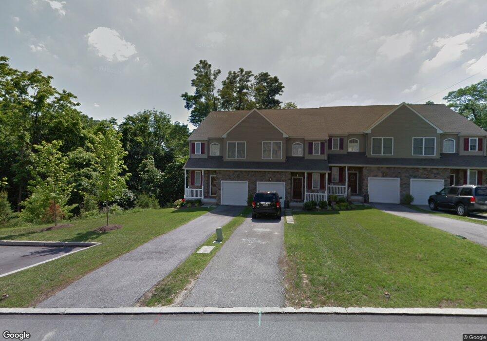
This home is located at 332 Burnt Church Ct, Media, PA 19063 and is currently estimated at $544,446, approximately $264 per square foot. 332 Burnt Church Ct is a home located in Delaware County with nearby schools including Glenwood Elementary School, Springton Lake Middle School, and Penncrest High School.
Ownership History
Date
Name
Owned For
Owner Type
Purchase Details
Closed on
May 5, 2009
Sold by
Willowbank Development Llc
Bought by
Parkmount Properties Inc
Current Estimated Value
Purchase Details
Closed on
Oct 14, 2004
Sold by
Grc Development Corp
Bought by
Willowbank Development Llc
Home Financials for this Owner
Home Financials are based on the most recent Mortgage that was taken out on this home.
Original Mortgage
$4,096,000
Interest Rate
5.85%
Mortgage Type
Purchase Money Mortgage
Create a Home Valuation Report for This Property
The Home Valuation Report is an in-depth analysis detailing your home's value as well as a comparison with similar homes in the area
Home Values in the Area
Average Home Value in this Area
Purchase History
| Date | Buyer | Sale Price | Title Company |
|---|---|---|---|
| Parkmount Properties Inc | $388,000 | None Available | |
| Willowbank Development Llc | $1,500,000 | -- |
Source: Public Records
Mortgage History
| Date | Status | Borrower | Loan Amount |
|---|---|---|---|
| Previous Owner | Willowbank Development Llc | $4,096,000 |
Source: Public Records
Tax History Compared to Growth
Tax History
| Year | Tax Paid | Tax Assessment Tax Assessment Total Assessment is a certain percentage of the fair market value that is determined by local assessors to be the total taxable value of land and additions on the property. | Land | Improvement |
|---|---|---|---|---|
| 2025 | $5,874 | $303,810 | $65,620 | $238,190 |
| 2024 | $5,874 | $303,810 | $65,620 | $238,190 |
| 2023 | $5,667 | $303,810 | $65,620 | $238,190 |
| 2022 | $5,521 | $303,810 | $65,620 | $238,190 |
| 2021 | $9,402 | $303,810 | $65,620 | $238,190 |
| 2020 | $6,435 | $190,800 | $43,680 | $147,120 |
| 2019 | $6,230 | $190,800 | $43,680 | $147,120 |
| 2018 | $6,143 | $190,800 | $0 | $0 |
| 2017 | $6,006 | $190,800 | $0 | $0 |
| 2016 | $1,047 | $190,800 | $0 | $0 |
| 2015 | $1,047 | $190,800 | $0 | $0 |
| 2014 | $1,047 | $190,800 | $0 | $0 |
Source: Public Records
Map
Nearby Homes
- 234 Elm Ave
- 208 S Pennell Rd
- 206 Chestnut Ave
- 209 Martins Ln
- 30 Rampart W
- 23 Rampart W
- 440 Derry Dr Unit 440
- 237 Harvey Ln
- 268 Miley Rd Unit 268
- 346 Lenni Rd
- 571 Mount Alverno Rd
- 305 Crozerville Rd
- 242 Moria Place
- 226 Moria Place
- 532 Williamson Cir
- 630 Mount Alverno Rd
- 523 Summit Ct
- 20 Abel Place
- 131 Junction Rd
- 475 Mount Alverno Rd
- 306 Burnt Church Ct
- 308 Burnt Church Ct
- 336 Burnt Church Ct
- 310 Burnt Church Ct
- 304 Burnt Church Ct
- 338 Burnt Church Ct
- 334 Burnt Church Ct
- 302 Burnt Church Ct
- 300 Burnt Church Ct
- 320 Burnt Church Ct
- 322 Burnt Church Ct
- 331 Burnt Church Ct
- 324 Burnt Church Ct
- 333 Burnt Church Ct
- 326 Burnt Church Ct
- 337 Burnt Church Ct
- 328 Burnt Church Ct
- 339 Burnt Church Ct
- 330 Burnt Church Ct Unit 34
- 341 Burnt Church Ct