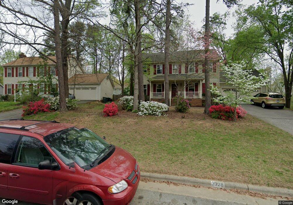
3328 Cardinal Ridge Dr Greensboro, NC 27410
Estimated Value: $384,000 - $406,000
4
Beds
3
Baths
2,156
Sq Ft
$181/Sq Ft
Est. Value
About This Home
This home is located at 3328 Cardinal Ridge Dr, Greensboro, NC 27410 and is currently estimated at $391,029, approximately $181 per square foot. 3328 Cardinal Ridge Dr is a home located in Guilford County with nearby schools including E.P. Pearce Elementary School, Kernodle Middle School, and Northwest Guilford High School.
Ownership History
Date
Name
Owned For
Owner Type
Purchase Details
Closed on
Jul 1, 2008
Bought by
Unknown Owner
Current Estimated Value
Purchase Details
Closed on
Apr 15, 2005
Sold by
Peaslee Philip C and Peaslee Jennifer M
Bought by
Barber John T and Barber Margaret K
Home Financials for this Owner
Home Financials are based on the most recent Mortgage that was taken out on this home.
Original Mortgage
$127,500
Interest Rate
5.74%
Mortgage Type
Fannie Mae Freddie Mac
Purchase Details
Closed on
Jul 28, 1998
Sold by
Swanick Dennis J and Swanick Iris S
Bought by
Peaslee Philip C and Peaslee Jennifer M
Home Financials for this Owner
Home Financials are based on the most recent Mortgage that was taken out on this home.
Original Mortgage
$133,200
Interest Rate
6.97%
Create a Home Valuation Report for This Property
The Home Valuation Report is an in-depth analysis detailing your home's value as well as a comparison with similar homes in the area
Home Values in the Area
Average Home Value in this Area
Purchase History
| Date | Buyer | Sale Price | Title Company |
|---|---|---|---|
| Unknown Owner | -- | -- | |
| Barber John T | $177,500 | -- | |
| Peaslee Philip C | $166,500 | -- |
Source: Public Records
Mortgage History
| Date | Status | Borrower | Loan Amount |
|---|---|---|---|
| Previous Owner | Barber John T | $127,500 | |
| Previous Owner | Peaslee Philip C | $133,200 |
Source: Public Records
Tax History Compared to Growth
Tax History
| Year | Tax Paid | Tax Assessment Tax Assessment Total Assessment is a certain percentage of the fair market value that is determined by local assessors to be the total taxable value of land and additions on the property. | Land | Improvement |
|---|---|---|---|---|
| 2025 | $3,416 | $243,500 | $65,000 | $178,500 |
| 2024 | $3,416 | $243,500 | $65,000 | $178,500 |
| 2023 | $3,416 | $243,500 | $65,000 | $178,500 |
| 2022 | $3,319 | $243,500 | $65,000 | $178,500 |
| 2021 | $2,814 | $202,000 | $45,000 | $157,000 |
| 2020 | $2,814 | $202,000 | $45,000 | $157,000 |
| 2019 | $2,814 | $202,000 | $0 | $0 |
| 2018 | $2,733 | $202,000 | $0 | $0 |
| 2017 | $2,753 | $202,000 | $0 | $0 |
| 2016 | $2,600 | $187,800 | $0 | $0 |
| 2015 | $2,615 | $187,800 | $0 | $0 |
| 2014 | $2,634 | $187,800 | $0 | $0 |
Source: Public Records
Map
Nearby Homes
- 6402 Lakebend Way
- 6880 Ironwood Cir
- 6400 Muirfield Dr
- 6313 Bonnybrook Ct
- 6204 Muirfield Dr
- 6308 Bonnybrook Ct
- 6310 Birch Pond Rd
- 4428 Cove Cay Ln
- 3659 Cherry Hill Dr
- 6401 Estes Ct
- 3231 Cheswick Dr
- 3216 Cottingham Ct
- 4 Limerock Ct
- 4903 Tamaron Dr
- 4805 Tamaron Dr
- 4305 Kerwick Dr
- 6424 Highland Oak Dr
- 6003 Muirfield Dr
- 6100 Dawn Ridge Trail
- 6001 Muirfield Dr
- 3330 Cardinal Ridge Dr
- 3326 Cardinal Ridge Dr
- 6411 Cardinal Wood Dr
- 3332 Cardinal Ridge Dr
- 3324 Cardinal Ridge Dr
- 6409 Cardinal Wood Dr
- 6413 Cardinal Wood Dr
- 3327 Cardinal Ridge Dr
- 3325 Cardinal Ridge Dr
- 6415 Cardinal Wood Dr
- 3323 Cardinal Ridge Dr
- 3329 Cardinal Ridge Dr
- 3322 Cardinal Ridge Dr
- 6407 Cardinal Wood Dr
- 3334 Cardinal Ridge Dr
- 6603 River Hills Dr
- 3321 Cardinal Ridge Dr
- 6701 River Hills Dr
- 3320 Cardinal Ridge Dr
- 6405 Cardinal Wood Dr