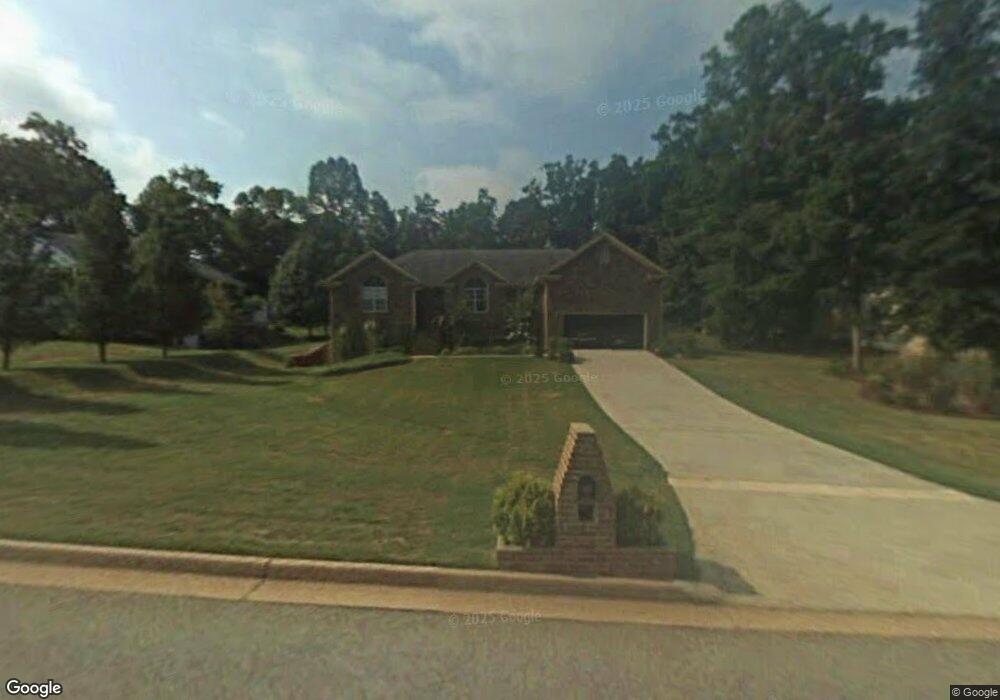
333 Mckenzie Dr Stockbridge, GA 30281
Estimated Value: $322,856 - $361,000
3
Beds
2
Baths
2,163
Sq Ft
$159/Sq Ft
Est. Value
About This Home
This home is located at 333 Mckenzie Dr, Stockbridge, GA 30281 and is currently estimated at $343,464, approximately $158 per square foot. 333 Mckenzie Dr is a home located in Henry County with nearby schools including Woodland Elementary School, Woodland Middle School, and Woodland High School.
Ownership History
Date
Name
Owned For
Owner Type
Purchase Details
Closed on
Oct 23, 1998
Sold by
G & H Quality Homes
Bought by
Benjamin Gregory
Current Estimated Value
Home Financials for this Owner
Home Financials are based on the most recent Mortgage that was taken out on this home.
Original Mortgage
$163,750
Outstanding Balance
$34,956
Interest Rate
6.61%
Mortgage Type
VA
Estimated Equity
$308,508
Create a Home Valuation Report for This Property
The Home Valuation Report is an in-depth analysis detailing your home's value as well as a comparison with similar homes in the area
Home Values in the Area
Average Home Value in this Area
Purchase History
| Date | Buyer | Sale Price | Title Company |
|---|---|---|---|
| Benjamin Gregory | $159,000 | -- |
Source: Public Records
Mortgage History
| Date | Status | Borrower | Loan Amount |
|---|---|---|---|
| Open | Benjamin Gregory | $163,750 |
Source: Public Records
Tax History Compared to Growth
Tax History
| Year | Tax Paid | Tax Assessment Tax Assessment Total Assessment is a certain percentage of the fair market value that is determined by local assessors to be the total taxable value of land and additions on the property. | Land | Improvement |
|---|---|---|---|---|
| 2025 | $694 | $150,640 | $18,000 | $132,640 |
| 2024 | $694 | $139,480 | $18,000 | $121,480 |
| 2023 | $379 | $138,480 | $16,000 | $122,480 |
| 2022 | $313 | $112,240 | $12,000 | $100,240 |
| 2021 | $65 | $94,320 | $12,000 | $82,320 |
| 2020 | $65 | $86,560 | $10,800 | $75,760 |
| 2019 | $65 | $84,120 | $10,800 | $73,320 |
| 2018 | $0 | $77,480 | $10,000 | $67,480 |
| 2016 | $65 | $61,200 | $10,000 | $51,200 |
| 2015 | -- | $53,680 | $7,200 | $46,480 |
| 2014 | $1,778 | $50,160 | $7,200 | $42,960 |
Source: Public Records
Map
Nearby Homes
- 0 Mckenzie Ave Unit 10593345
- 564 Mckenzie Ave
- 320 Mckenzie Dr
- 608 Mckenzie Cir
- 719 Erin Dr
- 164 Mckenzie Ct
- 805 Anna Kathryn Dr
- 825 Anna Kathryn Dr
- 809 Anna Kathryn Dr
- 807 Anna Kathryn Dr
- 829 Anna Kathryn Dr
- 830 Anna Kathryn Dr
- 811 Anna Kathryn Dr
- 831 Anna Kathryn Dr
- 813 Anna Kathryn Dr
- 1720 Highway 138 E
- 551 Hood Rd
- 95 Fern Ct
- 1810 Highway 138 E
- 65 Wynfield Dr
- 325 Mckenzie Dr
- 341 Mckenzie Dr
- 341 Mckenzie Dr Unit 40
- 1 Room McKenzie Subdivision
- 1 Room In McKenzie Subdivision
- 0 Mckenzie Dr Unit 7400785
- 0 Mckenzie Dr Unit 8388516
- 0 Mckenzie Dr Unit 8345817
- 0 Mckenzie Dr Unit 8351420
- 0 Mckenzie Dr Unit 8172431
- 0 Mckenzie Dr Unit 8745337
- 0 Mckenzie Dr
- 504 Mckenzie Ave
- 317 Mckenzie Dr
- 496 Mckenzie Ave
- 512 Mckenzie Ave
- 344 Mckenzie Dr
- 336 Mckenzie Dr
- 352 Mckenzie Dr
- 488 Mckenzie Ave