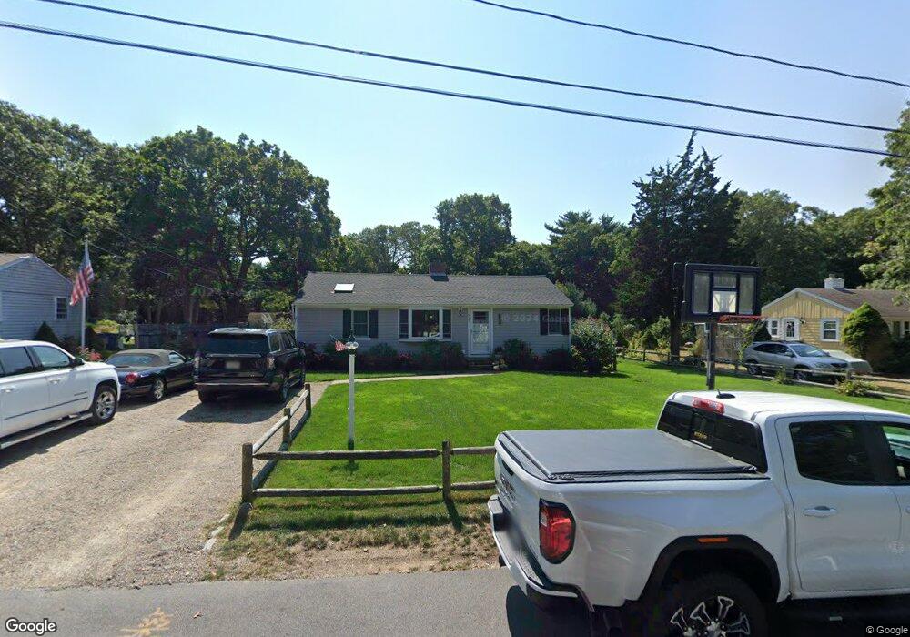
333 Poponessett Rd Cotuit, MA 02635
Cotuit NeighborhoodEstimated Value: $693,000 - $1,054,000
3
Beds
2
Baths
1,726
Sq Ft
$486/Sq Ft
Est. Value
About This Home
This home is located at 333 Poponessett Rd, Cotuit, MA 02635 and is currently estimated at $838,874, approximately $486 per square foot. 333 Poponessett Rd is a home located in Barnstable County with nearby schools including West Villages Elementary School, Barnstable United Elementary School, and Barnstable Intermediate School.
Ownership History
Date
Name
Owned For
Owner Type
Purchase Details
Closed on
Sep 26, 2014
Sold by
Oakley Franklin C and Souza Lesley A
Bought by
Souza Lesley A
Current Estimated Value
Home Financials for this Owner
Home Financials are based on the most recent Mortgage that was taken out on this home.
Original Mortgage
$195,000
Outstanding Balance
$143,209
Interest Rate
3%
Mortgage Type
Adjustable Rate Mortgage/ARM
Estimated Equity
$695,665
Purchase Details
Closed on
Jul 27, 1993
Sold by
Selby Darin H and Barnstable Comnty Fcu
Bought by
Souza Lesley A
Purchase Details
Closed on
May 31, 1990
Sold by
Barnstable Community
Bought by
Selby Darin H
Home Financials for this Owner
Home Financials are based on the most recent Mortgage that was taken out on this home.
Original Mortgage
$125,000
Interest Rate
10.25%
Mortgage Type
Purchase Money Mortgage
Create a Home Valuation Report for This Property
The Home Valuation Report is an in-depth analysis detailing your home's value as well as a comparison with similar homes in the area
Home Values in the Area
Average Home Value in this Area
Purchase History
| Date | Buyer | Sale Price | Title Company |
|---|---|---|---|
| Souza Lesley A | -- | -- | |
| Souza Lesley A | $75,000 | -- | |
| Selby Darin H | $125,000 | -- |
Source: Public Records
Mortgage History
| Date | Status | Borrower | Loan Amount |
|---|---|---|---|
| Open | Souza Lesley A | $195,000 | |
| Previous Owner | Selby Darin H | $165,000 | |
| Previous Owner | Selby Darin H | $147,500 | |
| Previous Owner | Selby Darin H | $125,000 |
Source: Public Records
Tax History Compared to Growth
Tax History
| Year | Tax Paid | Tax Assessment Tax Assessment Total Assessment is a certain percentage of the fair market value that is determined by local assessors to be the total taxable value of land and additions on the property. | Land | Improvement |
|---|---|---|---|---|
| 2025 | $5,498 | $658,500 | $189,200 | $469,300 |
| 2024 | $5,005 | $635,200 | $189,200 | $446,000 |
| 2023 | $4,124 | $492,700 | $187,000 | $305,700 |
| 2022 | $4,128 | $399,200 | $132,900 | $266,300 |
| 2021 | $3,697 | $334,800 | $132,900 | $201,900 |
| 2020 | $3,779 | $322,700 | $132,900 | $189,800 |
| 2019 | $3,530 | $297,100 | $132,900 | $164,200 |
| 2018 | $3,342 | $281,300 | $145,800 | $135,500 |
| 2017 | $3,226 | $273,400 | $145,800 | $127,600 |
| 2016 | $3,119 | $271,000 | $143,400 | $127,600 |
| 2015 | $3,259 | $282,900 | $144,400 | $138,500 |
Source: Public Records
Map
Nearby Homes
- 105 Bay Rd
- 46 Oak St
- 46 Oak St
- 6 Cedar St
- 6 Cedar St
- 266 School St
- 30 Wings Ln
- 1081 Main St
- 640 Poponessett Rd
- 640 Poponessett Rd
- 15 Riverview Ave Unit 15E
- 16 Cedar St
- 43 Poponessett Rd
- 15 E Riverview Ave Unit 15E
- 1311 Main St
- 188 Ocean View Ave
- 55 Shoestring Bay Rd
- 61 Shoestring Bay Rd
- 916 Main St
- 353 Simons Narrows Rd
- 325 Poponessett Rd
- 341 Poponessett Rd
- 338 Poponessett Rd
- 351 Poponessett Rd
- 42 Guimquissett Rd
- 21 Quimquissett Rd
- 21 Quimquissett Rd
- 361 Poponessett Rd
- 21 Guimquissett Rd
- 52 Guimquissett Rd
- 184 Crockers Neck Rd
- 354 Poponessett Rd
- 202 Crockers Neck Rd
- 60 Guimquissett Rd
- 304 Poponessett Rd
- 72 Bayberry Ln
- 371 Poponessett Rd
- 172 Crockers Neck Rd
- 220 Crockers Neck Rd
- 62 Bayberry Ln