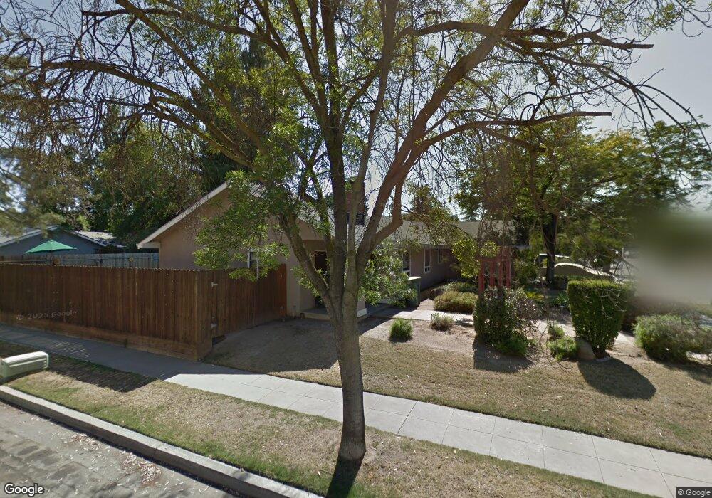
3333 E Los Altos Ave Fresno, CA 93710
Hoover NeighborhoodEstimated Value: $459,164 - $591,000
4
Beds
2
Baths
2,106
Sq Ft
$241/Sq Ft
Est. Value
About This Home
This home is located at 3333 E Los Altos Ave, Fresno, CA 93710 and is currently estimated at $507,291, approximately $240 per square foot. 3333 E Los Altos Ave is a home located in Fresno County with nearby schools including Cole Elementary School, Alta Sierra Intermediate School, and Buchanan High School.
Ownership History
Date
Name
Owned For
Owner Type
Purchase Details
Closed on
Jan 25, 2022
Sold by
Torres Abraham C and Torres Norma L
Bought by
Torres Family Trust
Current Estimated Value
Purchase Details
Closed on
Sep 12, 1996
Sold by
Rutter William F and Rutter Myntje W
Bought by
Torres Abraham C and Torres Norma L
Home Financials for this Owner
Home Financials are based on the most recent Mortgage that was taken out on this home.
Original Mortgage
$123,773
Interest Rate
8.37%
Mortgage Type
FHA
Create a Home Valuation Report for This Property
The Home Valuation Report is an in-depth analysis detailing your home's value as well as a comparison with similar homes in the area
Home Values in the Area
Average Home Value in this Area
Purchase History
| Date | Buyer | Sale Price | Title Company |
|---|---|---|---|
| Torres Family Trust | -- | Fennemore Dowling Aaron | |
| Torres Abraham C | $125,000 | First American Title Ins Co |
Source: Public Records
Mortgage History
| Date | Status | Borrower | Loan Amount |
|---|---|---|---|
| Previous Owner | Torres Abraham C | $123,773 |
Source: Public Records
Tax History Compared to Growth
Tax History
| Year | Tax Paid | Tax Assessment Tax Assessment Total Assessment is a certain percentage of the fair market value that is determined by local assessors to be the total taxable value of land and additions on the property. | Land | Improvement |
|---|---|---|---|---|
| 2025 | $2,437 | $203,396 | $63,506 | $139,890 |
| 2023 | $2,391 | $195,500 | $61,041 | $134,459 |
| 2022 | $2,359 | $191,668 | $59,845 | $131,823 |
| 2021 | $2,294 | $187,911 | $58,672 | $129,239 |
| 2020 | $2,285 | $185,985 | $58,071 | $127,914 |
| 2019 | $2,241 | $182,339 | $56,933 | $125,406 |
| 2018 | $2,193 | $178,765 | $55,817 | $122,948 |
| 2017 | $2,155 | $175,261 | $54,723 | $120,538 |
| 2016 | $2,084 | $171,825 | $53,650 | $118,175 |
| 2015 | $2,052 | $169,245 | $52,845 | $116,400 |
| 2014 | $2,014 | $165,930 | $51,810 | $114,120 |
Source: Public Records
Map
Nearby Homes
- 6660 N Winery Ave
- 0 Willow Bluff Unit 638378
- 150 N Anderson Ave
- 2954 Tierra Dr
- 2942 E Tierra Dr
- 2894 E Tierra Dr
- 2882 E Tierra Dr
- 2870 E Tierra Dr
- 194 Cindy Ave
- 2728 E Sierra Ave
- 493 Timmy Ave
- 2669 E Sean Ave
- 2625 E Sean Ave
- 345 Sylmar Ave
- 510 W Mahogany Ln
- 563 N Chapel Hill Ln
- 6776 N Woodrow Ave
- 460 W Balsam Ln
- 2550 E Jenny Ave
- 523 W Mesa Ave
- 3319 E Los Altos Ave
- 3332 E Paul Ave
- 3318 E Paul Ave
- 3307 E Los Altos Ave
- 3334 E Los Altos Ave
- 3320 E Los Altos Ave
- 3306 E Paul Ave
- 3308 E Los Altos Ave
- 3291 E Los Altos Ave
- 3290 E Paul Ave
- 3317 E Paul Ave
- 3292 E Los Altos Ave
- 6699 N Willow Ave
- 143 N Willow Ave
- 3305 E Paul Ave
- 3305 E Palo Alto Ave
- 3275 E Los Altos Ave
- 153 N Willow Ave
- 3274 E Paul Ave
- 3291 E Palo Alto Ave