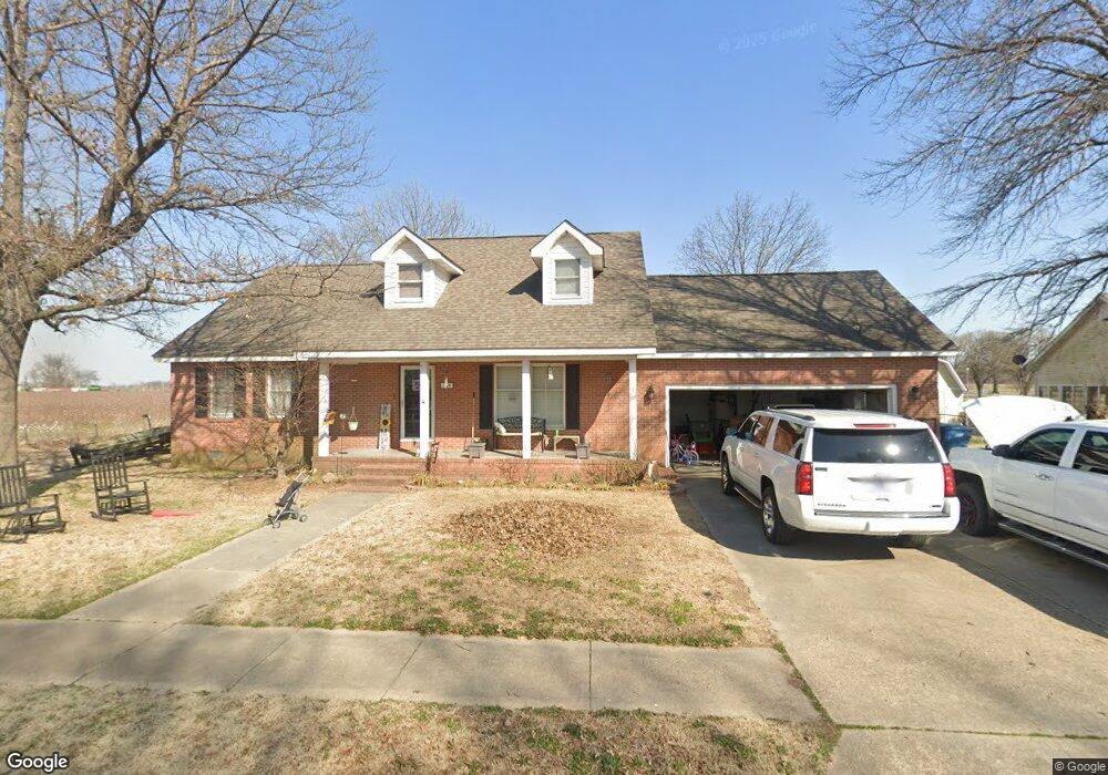
334 Saint Paul Dr New Madrid, MO 63869
Estimated Value: $122,000 - $195,000
3
Beds
1
Bath
1,428
Sq Ft
$115/Sq Ft
Est. Value
About This Home
This home is located at 334 Saint Paul Dr, New Madrid, MO 63869 and is currently estimated at $163,594, approximately $114 per square foot. 334 Saint Paul Dr is a home with nearby schools including Central High School and Immaculate Conception School.
Ownership History
Date
Name
Owned For
Owner Type
Purchase Details
Closed on
Jul 27, 2005
Sold by
Graham Maureen B Klein
Bought by
Sullenger Jessie William and Sullenger Carolyn
Current Estimated Value
Home Financials for this Owner
Home Financials are based on the most recent Mortgage that was taken out on this home.
Original Mortgage
$595,000
Interest Rate
5.61%
Mortgage Type
Unknown
Create a Home Valuation Report for This Property
The Home Valuation Report is an in-depth analysis detailing your home's value as well as a comparison with similar homes in the area
Home Values in the Area
Average Home Value in this Area
Purchase History
| Date | Buyer | Sale Price | Title Company |
|---|---|---|---|
| Sullenger Jessie William | -- | -- |
Source: Public Records
Mortgage History
| Date | Status | Borrower | Loan Amount |
|---|---|---|---|
| Closed | Sullenger Jessie William | $595,000 |
Source: Public Records
Tax History Compared to Growth
Tax History
| Year | Tax Paid | Tax Assessment Tax Assessment Total Assessment is a certain percentage of the fair market value that is determined by local assessors to be the total taxable value of land and additions on the property. | Land | Improvement |
|---|---|---|---|---|
| 2024 | $1,248 | $24,100 | $2,000 | $22,100 |
| 2023 | $1,252 | $24,100 | $0 | $0 |
| 2022 | $1,137 | $22,000 | $2,000 | $20,000 |
| 2021 | $1,135 | $22,000 | $0 | $0 |
| 2020 | $1,087 | $22,000 | $0 | $0 |
| 2019 | $1,086 | $20,900 | $1,900 | $19,000 |
| 2018 | $1,049 | $20,180 | $0 | $0 |
| 2017 | $1,038 | $20,180 | $0 | $0 |
| 2016 | -- | $20,180 | $0 | $0 |
| 2015 | -- | $20,180 | $0 | $0 |
| 2014 | -- | $20,180 | $0 | $0 |
| 2011 | -- | $0 | $0 | $0 |
Source: Public Records
Map
Nearby Homes
- 470 Saint Paul Dr
- 950 2nd St
- 22 Greenbriar Dr
- 101 Saint Matthew Ln
- 340 Semo Dr
- 731 Davis St
- 931 Davis St
- 402 Waters St
- 0 Highway P Unit MIS25062383
- I-55 S Outer Rd
- 202 S Lewis St
- 954 Highway Hh
- 1608 County Road 711
- 8 Mississippi Island
- 209 Kell Rd
- 0 County Road 714
- 506 W Main St
- 102 N Davis St
- 100 Summit St
- 17 Cardinal Ln
- 338 Saint Paul Dr
- 331 Saint Paul Dr
- 335 Saint Paul Dr
- 340 Saint Paul Dr
- 339 Saint Paul Dr
- 342 Saint Paul Dr
- 343 Saint Paul Dr
- 346 Saint Paul Dr
- 347 Saint Paul Dr
- 350 Saint Paul Dr
- 455 Saint Lawrence Dr
- 351 Saint Paul Dr
- 370 Saint Paul Dr
- 465 Saint Lawrence Dr
- 425 Saint Peter Dr
- 450 Saint Lawrence Dr
- 380 Saint Paul Dr
- 390 Saint Paul Dr
- 400 Saint Peter Dr
- 470 Saint Lawrence Dr