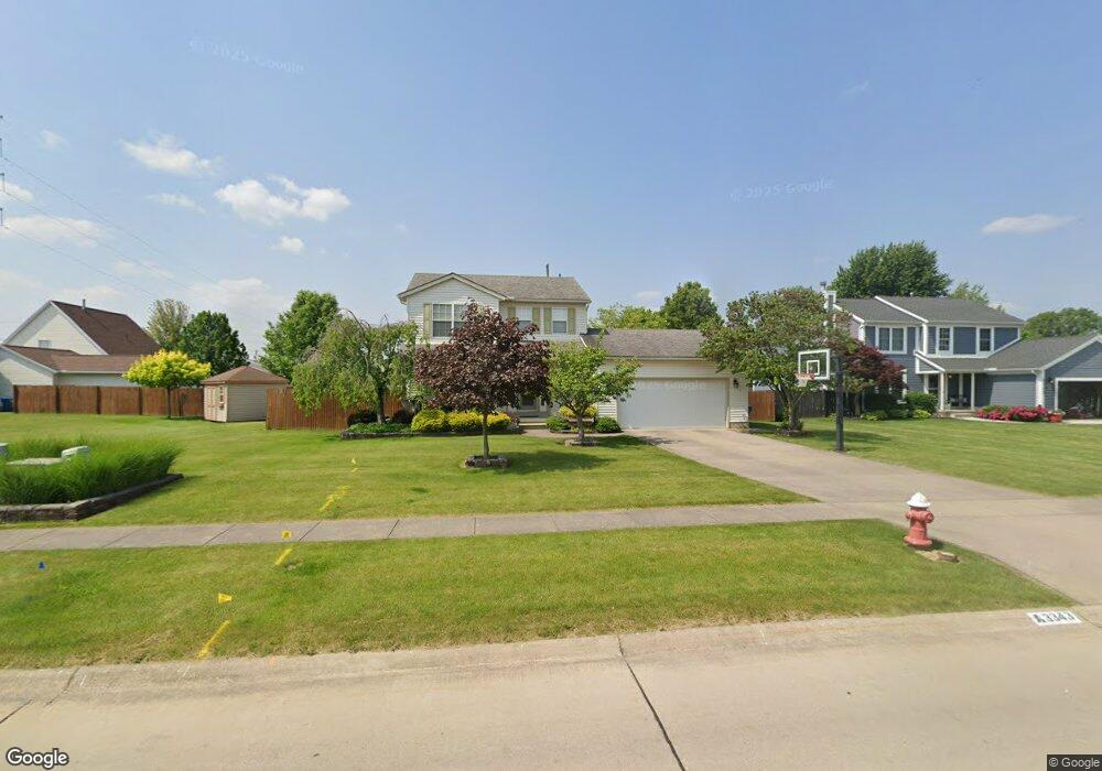
3343 Bellflower Dr Lorain, OH 44053
Estimated Value: $270,000 - $322,000
3
Beds
3
Baths
1,548
Sq Ft
$186/Sq Ft
Est. Value
About This Home
This home is located at 3343 Bellflower Dr, Lorain, OH 44053 and is currently estimated at $287,389, approximately $185 per square foot. 3343 Bellflower Dr is a home located in Lorain County with nearby schools including Powers Elementary School, Walter G. Nord Middle School, and Amherst Junior High School.
Ownership History
Date
Name
Owned For
Owner Type
Purchase Details
Closed on
Mar 4, 2009
Sold by
Parr Marie L and Taft Marie L
Bought by
Taft Marie L and Taft Robert A
Current Estimated Value
Purchase Details
Closed on
Mar 17, 1998
Sold by
Starland Investment Co
Bought by
Parr Marie L
Home Financials for this Owner
Home Financials are based on the most recent Mortgage that was taken out on this home.
Original Mortgage
$102,465
Outstanding Balance
$18,944
Interest Rate
7.14%
Mortgage Type
Construction
Estimated Equity
$268,445
Create a Home Valuation Report for This Property
The Home Valuation Report is an in-depth analysis detailing your home's value as well as a comparison with similar homes in the area
Home Values in the Area
Average Home Value in this Area
Purchase History
| Date | Buyer | Sale Price | Title Company |
|---|---|---|---|
| Taft Marie L | -- | Attorney | |
| Parr Marie L | $27,000 | Lorain County Title Co Inc |
Source: Public Records
Mortgage History
| Date | Status | Borrower | Loan Amount |
|---|---|---|---|
| Open | Parr Marie L | $102,465 |
Source: Public Records
Tax History
| Year | Tax Paid | Tax Assessment Tax Assessment Total Assessment is a certain percentage of the fair market value that is determined by local assessors to be the total taxable value of land and additions on the property. | Land | Improvement |
|---|---|---|---|---|
| 2024 | $3,043 | $71,554 | $19,219 | $52,336 |
| 2023 | $3,030 | $60,060 | $14,116 | $45,945 |
| 2022 | $2,913 | $60,060 | $14,116 | $45,945 |
| 2021 | $2,920 | $60,060 | $14,116 | $45,945 |
| 2020 | $2,860 | $52,130 | $12,250 | $39,880 |
| 2019 | $2,807 | $52,130 | $12,250 | $39,880 |
| 2018 | $2,821 | $52,130 | $12,250 | $39,880 |
| 2017 | $2,941 | $51,480 | $11,360 | $40,120 |
| 2016 | $2,920 | $51,480 | $11,360 | $40,120 |
| 2015 | $2,751 | $51,480 | $11,360 | $40,120 |
| 2014 | $2,705 | $50,470 | $11,140 | $39,330 |
| 2013 | $2,712 | $50,470 | $11,140 | $39,330 |
Source: Public Records
Map
Nearby Homes
- 423 Quarry Creek Dr
- 1011 N Main St
- 122 Lakeview Cir
- 120 Springvale Dr
- 110 Habant Dr
- 1301 N Main St
- 320 Pebble Creek Ct
- 109 Beaver Creek Trail
- 110 Beaver Creek Trail
- 4872 Leavitt Rd
- 373 Pebble Creek Ct
- 4657 Fields Way
- 0 Leavitt Rd Unit 5169364
- 3982 Courtyard Dr
- 4497 Bellow Dr
- Pine—End Unit Plan at Quarry Creek
- Ivy Plan at Quarry Creek
- Pine w/ Full Basement Plan at Quarry Creek
- 5611 Independence Dr
- 4513 Vineyard Dr
- 3365 Bellflower Dr
- 5960 N Pointe Pkwy
- 5940 N Pointe Pkwy
- 3387 Bellflower Dr
- 5980 N Pointe Pkwy
- 5887 Boxwood Dr
- 5880 N Pointe Pkwy
- 1135 Meadowview Ln
- 1125 Meadowview Ln
- 1145 Meadowview Ln
- 1115 Meadowview Ln
- 5865 Boxwood Dr
- 5882 Boxwood Dr
- 5860 N North Pointe Pkwy
- 5860 N Pointe Pkwy
- VL Cooper Foster Park Rd
- 0 Cooper Foster Park Rd Unit 4130825
- 1155 Meadowview Ln
- 1105 Meadowview Ln
- 5862 Boxwood Dr