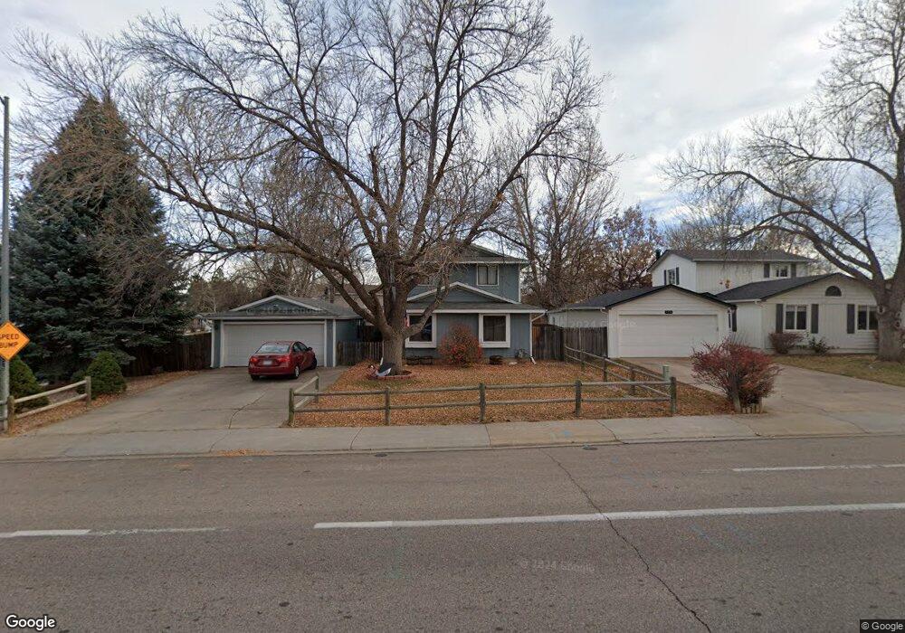
3348 Dunbar Ave Fort Collins, CO 80526
Estimated Value: $514,000 - $533,252
3
Beds
3
Baths
1,680
Sq Ft
$312/Sq Ft
Est. Value
About This Home
This home is located at 3348 Dunbar Ave, Fort Collins, CO 80526 and is currently estimated at $524,563, approximately $312 per square foot. 3348 Dunbar Ave is a home located in Larimer County with nearby schools including Johnson Elementary School, Webber Middle School, and Rocky Mountain High School.
Ownership History
Date
Name
Owned For
Owner Type
Purchase Details
Closed on
Nov 14, 1997
Sold by
Mcjilton Charles M
Bought by
Keough Warren Dutch and Keough Lovena J
Current Estimated Value
Home Financials for this Owner
Home Financials are based on the most recent Mortgage that was taken out on this home.
Original Mortgage
$117,484
Outstanding Balance
$19,281
Interest Rate
7.28%
Mortgage Type
FHA
Estimated Equity
$505,282
Purchase Details
Closed on
May 1, 1994
Sold by
Arnesen Mary F
Bought by
Mcjilton Charles M
Create a Home Valuation Report for This Property
The Home Valuation Report is an in-depth analysis detailing your home's value as well as a comparison with similar homes in the area
Home Values in the Area
Average Home Value in this Area
Purchase History
| Date | Buyer | Sale Price | Title Company |
|---|---|---|---|
| Keough Warren Dutch | $118,500 | -- | |
| Mcjilton Charles M | $117,900 | -- |
Source: Public Records
Mortgage History
| Date | Status | Borrower | Loan Amount |
|---|---|---|---|
| Open | Keough Warren Dutch | $117,484 |
Source: Public Records
Tax History Compared to Growth
Tax History
| Year | Tax Paid | Tax Assessment Tax Assessment Total Assessment is a certain percentage of the fair market value that is determined by local assessors to be the total taxable value of land and additions on the property. | Land | Improvement |
|---|---|---|---|---|
| 2025 | $2,993 | $34,880 | $2,680 | $32,200 |
| 2024 | $2,848 | $34,880 | $2,680 | $32,200 |
| 2022 | $2,432 | $25,757 | $2,780 | $22,977 |
| 2021 | $2,458 | $26,498 | $2,860 | $23,638 |
| 2020 | $2,579 | $27,563 | $2,860 | $24,703 |
| 2019 | $2,590 | $27,563 | $2,860 | $24,703 |
| 2018 | $1,967 | $21,578 | $2,880 | $18,698 |
| 2017 | $1,960 | $21,578 | $2,880 | $18,698 |
| 2016 | $823 | $18,021 | $3,184 | $14,837 |
| 2015 | $1,633 | $18,020 | $3,180 | $14,840 |
| 2014 | $1,467 | $16,080 | $3,180 | $12,900 |
Source: Public Records
Map
Nearby Homes
- 3366 Liverpool St
- 1819 Birmingham Dr
- 1631 Enfield St
- 3502 Big Ben Dr Unit C
- 2025 Cheshire St
- 3136 Birmingham Dr
- 3622 Capitol Dr
- 2 County Road 19
- 1531 W Swallow Rd Unit 28
- 1531 W Swallow Rd Unit 25
- 1601 W Swallow Rd Unit 9
- 1601 W Swallow Rd Unit 1
- 1601 W Swallow Rd
- 1401 Sioux Blvd
- 1401 Sanford Dr
- 2855 Trenton Way
- 1526 Corydalis Ct
- 1539 Corydalis Ct
- 3318 Hickok Dr Unit C/3
- 2918 Silverplume Dr Unit C1
- 3354 Dunbar Ave
- 3384 Liverpool St
- 3360 Dunbar Ave
- 3361 Liverpool St
- 3378 Liverpool St
- 3355 Liverpool St
- 3331 Dunbar Ave
- 3355 Dunbar Ave
- 3372 Liverpool St
- 3349 Liverpool St
- 3349 Kittery Ct
- 1800 Birmingham Dr
- 3330 Dunbar Ave
- 1724 Birmingham Dr
- 3337 Dunbar Ave
- 1806 Birmingham Dr
- 1812 Birmingham Dr
- 1818 Birmingham Dr
- 1718 Birmingham Dr
- 3343 Liverpool St