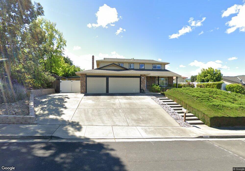
335 Granite Cir Antioch, CA 94509
Deer Valley NeighborhoodEstimated Value: $659,000 - $713,000
About This Home
This home is located at 335 Granite Cir, Antioch, CA 94509 and is currently estimated at $683,309, approximately $297 per square foot. 335 Granite Cir is a home located in Contra Costa County with nearby schools including John Muir Elementary School, Dallas Ranch Middle School, and Deer Valley High School.
Ownership History
We collect this data history from publicly available records. To have your information removed, we recommend requesting removal directly through your county’s website.
Purchase Details
Purchase Details
Home Financials for this Owner
Home Financials are based on the most recent Mortgage that was taken out on this home.Home Values in the Area
Average Home Value in this Area
Purchase History
We collect this data history from publicly available records. To have your information removed, we recommend requesting removal directly through your county’s website.
| Date | Buyer | Sale Price | Title Company |
|---|---|---|---|
| -- | None Available | ||
| -- | Orange Coast Title |
Mortgage History
We collect this data history from publicly available records. To have your information removed, we recommend requesting removal directly through your county’s website.
| Date | Status | Borrower | Loan Amount |
|---|---|---|---|
| Closed | $80,000 |
Tax History
We collect this data history from publicly available records. To have your information removed, we recommend requesting removal directly through your county’s website.
| Year | Tax Paid | Tax Assessment Tax Assessment Total Assessment is a certain percentage of the fair market value that is determined by local assessors to be the total taxable value of land and additions on the property. | Land | Improvement |
|---|---|---|---|---|
| 2025 | $3,232 | $244,595 | $36,208 | $208,387 |
| 2024 | $3,053 | $239,800 | $35,499 | $204,301 |
| 2023 | $3,053 | $235,099 | $34,803 | $200,296 |
| 2022 | $3,008 | $230,490 | $34,121 | $196,369 |
| 2021 | $2,889 | $225,971 | $33,452 | $192,519 |
| 2019 | $2,841 | $219,269 | $32,460 | $186,809 |
| 2018 | $2,739 | $214,971 | $31,824 | $183,147 |
| 2017 | $2,666 | $210,756 | $31,200 | $179,556 |
| 2016 | $2,598 | $206,625 | $30,589 | $176,036 |
| 2015 | $2,568 | $203,522 | $30,130 | $173,392 |
| 2014 | $2,489 | $199,536 | $29,540 | $169,996 |
Map
- 4006 Boulder Dr
- 3924 Cinnabar St
- 3508 Alberti Ct
- 621 Black Oak Way
- 820 Carpinteria Dr
- 311 Huntington Dr
- 3855 Rockford Dr
- 4720 Hunter Peak Ct
- 18 El Capitan Ln
- 14 El Capitan Ln
- 4860 Massive Peak Way
- 3516 Brookdale Ct
- 9 El Capitan Ln
- 4153 S Royal Links Cir
- 4161 S Royal Links Cir
- 1009 Flintrock Dr
- 1016 Carpinteria Dr
- 2 Echo Cir
- 2120 Lynwood Way
- 14 Terranova Dr
- 328 Granite Cir
- 324 Granite Cir
- 332 Granite Cir
- 228 Marble Dr
- 232 Marble Dr
- 309 Granite Cir
- 224 Marble Dr
- 336 Granite Cir
- 331 Granite Cir
- 320 Granite Ct
- 236 Marble Dr
- 229 Marble Dr
- 240 Marble Dr
- 340 Granite Cir
- 308 Granite Cir
- 225 Marble Dr
- 305 Bluerock Dr
- 216 Marble Dr
- 301 Granite Cir
- 237 Marble Dr
Ask me questions while you tour the home.