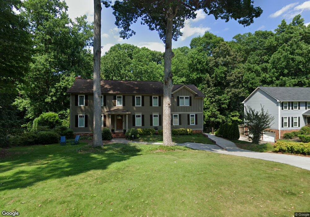
335 Millbrook Trace Unit 2 Marietta, GA 30068
East Cobb NeighborhoodEstimated Value: $701,504 - $744,000
4
Beds
6
Baths
3,282
Sq Ft
$222/Sq Ft
Est. Value
About This Home
This home is located at 335 Millbrook Trace Unit 2, Marietta, GA 30068 and is currently estimated at $729,126, approximately $222 per square foot. 335 Millbrook Trace Unit 2 is a home located in Cobb County with nearby schools including Eastvalley Elementary School, East Cobb Middle School, and Wheeler High School.
Ownership History
Date
Name
Owned For
Owner Type
Purchase Details
Closed on
Oct 5, 2020
Sold by
Bissell Robert Christopher and Bissell Ginger K
Bought by
Masse Jason and Masse Caroline
Current Estimated Value
Home Financials for this Owner
Home Financials are based on the most recent Mortgage that was taken out on this home.
Original Mortgage
$434,400
Outstanding Balance
$382,865
Interest Rate
2.9%
Mortgage Type
New Conventional
Estimated Equity
$346,261
Purchase Details
Closed on
Apr 27, 2006
Sold by
Dantzler Alice I
Bought by
Bissell Ginger K
Home Financials for this Owner
Home Financials are based on the most recent Mortgage that was taken out on this home.
Original Mortgage
$221,200
Interest Rate
6.28%
Mortgage Type
New Conventional
Purchase Details
Closed on
Jul 31, 1997
Sold by
Henderson James E
Bought by
Dantzler Alice I
Home Financials for this Owner
Home Financials are based on the most recent Mortgage that was taken out on this home.
Original Mortgage
$152,000
Interest Rate
7.61%
Mortgage Type
New Conventional
Create a Home Valuation Report for This Property
The Home Valuation Report is an in-depth analysis detailing your home's value as well as a comparison with similar homes in the area
Home Values in the Area
Average Home Value in this Area
Purchase History
| Date | Buyer | Sale Price | Title Company |
|---|---|---|---|
| Masse Jason | $548,000 | None Available | |
| Bissell Ginger K | $276,500 | -- | |
| Dantzler Alice I | $190,000 | -- |
Source: Public Records
Mortgage History
| Date | Status | Borrower | Loan Amount |
|---|---|---|---|
| Open | Masse Jason | $434,400 | |
| Previous Owner | Bissell Ginger K | $221,200 | |
| Previous Owner | Dantzler Alice I | $152,000 |
Source: Public Records
Tax History
| Year | Tax Paid | Tax Assessment Tax Assessment Total Assessment is a certain percentage of the fair market value that is determined by local assessors to be the total taxable value of land and additions on the property. | Land | Improvement |
|---|---|---|---|---|
| 2025 | $7,161 | $271,556 | $46,000 | $225,556 |
| 2024 | $7,167 | $271,556 | $46,000 | $225,556 |
| 2023 | $5,959 | $240,904 | $36,000 | $204,904 |
Source: Public Records
Map
Nearby Homes
- 247 Millbrook Farm Rd
- 2720 Dale Dr
- 301 E Valley Dr
- 156 Rhodes Dr
- 3079 Gant Quarters Cir
- 2700 Smithstone Way SE
- 654 Grove Pkwy SE
- 656 Brookline Dr SE Unit 2
- 15 Vickwood Ct NE
- 2514 Sunny Ln SE
- 663 Foxcroft Cir SE
- 3312 Hunterdon Way SE
- 651 Inglis Dr SE
- 621 Windgrove Rd SE Unit 2
- 731 Smithstone Ct SE
- 3330 Turtle Lake Club Dr SE
- 180 Blue Sky Dr
- 721 Smithstone Rd SE
- 2431 Weatherford Ct
- 454 Jo Ann Dr SE
- 345 Millbrook Trace
- 325 Millbrook Trace
- 355 Millbrook Trace
- 340 Millbrook Trace
- 315 Millbrook Trace
- 238 Millbrook Farm Rd
- 365 Boling Dr
- 239 Millbrook Farm Rd
- 350 Millbrook Trace
- 224 Millbrook Farm Rd
- 224 Millbrook Farm Rd
- 305 Millbrook Trace
- 248 Millbrook Farm Rd
- 258 Millbrook Farm Rd
- 214 Millbrook Farm Rd
- 360 Millbrook Trace
- 375 Boling Dr
- 375 Millbrook Trace Unit 2
- 268 Millbrook Farm Rd
- 2805 Burtz Dr
Your Personal Tour Guide
Ask me questions while you tour the home.