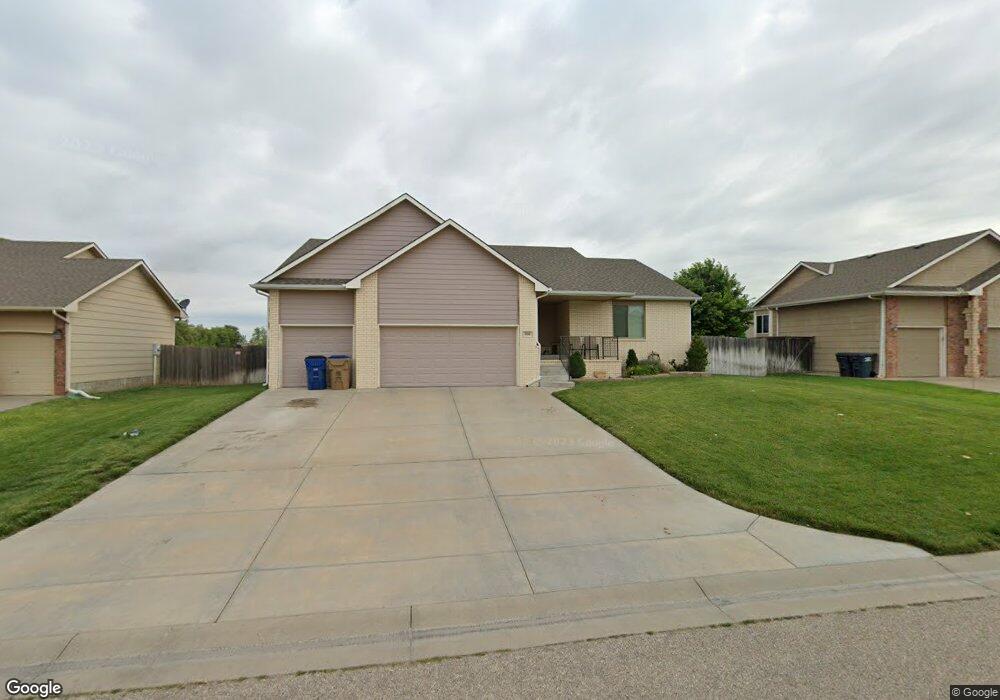
336 E Fox Run St Mulvane, KS 67110
Estimated Value: $331,916 - $403,000
--
Bed
3
Baths
1,766
Sq Ft
$208/Sq Ft
Est. Value
About This Home
This home is located at 336 E Fox Run St, Mulvane, KS 67110 and is currently estimated at $367,458, approximately $208 per square foot. 336 E Fox Run St is a home located in Sedgwick County with nearby schools including Munson Primary School, Mulvane Grade School, and Mulvane Middle School.
Ownership History
Date
Name
Owned For
Owner Type
Purchase Details
Closed on
Aug 25, 2016
Sold by
Dietrich Eric Neil
Bought by
Dietrich Eric Neil and Dietrich Sheila
Current Estimated Value
Home Financials for this Owner
Home Financials are based on the most recent Mortgage that was taken out on this home.
Original Mortgage
$183,870
Outstanding Balance
$146,963
Interest Rate
3.45%
Mortgage Type
VA
Estimated Equity
$220,495
Purchase Details
Closed on
Apr 27, 2012
Sold by
Warren Brothers Construction Co
Bought by
Dietrich Eric Neil
Create a Home Valuation Report for This Property
The Home Valuation Report is an in-depth analysis detailing your home's value as well as a comparison with similar homes in the area
Home Values in the Area
Average Home Value in this Area
Purchase History
| Date | Buyer | Sale Price | Title Company |
|---|---|---|---|
| Dietrich Eric Neil | -- | United Lender Services Corp | |
| Dietrich Eric Neil | -- | Security 1St Title |
Source: Public Records
Mortgage History
| Date | Status | Borrower | Loan Amount |
|---|---|---|---|
| Open | Dietrich Eric Neil | $183,870 |
Source: Public Records
Tax History
| Year | Tax Paid | Tax Assessment Tax Assessment Total Assessment is a certain percentage of the fair market value that is determined by local assessors to be the total taxable value of land and additions on the property. | Land | Improvement |
|---|---|---|---|---|
| 2025 | $4,992 | $35,317 | $6,808 | $28,509 |
| 2023 | $4,992 | $33,316 | $4,853 | $28,463 |
| 2022 | $4,616 | $31,004 | $4,577 | $26,427 |
| 2021 | $3,976 | $28,704 | $3,197 | $25,507 |
| 2020 | $3,743 | $26,577 | $3,197 | $23,380 |
| 2019 | $4,962 | $24,219 | $3,197 | $21,022 |
| 2018 | $4,995 | $25,369 | $2,162 | $23,207 |
| 2017 | $1,791 | $0 | $0 | $0 |
| 2016 | $1,763 | $0 | $0 | $0 |
| 2015 | -- | $0 | $0 | $0 |
| 2014 | -- | $0 | $0 | $0 |
Source: Public Records
Map
Nearby Homes
- 3040 N Susan Ln
- 122 E Eagle Watch St
- 1729 N Timbercreek Dr
- 1657 N Prairie Run Cir
- 1850 N Rock Rd
- 1619 N Rock Rd
- 170 Chestnut Dr
- 105 E Burlington Dr
- 1607 N Emerald Valley Cir
- 1603 N Emerald Valley Cir
- 1611 N Emerald Valley Cir
- 1522 N Emerald Valley Dr
- 1530 N Emerald Valley Cir
- 1542 N Emerald Valley Cir
- 1534 N Emerald Valley Cir
- 1538 N Emerald Valley Cir
- 1612 N Diamond Cir
- 1651 N Diamond Cir
- 1647 N Diamond Cir
- 1624 N Diamond Cir
- 336 E Fox Run St Unit 336 E FOX RUN ST.
- 332 E Fox Run St
- 340 E Fox Run St
- 333 E Quail Ridge St
- 344 E Fox Run St
- 328 E Fox Run St
- 2014 N Whitetail Ct
- 341 E Quail Ridge St
- 343 E Fox Run St
- 347 E Fox Run St
- 2010 N Whitetail Ct
- 2031 N Whitetail Ct
- 330 E Quail Ridge St
- 334 E Quail Ridge St
- 2027 N Whitetail Ct
- 402 E Fox Run Ct
- 338 E Quail Ridge St
- 2006 N Whitetail Ct
- 411 E Quail Ridge Ct
- 401 E Fox Run Ct
Your Personal Tour Guide
Ask me questions while you tour the home.