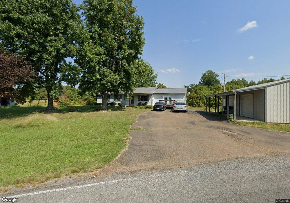
3364 L Maupin Rd Union City, TN 38261
Estimated Value: $200,000 - $246,000
3
Beds
2
Baths
1,972
Sq Ft
$114/Sq Ft
Est. Value
About This Home
This home is located at 3364 L Maupin Rd, Union City, TN 38261 and is currently estimated at $225,490, approximately $114 per square foot. 3364 L Maupin Rd is a home located in Obion County.
Ownership History
Date
Name
Owned For
Owner Type
Purchase Details
Closed on
Nov 13, 2015
Sold by
Bullock Kristina
Bought by
Young Jimmy D and Young Terra L
Current Estimated Value
Home Financials for this Owner
Home Financials are based on the most recent Mortgage that was taken out on this home.
Original Mortgage
$118,698
Outstanding Balance
$93,615
Interest Rate
3.87%
Mortgage Type
VA
Estimated Equity
$131,875
Purchase Details
Closed on
Jun 15, 1993
Bought by
Bullock Montie M and Bullock Kristina
Purchase Details
Closed on
Aug 27, 1991
Bought by
Warner Dale E
Purchase Details
Closed on
Jan 2, 1987
Bought by
Warner Dale E and Warner Judy
Purchase Details
Closed on
Jan 1, 1987
Purchase Details
Closed on
Jan 1, 1986
Create a Home Valuation Report for This Property
The Home Valuation Report is an in-depth analysis detailing your home's value as well as a comparison with similar homes in the area
Home Values in the Area
Average Home Value in this Area
Purchase History
| Date | Buyer | Sale Price | Title Company |
|---|---|---|---|
| Young Jimmy D | $116,200 | -- | |
| Bullock Montie M | $48,000 | -- | |
| Warner Dale E | -- | -- | |
| Warner Dale E | $48,000 | -- | |
| -- | $1,800 | -- | |
| -- | $1,800 | -- |
Source: Public Records
Mortgage History
| Date | Status | Borrower | Loan Amount |
|---|---|---|---|
| Open | Young Jimmy D | $118,698 |
Source: Public Records
Tax History Compared to Growth
Tax History
| Year | Tax Paid | Tax Assessment Tax Assessment Total Assessment is a certain percentage of the fair market value that is determined by local assessors to be the total taxable value of land and additions on the property. | Land | Improvement |
|---|---|---|---|---|
| 2024 | $571 | $41,375 | $2,675 | $38,700 |
| 2023 | $571 | $41,375 | $2,675 | $38,700 |
| 2022 | $525 | $27,650 | $2,800 | $24,850 |
| 2021 | $525 | $27,650 | $2,800 | $24,850 |
| 2020 | $432 | $27,650 | $2,800 | $24,850 |
| 2019 | $432 | $22,750 | $2,800 | $19,950 |
| 2018 | $434 | $22,750 | $2,800 | $19,950 |
| 2017 | $511 | $25,500 | $2,800 | $22,700 |
| 2016 | $511 | $25,500 | $2,800 | $22,700 |
| 2015 | $405 | $20,225 | $2,800 | $17,425 |
| 2014 | $405 | $20,225 | $2,800 | $17,425 |
Source: Public Records
Map
Nearby Homes
- 72 W Highway 22
- 317 W Highway 22
- 3105 Rock Springs Extended Rd
- 2942 Troy Hickman Rd
- 0 Denson Rd
- 3694 Pete Gray Rd
- 1127 W Shawtown Rd
- 4478 Crystal Rd
- 0 Burrus Rd
- 848 Bethel Church Rd
- 1559 Ella Groom Rd
- 1428 Meadow Dr
- 0 Add Osburn Rd
- 1587 Troy Hickman Rd
- 874 Coon Williams Rd
- Tract 1 Walter Whipple Rd
- 161 Cedar St
- 2610-2608 Nettle St
- 874 Gum St
- 4744 N Clayton Antioch Rd
- 3478 L Maupin Rd
- 3241 L Maupin Rd
- 139 W Highway 22
- 3519 L Maupin Rd
- 171 W Highway 22
- 267 W Highway 22
- 59 W Highway 22
- 125 Bonnie Hickman Rd Unit 127
- 142 Bonnie Hickman Rd
- 206 W Highway 22
- 82 W Highway 22
- 146 W Highway 22
- 77 E Maupin Rd
- 19 W Highway 22
- 3 E Highway 22
- 112 Bonnie Hickman Rd
- 301 & 317 W Highway 22
- 301 & 317 W Highway 22
- 317 W Highway 22
- 317 W Highway 22 Unit 301 W Highway 22