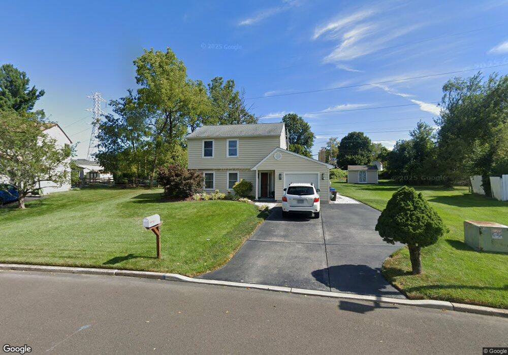
337 Barnsbury Rd Langhorne, PA 19047
Estimated Value: $545,579 - $589,000
3
Beds
2
Baths
1,540
Sq Ft
$368/Sq Ft
Est. Value
About This Home
This home is located at 337 Barnsbury Rd, Langhorne, PA 19047 and is currently estimated at $567,395, approximately $368 per square foot. 337 Barnsbury Rd is a home located in Bucks County with nearby schools including Pearl S. Buck Elementary School, Maple Point Middle School, and Neshaminy High School.
Ownership History
Date
Name
Owned For
Owner Type
Purchase Details
Closed on
Aug 27, 2004
Sold by
Curran John and Curran Donna
Bought by
Miatselitsa Yury and Miatselitsa Alena
Current Estimated Value
Home Financials for this Owner
Home Financials are based on the most recent Mortgage that was taken out on this home.
Original Mortgage
$252,000
Outstanding Balance
$126,510
Interest Rate
6.08%
Mortgage Type
Purchase Money Mortgage
Estimated Equity
$440,885
Purchase Details
Closed on
Feb 24, 1999
Sold by
Gregitis Frank V and Gregitis Rachel J
Bought by
Curran John and Curran Donna
Home Financials for this Owner
Home Financials are based on the most recent Mortgage that was taken out on this home.
Original Mortgage
$129,600
Interest Rate
6.76%
Create a Home Valuation Report for This Property
The Home Valuation Report is an in-depth analysis detailing your home's value as well as a comparison with similar homes in the area
Home Values in the Area
Average Home Value in this Area
Purchase History
| Date | Buyer | Sale Price | Title Company |
|---|---|---|---|
| Miatselitsa Yury | $280,000 | Nita Commonwealth Land Title | |
| Curran John | $162,000 | Lawyers Title Insurance Corp |
Source: Public Records
Mortgage History
| Date | Status | Borrower | Loan Amount |
|---|---|---|---|
| Open | Miatselitsa Yury | $252,000 | |
| Previous Owner | Curran John | $129,600 |
Source: Public Records
Tax History Compared to Growth
Tax History
| Year | Tax Paid | Tax Assessment Tax Assessment Total Assessment is a certain percentage of the fair market value that is determined by local assessors to be the total taxable value of land and additions on the property. | Land | Improvement |
|---|---|---|---|---|
| 2025 | $6,270 | $28,800 | $6,920 | $21,880 |
| 2024 | $6,270 | $28,800 | $6,920 | $21,880 |
| 2023 | $6,170 | $28,800 | $6,920 | $21,880 |
| 2022 | $6,008 | $28,800 | $6,920 | $21,880 |
| 2021 | $6,008 | $28,800 | $6,920 | $21,880 |
| 2020 | $5,936 | $28,800 | $6,920 | $21,880 |
| 2019 | $5,804 | $28,800 | $6,920 | $21,880 |
| 2018 | $5,697 | $28,800 | $6,920 | $21,880 |
| 2017 | $5,552 | $28,800 | $6,920 | $21,880 |
| 2016 | $5,552 | $28,800 | $6,920 | $21,880 |
| 2015 | $5,741 | $28,800 | $6,920 | $21,880 |
| 2014 | $5,741 | $28,800 | $6,920 | $21,880 |
Source: Public Records
Map
Nearby Homes
- 354 Shady Brook Dr Unit 180
- 273 Shady Brook Dr Unit 243
- 210 Shady Brook Dr
- 510 Pin Oak Dr
- 187 Shady Brook Dr Unit 129
- 175 Shady Brook Dr Unit 122
- 120 Shady Brook Dr Unit 89
- 0 Route 413 Bypass Unit PABU2010042
- 1835 Windflower Ln
- 1839 Windflower Ln
- 1819 Windflower Ln
- 462 Scott Ct
- 128 Thornhill Ln
- 277 Willow Dr
- 1988 Knight Cir
- 660 Bayberry Ln Unit T5
- 1102 Waterford Rd Unit 1
- 25 Wellington Rd
- 1948 Satter Ct
- 21 Violet Ln Unit 161A
- 349 Barnsbury Rd
- 325 Barnsbury Rd
- 315 Barnsbury Rd
- 371 Barnsbury Rd
- 346 Barnsbury Rd
- 271 Dorset Ct
- 251 Dorset Ct
- 316 Barnsbury Rd
- 301 Barnsbury Rd
- 304 Barnsbury Rd
- 207 Dorset Ct
- 242 Argyle Rd
- 189 Dorset Ct
- 230 Argyle Rd
- 227 Dorset Ct
- 254 Argyle Rd
- 218 Argyle Rd
- 171 Dorset Ct
- 292 Barnsbury Rd
- 206 Argyle Rd