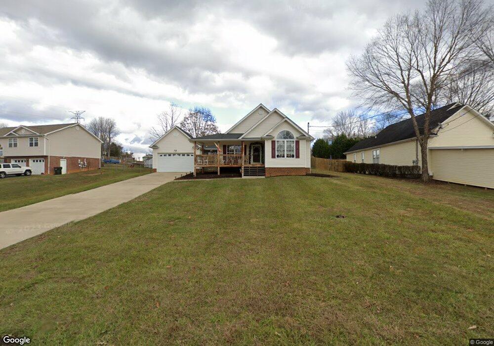
337 Center Dr Blountville, TN 37617
Estimated Value: $253,187 - $446,000
3
Beds
2
Baths
1,253
Sq Ft
$277/Sq Ft
Est. Value
About This Home
This home is located at 337 Center Dr, Blountville, TN 37617 and is currently estimated at $347,297, approximately $277 per square foot. 337 Center Dr is a home located in Sullivan County with nearby schools including Holston Elementary School and Sullivan Central Middle School.
Ownership History
Date
Name
Owned For
Owner Type
Purchase Details
Closed on
Dec 9, 2002
Sold by
Allen Stine Chris
Bought by
Yvette Stine Kimberly
Current Estimated Value
Purchase Details
Closed on
Sep 30, 1999
Home Financials for this Owner
Home Financials are based on the most recent Mortgage that was taken out on this home.
Original Mortgage
$81,550
Interest Rate
7.85%
Purchase Details
Closed on
Sep 28, 1998
Create a Home Valuation Report for This Property
The Home Valuation Report is an in-depth analysis detailing your home's value as well as a comparison with similar homes in the area
Home Values in the Area
Average Home Value in this Area
Purchase History
| Date | Buyer | Sale Price | Title Company |
|---|---|---|---|
| Yvette Stine Kimberly | -- | -- | |
| -- | $116,900 | -- | |
| -- | $18,500 | -- |
Source: Public Records
Mortgage History
| Date | Status | Borrower | Loan Amount |
|---|---|---|---|
| Previous Owner | -- | $81,550 |
Source: Public Records
Tax History Compared to Growth
Tax History
| Year | Tax Paid | Tax Assessment Tax Assessment Total Assessment is a certain percentage of the fair market value that is determined by local assessors to be the total taxable value of land and additions on the property. | Land | Improvement |
|---|---|---|---|---|
| 2024 | $824 | $33,000 | $4,575 | $28,425 |
| 2023 | $794 | $33,000 | $4,575 | $28,425 |
| 2022 | $794 | $33,000 | $4,575 | $28,425 |
| 2021 | $794 | $33,000 | $4,575 | $28,425 |
| 2020 | $801 | $33,000 | $4,575 | $28,425 |
| 2019 | $801 | $31,150 | $4,575 | $26,575 |
| 2018 | $794 | $31,150 | $4,575 | $26,575 |
| 2017 | $794 | $31,150 | $4,575 | $26,575 |
| 2016 | $862 | $33,475 | $4,575 | $28,900 |
| 2014 | $772 | $33,478 | $0 | $0 |
Source: Public Records
Map
Nearby Homes
- 780 Hamilton Rd Unit 6
- 780 Hamilton Rd Unit I-4
- 1033 Haw Ridge Rd
- 225 Forest Ln N
- 145 Grande Harbor Way
- 112 Cardinal Point
- 205 Forest Ct
- 164 Forest Ln N
- 156 Forest Ln N
- 148 Forest Ln S
- 205 Grande Harbor Way
- 191 Grande Harbor Way
- 290 Candy Creek Private Dr
- 500 Geisler Rd
- 341 Haw Ridge Rd E
- 417 Cope Rd
- 200 Deck Ln Unit 1105
- 200 Deck Ln Unit 803
- 200 Deck Ln Unit 802
- 200 Deck Ln Unit 801