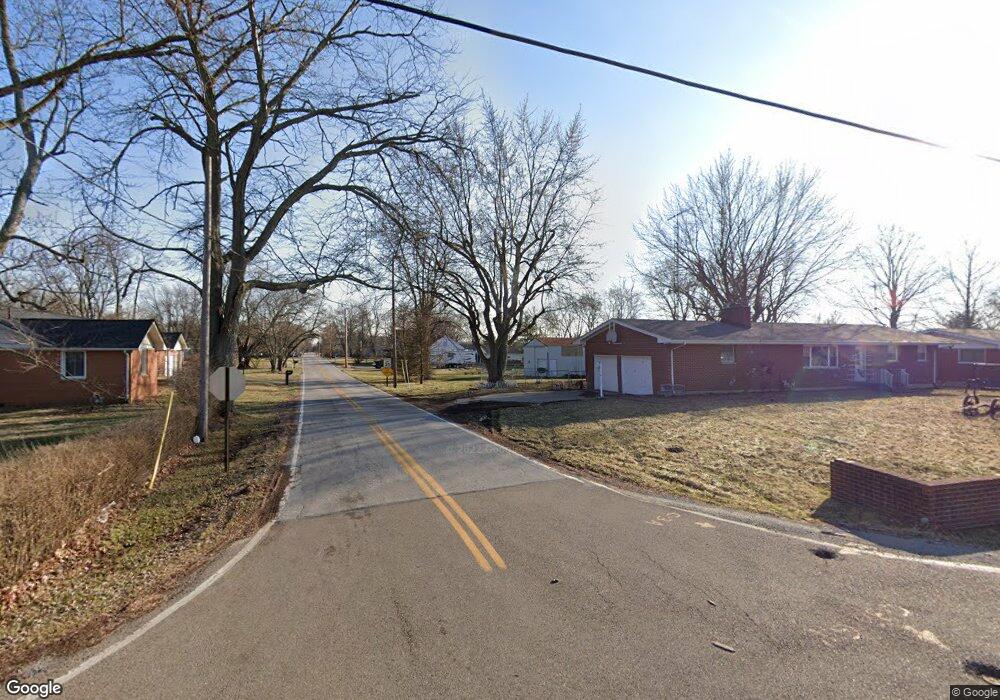
337 Gordon Rd Springfield, OH 45504
Cedar Hills/Broadview NeighborhoodEstimated Value: $83,000 - $111,000
3
Beds
2
Baths
1,419
Sq Ft
$70/Sq Ft
Est. Value
About This Home
This home is located at 337 Gordon Rd, Springfield, OH 45504 and is currently estimated at $98,667, approximately $69 per square foot. 337 Gordon Rd is a home located in Clark County with nearby schools including Donnelsville Elementary School, Park Layne Elementary School, and New Carlisle Elementary School.
Ownership History
Date
Name
Owned For
Owner Type
Purchase Details
Closed on
Aug 16, 2024
Sold by
Hitchcock Bonnie and Hitchcock Warren A
Bought by
Hitchcock Warren A and Hitchcock Bonnie L
Current Estimated Value
Purchase Details
Closed on
Nov 1, 2013
Sold by
The Bank Of New York Mellon
Bought by
Hitchcock Bonnie and Hitchcock Warren A
Purchase Details
Closed on
Jan 26, 2012
Sold by
Fullerton Bambi
Bought by
Bank Of New York Mellon and Bank Of New York
Purchase Details
Closed on
Aug 27, 2004
Sold by
Mihaly Carol M
Bought by
Fullerton Bambi
Home Financials for this Owner
Home Financials are based on the most recent Mortgage that was taken out on this home.
Original Mortgage
$85,000
Interest Rate
7.5%
Mortgage Type
Purchase Money Mortgage
Create a Home Valuation Report for This Property
The Home Valuation Report is an in-depth analysis detailing your home's value as well as a comparison with similar homes in the area
Home Values in the Area
Average Home Value in this Area
Purchase History
| Date | Buyer | Sale Price | Title Company |
|---|---|---|---|
| Hitchcock Warren A | -- | Ohio Real Estate Title | |
| Hitchcock Warren A | -- | Ohio Real Estate Title | |
| Hitchcock Bonnie | $35,299 | Attorney | |
| Bank Of New York Mellon | $55,000 | None Available | |
| Fullerton Bambi | -- | -- |
Source: Public Records
Mortgage History
| Date | Status | Borrower | Loan Amount |
|---|---|---|---|
| Previous Owner | Fullerton Bambi | $85,000 |
Source: Public Records
Tax History
| Year | Tax Paid | Tax Assessment Tax Assessment Total Assessment is a certain percentage of the fair market value that is determined by local assessors to be the total taxable value of land and additions on the property. | Land | Improvement |
|---|---|---|---|---|
| 2025 | $440 | $10,920 | $10,920 | -- |
| 2024 | $428 | $8,910 | $8,910 | -- |
| 2023 | $428 | $8,910 | $8,910 | $0 |
| 2022 | $247 | $8,910 | $8,910 | $0 |
| 2021 | $367 | $6,970 | $6,970 | $0 |
| 2020 | $368 | $6,970 | $6,970 | $0 |
| 2019 | $378 | $6,970 | $6,970 | $0 |
| 2018 | $499 | $8,700 | $8,700 | $0 |
| 2017 | $496 | $28,344 | $8,705 | $19,639 |
| 2016 | $476 | $28,344 | $8,705 | $19,639 |
| 2015 | $493 | $28,344 | $8,705 | $19,639 |
| 2014 | $1,483 | $28,344 | $8,705 | $19,639 |
| 2013 | $1,653 | $30,832 | $8,705 | $22,127 |
Source: Public Records
Map
Nearby Homes
- 4461 New Carlisle Pike
- 4638 W National Rd
- 128 Ravenwood Dr
- 195 N Tecumseh Rd
- 419 Candace Dr
- 0 S Tecumseh Rd Unit 1042892
- 0 S Tecumseh Rd Unit 1042894
- 3891 New Carlisle Pike
- 929 N Tecumseh Rd
- 96 Eastwood Dr
- 3183 Lower Valley Pike
- 124 Old Mill Rd
- 624 Aberfelda Dr
- 3319 Wendover St
- 1650 Cranbrook Dr
- 190 Oakridge Dr
- 1559 Folk Ream Rd
- 2805 Cottonwood Dr
- 6771 W National Rd
- 1290 Red Oaks Cir
- 309 Gordon Rd
- 4783 New Carlisle Pike
- 4803 New Carlisle Pike
- 312 Gordon Rd
- 305 Gordon Rd
- 4841 New Carlisle Pike
- 4850 Jenny Ct
- 308 Gordon Rd
- 300 Gordon Rd
- 301 Gordon Rd
- 4847 Jenny Ct
- 4709 New Carlisle Pike
- 288 Gordon Rd
- 4882 Jenny Ct
- 4867 New Carlisle Pike
- 277 Gordon Rd
- 4754 New Carlisle Pike
- 4691 New Carlisle Pike
- 248 Gordon Rd
- 4840 New Carlisle Pike
Your Personal Tour Guide
Ask me questions while you tour the home.