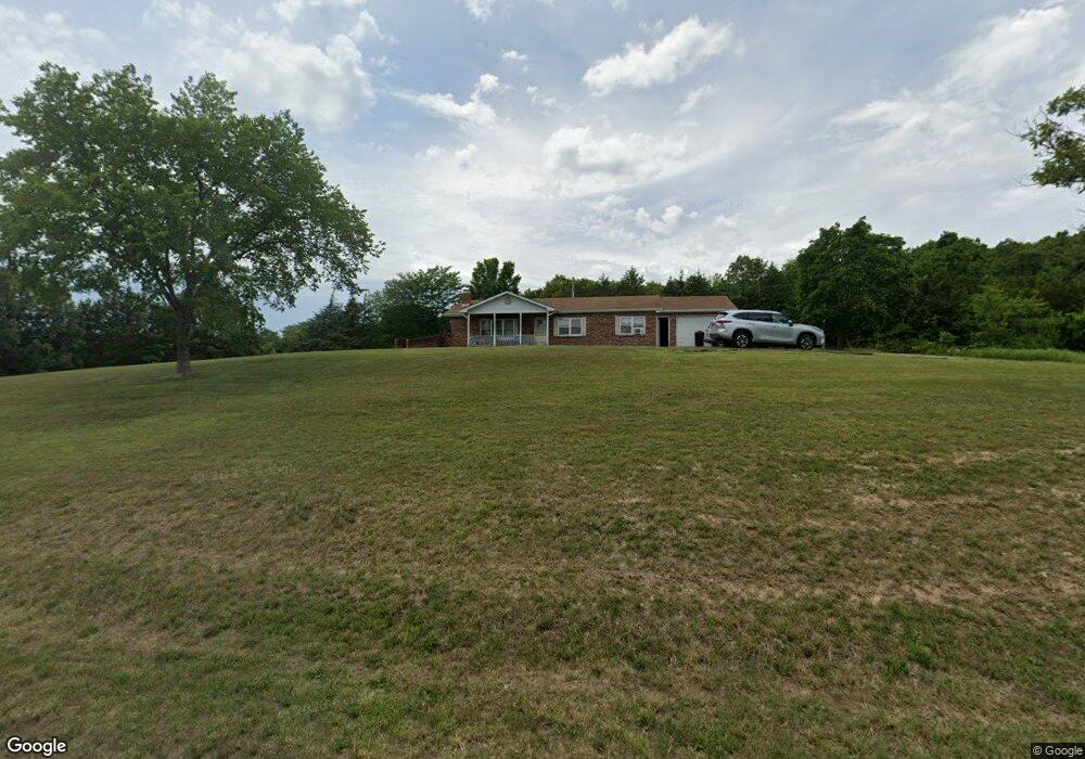
33719 Highway Ff Richland, MO 65556
Estimated Value: $161,000 - $201,000
3
Beds
1
Bath
1,340
Sq Ft
$135/Sq Ft
Est. Value
About This Home
This home is located at 33719 Highway Ff, Richland, MO 65556 and is currently estimated at $180,948, approximately $135 per square foot. 33719 Highway Ff is a home located in Laclede County with nearby schools including Richland Elementary School, Richland Jr. High School, and Richland High School.
Ownership History
Date
Name
Owned For
Owner Type
Purchase Details
Closed on
Oct 14, 2011
Sold by
Barber Daniel G
Bought by
Ashburn Kristi L and Ashburn Nathan
Current Estimated Value
Home Financials for this Owner
Home Financials are based on the most recent Mortgage that was taken out on this home.
Original Mortgage
$79,591
Outstanding Balance
$54,363
Interest Rate
4.13%
Mortgage Type
New Conventional
Estimated Equity
$126,585
Purchase Details
Closed on
Aug 15, 2005
Sold by
Daley William F
Bought by
Barber Daniel G and Barber Deanna L
Home Financials for this Owner
Home Financials are based on the most recent Mortgage that was taken out on this home.
Original Mortgage
$75,400
Interest Rate
5.61%
Mortgage Type
Purchase Money Mortgage
Create a Home Valuation Report for This Property
The Home Valuation Report is an in-depth analysis detailing your home's value as well as a comparison with similar homes in the area
Home Values in the Area
Average Home Value in this Area
Purchase History
| Date | Buyer | Sale Price | Title Company |
|---|---|---|---|
| Ashburn Kristi L | -- | None Available | |
| Barber Daniel G | -- | None Available |
Source: Public Records
Mortgage History
| Date | Status | Borrower | Loan Amount |
|---|---|---|---|
| Open | Ashburn Kristi L | $79,591 | |
| Previous Owner | Barber Daniel G | $75,400 |
Source: Public Records
Tax History Compared to Growth
Tax History
| Year | Tax Paid | Tax Assessment Tax Assessment Total Assessment is a certain percentage of the fair market value that is determined by local assessors to be the total taxable value of land and additions on the property. | Land | Improvement |
|---|---|---|---|---|
| 2025 | $371 | $11,210 | $0 | $0 |
| 2024 | $371 | $9,880 | $0 | $0 |
| 2023 | $367 | $9,880 | $0 | $0 |
| 2022 | $365 | $9,880 | $0 | $0 |
| 2021 | $349 | $9,880 | $1,007 | $8,873 |
| 2020 | $352 | $9,880 | $1,007 | $8,873 |
| 2019 | $356 | $9,880 | $1,010 | $8,870 |
| 2018 | $351 | $9,880 | $1,010 | $8,870 |
| 2017 | $354 | $9,880 | $0 | $0 |
| 2016 | $354 | $9,880 | $0 | $0 |
| 2015 | $354 | $9,880 | $0 | $0 |
| 2014 | $354 | $9,880 | $0 | $0 |
| 2013 | -- | $9,880 | $0 | $0 |
Source: Public Records
Map
Nearby Homes
- 34990 S Highway 133
- 30131 Ranch Ln
- 704 Ogle Dr
- 605 W Washington Ave
- 218 Francis St
- 0 Tbd King Rd
- 23013 Rock Bluff Dr
- 23288 Rock Bluff Dr
- 000 Missouri 7
- 25455 Rail Rd
- 402 N Chestnut St
- 501 Hillvale Ave
- 501 Hillvale Dr
- 504 N Pine St
- 304 Warren St
- 608 Cedar St
- 104 E Jefferson Ave
- 2518 State Highway H
- 26287 Radcliff Dr
- 815 N Pine St
- 33497 Highway Ff
- 3146 E Hwy Ff
- 000 Sheperd Rd
- 0 Jnctn of 133 Ab Unit 108088
- 1 Buster's Bayou (Rochester Rd)
- 0 Raleigh Rd Unit 15056794
- 555 A-Hwy
- 0 T Hwy Unit 21010592
- 1 T Hwy
- 100 K Hwy
- 100 K Rd
- 160 Elm Grove Church Rd
- 100 Range Ln
- 555 Black Oak
- 32064 Route 66
- 30625 Swallow
- 202 202
- 0Lot 2,3 Wildwood Subd
- 34020 Highway Ff
- 32880 Knoxville Rd