Estimated Value: $326,429 - $346,000
3
Beds
2
Baths
1,391
Sq Ft
$244/Sq Ft
Est. Value
About This Home
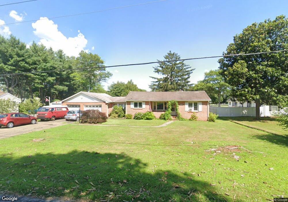
This home is located at 3384 Upper King Rd Unit 1, Dover, DE 19904 and is currently estimated at $339,607, approximately $244 per square foot. 3384 Upper King Rd Unit 1 is a home located in Kent County with nearby schools including Nellie Hughes Stokes Elementary School, Fred Fifer Middle School, and Caesar Rodney High School.
Ownership History
Date
Name
Owned For
Owner Type
Purchase Details
Closed on
Jan 5, 2016
Sold by
Mehrtens Rentals Llc
Bought by
Guentner John C
Current Estimated Value
Home Financials for this Owner
Home Financials are based on the most recent Mortgage that was taken out on this home.
Original Mortgage
$125,000
Outstanding Balance
$53,121
Interest Rate
3.96%
Mortgage Type
New Conventional
Estimated Equity
$286,486
Purchase Details
Closed on
Jul 21, 2014
Sold by
Fannie Mae
Bought by
Mehrtens Rentals Llc
Home Financials for this Owner
Home Financials are based on the most recent Mortgage that was taken out on this home.
Original Mortgage
$68,000
Interest Rate
4.18%
Mortgage Type
Commercial
Purchase Details
Closed on
Aug 30, 2013
Sold by
Wallace Lydia L
Bought by
Federal National Mortgage Association
Purchase Details
Closed on
Mar 15, 2006
Sold by
Wallace Vernon S
Bought by
Wallace Vernon S and Wallace Lydia L
Create a Home Valuation Report for This Property
The Home Valuation Report is an in-depth analysis detailing your home's value as well as a comparison with similar homes in the area
Home Values in the Area
Average Home Value in this Area
Purchase History
| Date | Buyer | Sale Price | Title Company |
|---|---|---|---|
| Guentner John C | $180,000 | None Available | |
| Mehrtens Rentals Llc | -- | None Available | |
| Federal National Mortgage Association | $119,848 | None Available | |
| Wallace Vernon S | -- | None Available |
Source: Public Records
Mortgage History
| Date | Status | Borrower | Loan Amount |
|---|---|---|---|
| Open | Guentner John C | $125,000 | |
| Previous Owner | Mehrtens Rentals Llc | $68,000 |
Source: Public Records
Tax History
| Year | Tax Paid | Tax Assessment Tax Assessment Total Assessment is a certain percentage of the fair market value that is determined by local assessors to be the total taxable value of land and additions on the property. | Land | Improvement |
|---|---|---|---|---|
| 2025 | $1,448 | $263,800 | $69,500 | $194,300 |
| 2024 | $1,419 | $263,800 | $69,500 | $194,300 |
| 2023 | $1,359 | $39,400 | $9,000 | $30,400 |
| 2022 | $1,291 | $39,400 | $9,000 | $30,400 |
| 2021 | $1,273 | $39,400 | $9,000 | $30,400 |
| 2020 | $1,241 | $39,400 | $9,000 | $30,400 |
| 2019 | $1,204 | $39,400 | $9,000 | $30,400 |
| 2018 | $1,172 | $39,400 | $9,000 | $30,400 |
| 2017 | $1,148 | $39,400 | $0 | $0 |
| 2016 | $1,073 | $39,400 | $0 | $0 |
| 2015 | $929 | $39,400 | $0 | $0 |
| 2014 | $927 | $39,400 | $0 | $0 |
Source: Public Records
Map
Nearby Homes
- 96 Lochmeath Way
- 50 Nanticoke Dr
- 43 E Darby Cir
- 74 Nanticoke Dr
- 45 Capricorn Way
- 143 S Knight Ln Unit 107
- 11 N Kimmer Ln Unit 265
- 107 S Hairgrove Ln Unit 86
- 24 S Stetson Ln Unit 210
- 25 Martindale Way Unit 51
- 21 Catts Ln Unit 27
- 12 Catts Ln Unit 21
- 68 Carey Ln Unit 15
- 16 Lone Tree Dr
- 104 Lake Front Dr
- 31 E Fred Cir
- 13 Casterline Ct
- Lot 47 Red Brookfield Dr
- Lot 42 Lin Brookfield Dr
- 870 Brookfield Dr
- 3384 Upper King Rd
- 3400 Upper King Rd
- 23 Semans Dr
- 46 Lochmeath Way
- 8 Lochmeath Way
- 57 Semans Dr
- 3334 Upper King Rd
- 83 Semans Dr
- 64 Lochmeath Way
- 64 Lochmeath Way
- 37 Lochmeath Way
- 78 Lochmeath Way
- 3452 Upper King Rd
- 3367 Upper King Rd
- 105 Semans Dr
- 3306 Upper King Rd
- 50 Semans Dr
- 3307 Upper King Rd
- 72 Semans Dr
- 67 Lochmeath Way
Your Personal Tour Guide
Ask me questions while you tour the home.