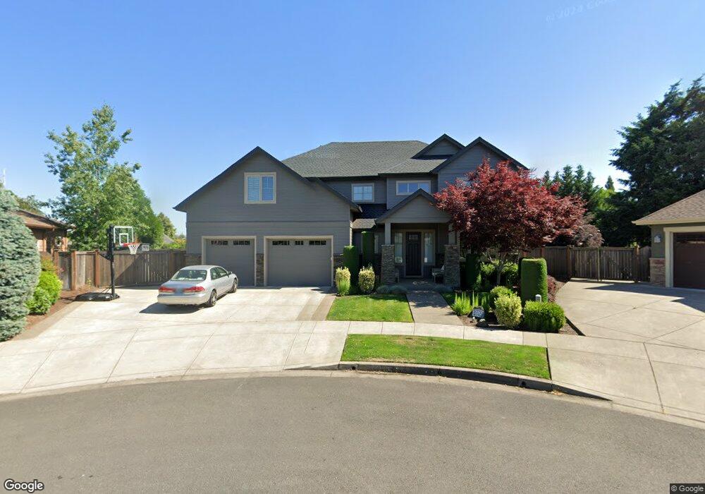
3387 Amherst Way Eugene, OR 97408
Harlow NeighborhoodEstimated Value: $1,073,282 - $1,218,000
3
Beds
3
Baths
3,971
Sq Ft
$284/Sq Ft
Est. Value
About This Home
This home is located at 3387 Amherst Way, Eugene, OR 97408 and is currently estimated at $1,125,821, approximately $283 per square foot. 3387 Amherst Way is a home with nearby schools including Gilham Elementary School, Cal Young Middle School, and Sheldon High School.
Ownership History
Date
Name
Owned For
Owner Type
Purchase Details
Closed on
Apr 23, 2014
Sold by
Future B Inc
Bought by
Brooke Travis and Brooke Sarah
Current Estimated Value
Home Financials for this Owner
Home Financials are based on the most recent Mortgage that was taken out on this home.
Original Mortgage
$417,000
Outstanding Balance
$313,026
Interest Rate
4.32%
Mortgage Type
New Conventional
Estimated Equity
$812,795
Purchase Details
Closed on
Jul 19, 2013
Sold by
Gjs Land Company Llc
Bought by
Future B Inc and Future B Homes
Create a Home Valuation Report for This Property
The Home Valuation Report is an in-depth analysis detailing your home's value as well as a comparison with similar homes in the area
Home Values in the Area
Average Home Value in this Area
Purchase History
| Date | Buyer | Sale Price | Title Company |
|---|---|---|---|
| Brooke Travis | $525,000 | Cascade Title Company | |
| Future B Inc | $300,000 | Cascade Title Company |
Source: Public Records
Mortgage History
| Date | Status | Borrower | Loan Amount |
|---|---|---|---|
| Open | Brooke Travis | $417,000 |
Source: Public Records
Tax History
| Year | Tax Paid | Tax Assessment Tax Assessment Total Assessment is a certain percentage of the fair market value that is determined by local assessors to be the total taxable value of land and additions on the property. | Land | Improvement |
|---|---|---|---|---|
| 2025 | $11,461 | $588,247 | -- | -- |
| 2024 | $11,319 | $571,114 | -- | -- |
| 2023 | $11,319 | $554,480 | $0 | $0 |
| 2022 | $10,604 | $538,331 | $0 | $0 |
| 2021 | $9,959 | $522,652 | $0 | $0 |
| 2020 | $9,725 | $507,430 | $0 | $0 |
| 2019 | $9,391 | $492,651 | $0 | $0 |
| 2018 | $8,854 | $464,371 | $0 | $0 |
| 2017 | $8,360 | $464,371 | $0 | $0 |
| 2016 | $8,053 | $450,846 | $0 | $0 |
| 2015 | $8,883 | $496,686 | $0 | $0 |
| 2014 | $1,891 | $108,512 | $0 | $0 |
Source: Public Records
Map
Nearby Homes
- 1794 Kings St N
- 1993 Best Ln
- 1564 Regency Dr
- 3090 Willakenzie Rd
- 1491 Victorian Way
- 2889 Kinney Loop
- 0 Sprig Ln Unit Lot 3
- 0 Sprig Ln Unit Lot 3 766109892
- 610 Colonial Dr
- 3425 Coburg Rd
- 2611 Erin Way
- 2707 Dayna Ln
- 1271 Arcadia Dr
- 1270 Calvin St
- 2776 Dayna Ln
- 2752 Dayna Ln
- 2577 Elysium Ave
- 89805 Sprague Rd
- 2527 Park View Dr
- 3227 Partridge Way
- 3375 Amherst Way
- 3395 Amherst Way
- 3396 Amherst Way
- 2529 Chesapeake Dr
- 3382 Amherst Way
- 89338 Old Coburg Rd
- 89344 Old Coburg Rd
- 3370 Amherst Way
- 3366 Cape Hatteras Dr
- 3358 Cape Hatteras Dr
- 89350 Old Coburg Rd
- 3364 Amherst Way
- 89324 Old Coburg Rd
- 3353 Amherst Way
- 89326 Old Coburg Rd
- 3382 Cape Hatteras Dr
- 3370 Cape Hatteras Dr
- 3352 Cape Hatteras Dr
- 3355 Wyndham Ct
- 3358 Amherst Way
Your Personal Tour Guide
Ask me questions while you tour the home.