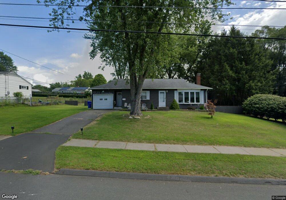
34 Brett Ln Enfield, CT 06082
Estimated Value: $277,000 - $307,000
2
Beds
1
Bath
1,064
Sq Ft
$272/Sq Ft
Est. Value
About This Home
This home is located at 34 Brett Ln, Enfield, CT 06082 and is currently estimated at $289,808, approximately $272 per square foot. 34 Brett Ln is a home located in Hartford County with nearby schools including Nathan Hale Elementary School, Eli Whitney Elementary School, and John F. Kennedy Middle School.
Ownership History
Date
Name
Owned For
Owner Type
Purchase Details
Closed on
Mar 26, 2024
Sold by
Marcil Jeffrey T
Bought by
Marcil Ralph W and Marcil Jeffrey T
Current Estimated Value
Purchase Details
Closed on
Jun 24, 2004
Sold by
Usa Va
Bought by
Courtney Deborah
Purchase Details
Closed on
Nov 4, 1999
Sold by
Yikitus Florence
Bought by
Sheckarski Frank
Create a Home Valuation Report for This Property
The Home Valuation Report is an in-depth analysis detailing your home's value as well as a comparison with similar homes in the area
Home Values in the Area
Average Home Value in this Area
Purchase History
| Date | Buyer | Sale Price | Title Company |
|---|---|---|---|
| Marcil Ralph W | -- | None Available | |
| Marcil Ralph W | -- | None Available | |
| Courtney Deborah | $145,100 | -- | |
| Courtney Deborah | $145,100 | -- | |
| Sheckarski Frank | $102,000 | -- | |
| Sheckarski Frank | $102,000 | -- |
Source: Public Records
Mortgage History
| Date | Status | Borrower | Loan Amount |
|---|---|---|---|
| Previous Owner | Sheckarski Frank | $148,758 | |
| Previous Owner | Sheckarski Frank | $156,000 | |
| Previous Owner | Sheckarski Frank | $19,500 |
Source: Public Records
Tax History Compared to Growth
Tax History
| Year | Tax Paid | Tax Assessment Tax Assessment Total Assessment is a certain percentage of the fair market value that is determined by local assessors to be the total taxable value of land and additions on the property. | Land | Improvement |
|---|---|---|---|---|
| 2025 | $4,921 | $140,200 | $56,600 | $83,600 |
| 2024 | $4,740 | $140,200 | $56,600 | $83,600 |
| 2023 | $4,705 | $140,200 | $56,600 | $83,600 |
| 2022 | $4,331 | $140,200 | $56,600 | $83,600 |
| 2021 | $3,981 | $105,950 | $46,890 | $59,060 |
| 2020 | $3,954 | $105,950 | $46,890 | $59,060 |
| 2019 | $3,949 | $105,950 | $46,890 | $59,060 |
| 2018 | $3,843 | $105,950 | $46,890 | $59,060 |
| 2017 | $3,611 | $105,950 | $46,890 | $59,060 |
| 2016 | $3,525 | $105,670 | $48,110 | $57,560 |
| 2015 | $1,895 | $105,670 | $48,110 | $57,560 |
| 2014 | $3,332 | $105,670 | $48,110 | $57,560 |
Source: Public Records
Map
Nearby Homes
- 436 Taylor Rd
- 155 Sheridan Rd
- 31 Meade Ln
- 11 Northfield Rd
- 2 Meacham Dr Unit 2
- 4 Copley Cir
- 34 Ridgefield Rd
- 56 N Maple St
- 138 Main St
- 102 N Maple St Unit 1A
- 6 Cedar St
- 287 Hazard Ave
- 35 Therese Dr
- 12 Salerno Dr
- 45 Monroe Rd
- 3 Avon Street Extension
- 83 Oldefield Farms Unit 83
- 85 Oldefield Farms Unit 85
- 70 Fletcher Rd
- 12 the Laurels Unit 12