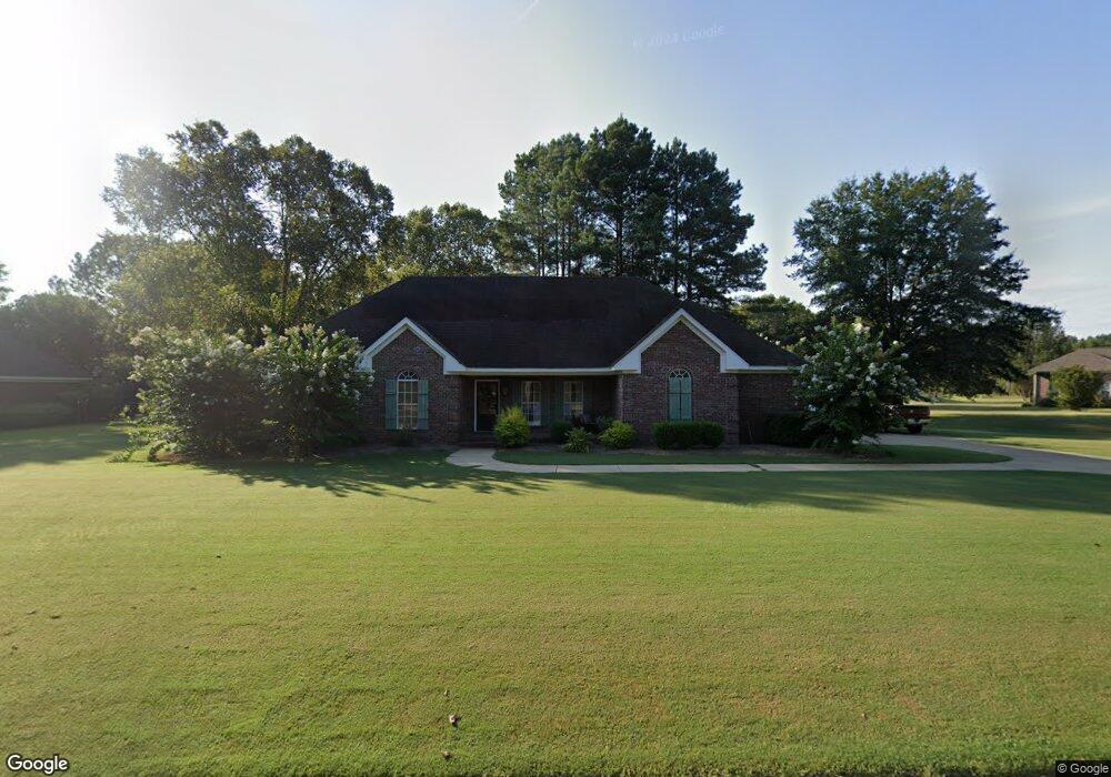
34 N Glen Brook Dr Grenada, MS 38901
Estimated Value: $294,000 - $397,000
4
Beds
4
Baths
2,795
Sq Ft
$120/Sq Ft
Est. Value
About This Home
This home is located at 34 N Glen Brook Dr, Grenada, MS 38901 and is currently estimated at $335,784, approximately $120 per square foot. 34 N Glen Brook Dr is a home located in Grenada County with nearby schools including Grenada Elementary School, Grenada Upper Elementary School, and Grenada Middle School.
Ownership History
Date
Name
Owned For
Owner Type
Purchase Details
Closed on
Nov 8, 2019
Sold by
Denoon Chase Aubrey and Denoon Haley Morgan
Bought by
Black Paul H and Black Leslie G
Current Estimated Value
Home Financials for this Owner
Home Financials are based on the most recent Mortgage that was taken out on this home.
Original Mortgage
$261,000
Outstanding Balance
$229,153
Interest Rate
3.5%
Mortgage Type
Unknown
Estimated Equity
$106,631
Purchase Details
Closed on
Dec 18, 2008
Sold by
Manuele
Bought by
Manuele
Create a Home Valuation Report for This Property
The Home Valuation Report is an in-depth analysis detailing your home's value as well as a comparison with similar homes in the area
Home Values in the Area
Average Home Value in this Area
Purchase History
| Date | Buyer | Sale Price | Title Company |
|---|---|---|---|
| Black Paul H | -- | None Available | |
| Manuele | -- | -- |
Source: Public Records
Mortgage History
| Date | Status | Borrower | Loan Amount |
|---|---|---|---|
| Open | Black Paul H | $261,000 |
Source: Public Records
Tax History Compared to Growth
Tax History
| Year | Tax Paid | Tax Assessment Tax Assessment Total Assessment is a certain percentage of the fair market value that is determined by local assessors to be the total taxable value of land and additions on the property. | Land | Improvement |
|---|---|---|---|---|
| 2024 | $2,148 | $23,138 | $3,000 | $20,138 |
| 2023 | $2,170 | $23,138 | $3,000 | $20,138 |
| 2022 | $2,116 | $23,138 | $3,000 | $20,138 |
| 2021 | $2,014 | $23,138 | $3,000 | $20,138 |
| 2020 | $2,023 | $23,259 | $3,000 | $20,259 |
| 2019 | $2,323 | $23,259 | $3,000 | $20,259 |
| 2018 | $2,298 | $23,259 | $3,000 | $20,259 |
| 2017 | $3,448 | $34,888 | $4,500 | $30,388 |
| 2016 | $3,372 | $34,123 | $0 | $0 |
| 2015 | $3,372 | $34,123 | $0 | $0 |
| 2014 | -- | $34,123 | $0 | $0 |
Source: Public Records
Map
Nearby Homes
- 57 Southlakes Dr
- 201 Shadow Wood Cove
- 211 Shadow Wood Cove
- 000 Southlakes Dr
- 865 John Borden Dr
- 1743 Perry Rd
- 2200 Perry Rd
- 271 Liberty Loop
- 250 Liberty Loop
- 2370 Perry Rd
- 0 Willis Cove
- 00 Halls Rd
- Tract 4 Tie Plant Rd
- 270 Pebble Creek Rd
- 856 Meadowbrook Rd
- 2985 Carrollton Rd
- 33 Oak Meadow Dr
- 2419 Laurin St
- 300 Oak Grove Dr
- 1188 Morrison Dr
- 14 N Glen Brook Dr
- 64 N Glen Brook Dr
- 60 Broadmeadow Dr
- 35 N Glen Brook Dr
- 55 N Glen Brook Dr
- 25 N Glen Brook Dr
- 70 Broadmeadow Dr
- 94 N Glen Brook Dr
- 15 N Glen Brook Dr
- 75 N Glen Brook Dr
- 525 Glenlake Dr
- 18 S Glen Brook Dr
- 51 Broadmeadow Dr
- 114 N Glen Brook Dr
- 61 Broadmeadow Dr
- 17 S Glen Brook Dr
- 80 Broadmeadow Dr
- 95 N Glen Brook Dr
- 85 Broadmeadow Dr
- 110 Broadmeadow Dr