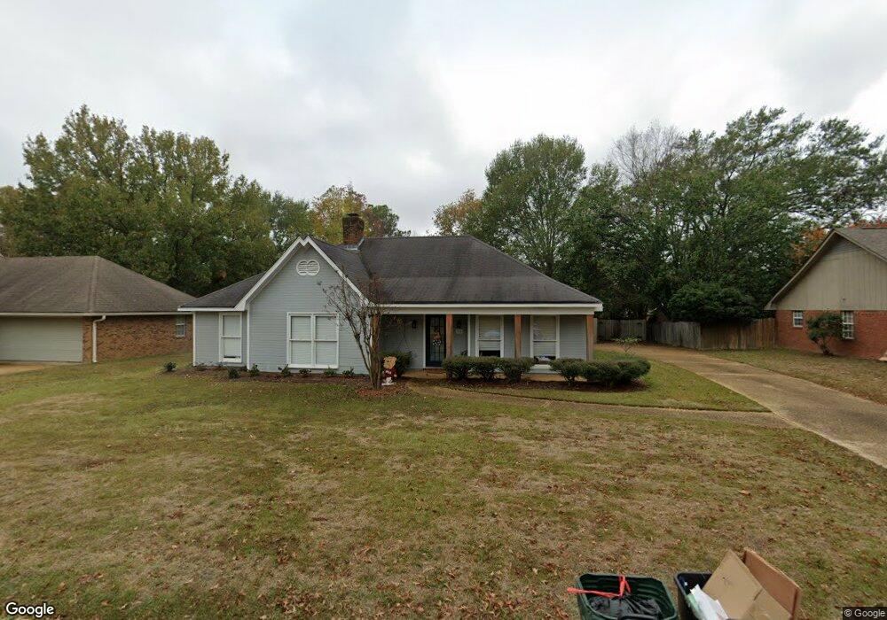
340 Mockingbird Ln Madison, MS 39110
Estimated Value: $244,186 - $304,000
3
Beds
2
Baths
1,901
Sq Ft
$144/Sq Ft
Est. Value
About This Home
This home is located at 340 Mockingbird Ln, Madison, MS 39110 and is currently estimated at $273,547, approximately $143 per square foot. 340 Mockingbird Ln is a home located in Madison County with nearby schools including Madison Avenue Upper Elementary School, Madison Avenue Elementary, and Madison Middle School.
Ownership History
Date
Name
Owned For
Owner Type
Purchase Details
Closed on
Feb 20, 2018
Sold by
Blake-Kenny Benjamin
Bought by
Kathleen Kenny Ret
Current Estimated Value
Purchase Details
Closed on
Aug 28, 2015
Sold by
Kenny Kathleen
Bought by
Kenny Benjamin Blake
Purchase Details
Closed on
May 24, 2007
Sold by
Kenny Kathleen
Bought by
Kenny Kathleen and Kathleen Kenny Revocable Living Trust
Purchase Details
Closed on
May 24, 2005
Sold by
Marshall Sandra O and Marshall Richard C
Bought by
Kenny Kathleen
Create a Home Valuation Report for This Property
The Home Valuation Report is an in-depth analysis detailing your home's value as well as a comparison with similar homes in the area
Home Values in the Area
Average Home Value in this Area
Purchase History
| Date | Buyer | Sale Price | Title Company |
|---|---|---|---|
| Kathleen Kenny Ret | -- | -- | |
| Kenny Benjamin Blake | -- | None Available | |
| Kenny Kathleen | -- | None Available | |
| Kenny Kathleen | -- | None Available |
Source: Public Records
Tax History
| Year | Tax Paid | Tax Assessment Tax Assessment Total Assessment is a certain percentage of the fair market value that is determined by local assessors to be the total taxable value of land and additions on the property. | Land | Improvement |
|---|---|---|---|---|
| 2025 | $1,262 | $13,407 | $0 | $0 |
| 2024 | $1,262 | $13,407 | $0 | $0 |
| 2023 | $1,262 | $13,407 | $0 | $0 |
| 2022 | $2,344 | $20,111 | $0 | $0 |
| 2021 | $2,257 | $19,370 | $0 | $0 |
| 2020 | $2,257 | $19,370 | $0 | $0 |
| 2019 | $2,257 | $19,370 | $0 | $0 |
| 2018 | $1,205 | $12,913 | $0 | $0 |
| 2017 | $1,182 | $12,714 | $0 | $0 |
| 2016 | $2,222 | $19,071 | $0 | $0 |
| 2015 | $1,182 | $12,714 | $0 | $0 |
| 2014 | $1,183 | $12,727 | $0 | $0 |
Source: Public Records
Map
Nearby Homes
- 717 Wildberry Pointe
- 106 Normandy Ct
- 606 Honeysuckle Dr
- 204 Street Charlotte Cove
- 0 Hoy Rd Unit 4143613
- 202 Saint Pierre Cove
- 865 Wellington Way
- 212 N Ridge Dr
- 559 Spring Hill Dr
- 0 Christmas Ln
- 1241 Woodberry Dr
- 1205 Woodberry Dr
- 0 Deerfield Dr Unit 4140244
- 481 Bellechase Place
- 268 Sundial Rd
- 224 S Woodcreek Rd
- 605 Arbor Ct
- 112 Woodsong Way
- 28 Deerfield Dr
- 213 S Woodcreek Rd
- 336 Mockingbird Ln
- 344 Mockingbird Ln
- 639 Honeysuckle Dr
- 635 Honeysuckle Dr
- 332 Mockingbird Ln
- 448 Wildwood Pointe
- 820 Strawberry Pointe
- 631 Honeysuckle Dr
- 341 Mockingbird Ln
- 328 Mockingbird Ln
- 349 Mockingbird Ln
- 442 Wildwood Pointe
- 824 Strawberry Pointe
- 353 Mockingbird Ln
- 816 Strawberry Pointe
- 630 Honeysuckle Dr
- 630 Honeysuckle Dr
- 828 Strawberry Pointe
- 642 Honeysuckle Dr
- 337 Mockingbird Ln
Your Personal Tour Guide
Ask me questions while you tour the home.