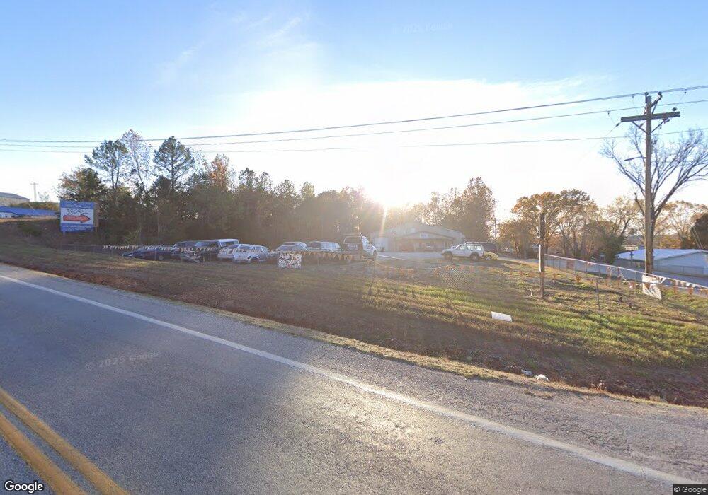
340 W Brook St Shell Knob, MO 65747
Estimated Value: $522,000 - $629,000
Studio
--
Bath
3,102
Sq Ft
$182/Sq Ft
Est. Value
About This Home
This home is located at 340 W Brook St, Shell Knob, MO 65747 and is currently estimated at $563,333, approximately $181 per square foot. 340 W Brook St is a home with nearby schools including Shell Knob Elementary School.
Ownership History
Date
Name
Owned For
Owner Type
Purchase Details
Closed on
Oct 20, 2020
Sold by
Blackacre Properties Llc
Bought by
Major Marvin R and Major Debra A
Current Estimated Value
Purchase Details
Closed on
Feb 19, 2008
Sold by
Major Marvin R and Major Debra A
Bought by
Major Marvin R and Major Debra A
Home Financials for this Owner
Home Financials are based on the most recent Mortgage that was taken out on this home.
Original Mortgage
$387,200
Interest Rate
5.68%
Mortgage Type
New Conventional
Purchase Details
Closed on
Nov 16, 2005
Sold by
Maples Carol Lee and Maples Alma J
Bought by
Major Marvin and Major Debra
Create a Home Valuation Report for This Property
The Home Valuation Report is an in-depth analysis detailing your home's value as well as a comparison with similar homes in the area
Purchase History
| Date | Buyer | Sale Price | Title Company |
|---|---|---|---|
| Major Marvin R | -- | None Available | |
| Major Marvin R | -- | Bcat | |
| Major Marvin | -- | None Available |
Source: Public Records
Mortgage History
| Date | Status | Borrower | Loan Amount |
|---|---|---|---|
| Previous Owner | Major Marvin R | $387,200 |
Source: Public Records
Tax History
| Year | Tax Paid | Tax Assessment Tax Assessment Total Assessment is a certain percentage of the fair market value that is determined by local assessors to be the total taxable value of land and additions on the property. | Land | Improvement |
|---|---|---|---|---|
| 2025 | $1,810 | $40,527 | $4,750 | $35,777 |
| 2024 | $18 | $37,278 | $4,750 | $32,528 |
| 2023 | $1,822 | $37,278 | $4,750 | $32,528 |
| 2022 | $1,822 | $37,278 | $4,750 | $32,528 |
| 2020 | $1,824 | $37,278 | $4,750 | $32,528 |
| 2018 | $1,796 | $35,948 | $3,876 | $32,072 |
| 2017 | $1,575 | $35,948 | $3,876 | $32,072 |
| 2016 | $1,464 | $32,490 | $3,629 | $28,861 |
| 2015 | -- | $32,490 | $3,629 | $28,861 |
| 2014 | -- | $32,490 | $3,629 | $28,861 |
| 2012 | -- | $0 | $0 | $0 |
Source: Public Records
Map
Nearby Homes
- 22821 Needles Eye Rd
- 25275 Riverside Ln
- 22008 Ice House Ln
- 22009 Mill Creek Way
- 21942 Mill Creek Cir
- 28110 State Highway 39
- 26094 State Highway 39
- 21791 Mill Creek Dr
- 21992 Knob Hill Ln
- 26032 State Highway 39
- 6 Lots Needles Eye Rd
- Tbd Needles Eye Rd
- Lot142 143 Needles Eye Rd
- 26237 Twin Rivers Dr
- 21461 Needles Eye Rd
- 000 Briarcliff Dr
- 22868 Briarcliff Dr
- 22924 Farm Road 1260
- 26385 Rustic Rd
- 22992 Farm Road 1260
- 17805 E 30th Terrace Ct S
- 22675 Needles Eye Rd
- 22723 Needles Eye Rd
- 23321 Needles Eye Rd
- 26036 State Highway Ee
- Lot 10 Farm Road 1255
- #12 Farm Road 1255
- 000 Farm Road 1255
- 22651 Needles Eye Rd
- 25294 Riverside Ln
- 25211 Waterview Ln
- 22591 Needles Eye Rd
- 1346 S Main St
- 25163 Riverside Ln
- 25262 Hot Rod Ln
- 9560 Farm Road 1040
- Lots 37-40 Windsor Lane & Fr 1260
- 25205 Riverside Ln
- 23223 Needles Eye Rd
- 25259 Hot Rod Ln
Your Personal Tour Guide
Ask me questions while you tour the home.
