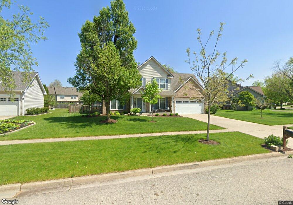
340 Whitewater Ln Oswego, IL 60543
Northwest Oswego NeighborhoodEstimated Value: $424,376 - $450,000
4
Beds
3
Baths
2,435
Sq Ft
$180/Sq Ft
Est. Value
About This Home
This home is located at 340 Whitewater Ln, Oswego, IL 60543 and is currently estimated at $438,594, approximately $180 per square foot. 340 Whitewater Ln is a home located in Kendall County with nearby schools including Fox Chase Elementary School, Traughber Junior High School, and Oswego High School.
Ownership History
Date
Name
Owned For
Owner Type
Purchase Details
Closed on
Jun 8, 2005
Sold by
Bann James J and Bann Deanna M
Bought by
Halvax Timothy and Halvax Elizabeth M
Current Estimated Value
Home Financials for this Owner
Home Financials are based on the most recent Mortgage that was taken out on this home.
Original Mortgage
$59,500
Outstanding Balance
$19,136
Interest Rate
6.12%
Mortgage Type
Unknown
Estimated Equity
$419,458
Purchase Details
Closed on
Nov 30, 2000
Sold by
The Old Second National Bank Of Aurora
Bought by
Bann James J and Bann Deanna M
Home Financials for this Owner
Home Financials are based on the most recent Mortgage that was taken out on this home.
Original Mortgage
$178,241
Interest Rate
7.58%
Create a Home Valuation Report for This Property
The Home Valuation Report is an in-depth analysis detailing your home's value as well as a comparison with similar homes in the area
Home Values in the Area
Average Home Value in this Area
Purchase History
| Date | Buyer | Sale Price | Title Company |
|---|---|---|---|
| Halvax Timothy | $297,500 | Chicago Title Insurance Comp | |
| Bann James J | $223,000 | Ticor Title Insurance Compan |
Source: Public Records
Mortgage History
| Date | Status | Borrower | Loan Amount |
|---|---|---|---|
| Open | Halvax Timothy | $59,500 | |
| Open | Halvax Timothy | $223,100 | |
| Previous Owner | Bann James J | $178,241 | |
| Closed | Bann James J | $22,280 |
Source: Public Records
Tax History Compared to Growth
Tax History
| Year | Tax Paid | Tax Assessment Tax Assessment Total Assessment is a certain percentage of the fair market value that is determined by local assessors to be the total taxable value of land and additions on the property. | Land | Improvement |
|---|---|---|---|---|
| 2024 | $8,898 | $116,575 | $27,628 | $88,947 |
| 2023 | $7,780 | $101,369 | $24,024 | $77,345 |
| 2022 | $7,780 | $92,154 | $21,840 | $70,314 |
| 2021 | $7,730 | $88,610 | $21,000 | $67,610 |
| 2020 | $7,407 | $84,390 | $20,000 | $64,390 |
| 2019 | $7,716 | $86,382 | $20,000 | $66,382 |
| 2018 | $7,777 | $86,240 | $22,347 | $63,893 |
| 2017 | $7,533 | $79,484 | $20,596 | $58,888 |
| 2016 | $7,212 | $75,340 | $19,522 | $55,818 |
| 2015 | $7,026 | $70,411 | $18,245 | $52,166 |
| 2014 | -- | $68,361 | $17,714 | $50,647 |
| 2013 | -- | $71,959 | $18,646 | $53,313 |
Source: Public Records
Map
Nearby Homes
- 338 Millstream Ln Unit 1
- 514 Bentson St
- 125 Presidential Blvd Unit 3248
- 602 Clearwater Ct Unit 2
- 411 Bayberry Dr
- 608 Clearwater Ct
- 505 Parkland Ct
- 238 Willowwood Dr
- 403 Lake Ct
- 435 Fawn Dr
- 409 Fawn Dr
- 537 Arbor Ln
- 5055 U S 34
- 114 Riverview Ct
- 173 Dolores St
- 2350 State Route 31
- 102 Mary St
- LOT 10 SW Station Dr
- 2110 State Route 31
- 123 W Benton St
- 342 Whitewater Ln
- 429 Stonewater Ln
- 336 Millstream Ln
- 427 Stonewater Ln
- 344 Whitewater Ln
- 341 Whitewater Ln Unit 1
- 431 Stonewater Ln
- 343 Whitewater Ln
- 339 Millstream Ln
- 332 Millstream Ln
- 337 Millstream Ln
- 425 Stonewater Ln
- 346 Whitewater Ln
- 702 Hoover Dr
- 345 Whitewater Ln
- 335 Millstream Ln
- 433 Stonewater Ln
- 330 Millstream Ln Unit 1
- 701 Hoover Dr
- 428 Burr Oak Dr