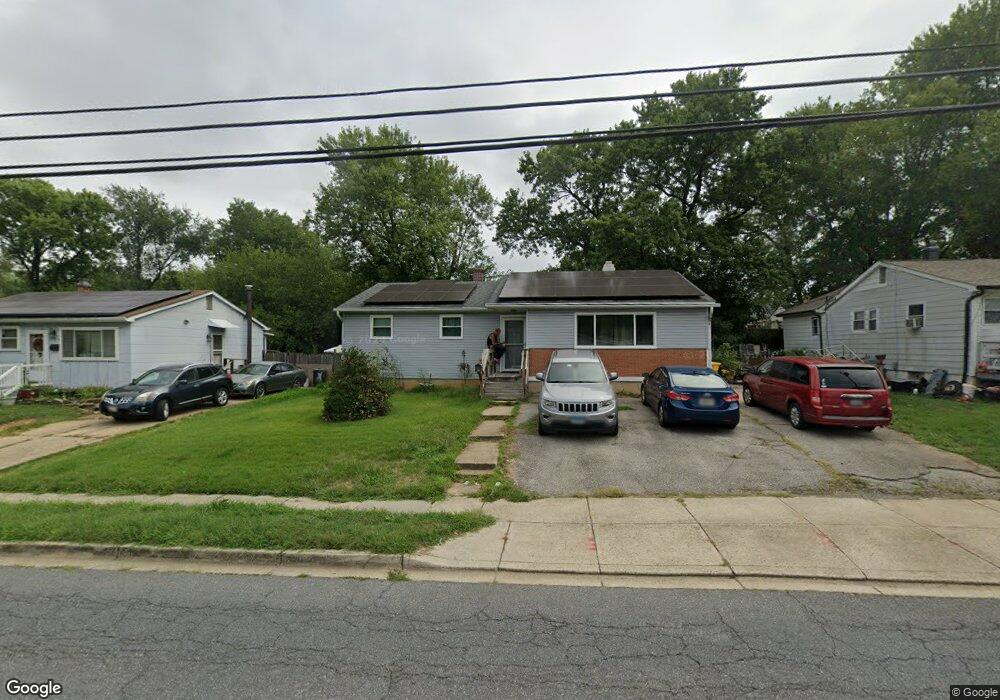
341 Brock Bridge Rd Laurel, MD 20724
Maryland City NeighborhoodEstimated Value: $379,218 - $419,000
Studio
3
Baths
1,512
Sq Ft
$267/Sq Ft
Est. Value
About This Home
This home is located at 341 Brock Bridge Rd, Laurel, MD 20724 and is currently estimated at $404,055, approximately $267 per square foot. 341 Brock Bridge Rd is a home located in Anne Arundel County with nearby schools including Brock Bridge Elementary School, Meade Middle School, and Meade High School.
Ownership History
Date
Name
Owned For
Owner Type
Purchase Details
Closed on
Nov 5, 1993
Sold by
Graham
Bought by
Egbert John D
Current Estimated Value
Home Financials for this Owner
Home Financials are based on the most recent Mortgage that was taken out on this home.
Original Mortgage
$127,350
Interest Rate
6.83%
Purchase Details
Closed on
May 12, 1986
Sold by
Stomierowski Louise
Bought by
Graham Patricia T
Home Financials for this Owner
Home Financials are based on the most recent Mortgage that was taken out on this home.
Original Mortgage
$91,292
Interest Rate
10%
Create a Home Valuation Report for This Property
The Home Valuation Report is an in-depth analysis detailing your home's value as well as a comparison with similar homes in the area
Home Values in the Area
Average Home Value in this Area
Purchase History
| Date | Buyer | Sale Price | Title Company |
|---|---|---|---|
| Egbert John D | $124,900 | -- | |
| Graham Patricia T | $89,000 | -- |
Source: Public Records
Mortgage History
| Date | Status | Borrower | Loan Amount |
|---|---|---|---|
| Closed | Egbert John D | $127,350 | |
| Previous Owner | Graham Patricia T | $91,292 |
Source: Public Records
Tax History
| Year | Tax Paid | Tax Assessment Tax Assessment Total Assessment is a certain percentage of the fair market value that is determined by local assessors to be the total taxable value of land and additions on the property. | Land | Improvement |
|---|---|---|---|---|
| 2025 | $3,731 | $353,000 | $196,800 | $156,200 |
| 2024 | $3,731 | $333,233 | $0 | $0 |
| 2023 | $3,616 | $313,467 | $0 | $0 |
| 2022 | $3,364 | $293,700 | $150,300 | $143,400 |
| 2020 | $3,200 | $273,300 | $0 | $0 |
| 2019 | $2,040 | $263,100 | $145,300 | $117,800 |
| 2018 | $2,597 | $256,133 | $0 | $0 |
| 2017 | $2,870 | $249,167 | $0 | $0 |
| 2016 | -- | $242,200 | $0 | $0 |
| 2015 | -- | $235,267 | $0 | $0 |
| 2014 | -- | $228,333 | $0 | $0 |
Source: Public Records
Map
Nearby Homes
- 322 Old Line Ave
- 11 S Carol St
- 328 Vale Summit S
- 3372 Sudlersville S
- 3352 Sudlersville S
- 342 Dameron S
- 3341 Valley Lee S
- 341 Dameron S
- 3339 Crumpton S
- 3338 Old Line Ave
- 3500 Old Annapolis Rd
- 3321 Yellow Flower Rd
- 6547 Clubhouse Dr
- 137 Collington Place
- 160 Lyons Creek Dr
- 149 Lyons Creek Dr
- 183 Lyons Creek Dr
- 136 Green Branch Rd
- 1729 Mill Branch Dr
- 9432 Nicklaus Ln
- 339 Brock Bridge Rd
- 343 Brock Bridge Rd
- 338 Marganza S
- 340 Marganza S
- 337 Brock Bridge Rd
- 345 Brock Bridge Rd
- 336 Marganza S
- 342 Marganza S
- 334 Marganza S
- 335 Brock Bridge Rd
- 347 Brock Bridge Rd
- 344 Marganza S
- 332 Marganza S
- 333 Brock Bridge Rd
- 349 Brock Bridge Rd
- 7 N Bruce St
- 11 N Bruce St
- 11 S Bruce St
- 346 Marganza S
- 337 Marganza S
Your Personal Tour Guide
Ask me questions while you tour the home.