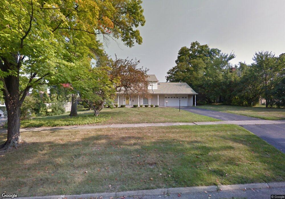
3410 Westwood Pkwy Flint, MI 48503
Woodcroft Estates NeighborhoodEstimated Value: $302,000 - $389,000
3
Beds
5
Baths
3,178
Sq Ft
$106/Sq Ft
Est. Value
About This Home
This home is located at 3410 Westwood Pkwy, Flint, MI 48503 and is currently estimated at $338,198, approximately $106 per square foot. 3410 Westwood Pkwy is a home located in Genesee County with nearby schools including Durant-Tuuri-Mott Elementary School, Flint Southwestern Classical Academy, and St. Paul Lutheran School.
Ownership History
Date
Name
Owned For
Owner Type
Purchase Details
Closed on
Apr 9, 2009
Sold by
Reynolds Linda Jane and Taylor Revocable T Marjories M
Bought by
Edwards Corinne E
Current Estimated Value
Create a Home Valuation Report for This Property
The Home Valuation Report is an in-depth analysis detailing your home's value as well as a comparison with similar homes in the area
Home Values in the Area
Average Home Value in this Area
Purchase History
| Date | Buyer | Sale Price | Title Company |
|---|---|---|---|
| Edwards Corinne E | $135,000 | Guaranty Title Company |
Source: Public Records
Tax History Compared to Growth
Tax History
| Year | Tax Paid | Tax Assessment Tax Assessment Total Assessment is a certain percentage of the fair market value that is determined by local assessors to be the total taxable value of land and additions on the property. | Land | Improvement |
|---|---|---|---|---|
| 2025 | $3,090 | $112,900 | $0 | $0 |
| 2024 | $2,726 | $125,600 | $0 | $0 |
| 2023 | $2,636 | $116,000 | $0 | $0 |
| 2022 | $0 | $102,300 | $0 | $0 |
| 2021 | $2,789 | $93,600 | $0 | $0 |
| 2020 | $2,441 | $88,900 | $0 | $0 |
| 2019 | $2,331 | $86,300 | $0 | $0 |
| 2018 | $2,492 | $79,700 | $0 | $0 |
| 2017 | $2,405 | $0 | $0 | $0 |
| 2016 | $2,385 | $0 | $0 | $0 |
| 2015 | -- | $0 | $0 | $0 |
| 2014 | -- | $0 | $0 | $0 |
| 2012 | -- | $51,600 | $0 | $0 |
Source: Public Records
Map
Nearby Homes
- 3401 Westwood Pkwy
- 3402 Brandon St
- 3102 Westwood Pkwy
- 3506 Chicago Blvd
- 3305 Larchmont St
- 3001 Yale St
- 2926 Yale St
- 3214 Clairmont St
- 3813 Larchmont St
- 3217 Arlene Ave
- 3918 Larchmont St
- 1414 Knapp Ave
- 1412 S Ballenger Hwy
- 1326 Hughes Ave
- 1318 Knapp Ave
- 1308 Barney Ave
- 1217 Barney Ave
- 3413 Augusta St
- 1202 Knapp Ave
- 1122 Stocker Ave
- 3402 Westwood Pkwy Unit Bldg-Unit
- 3402 Westwood Pkwy
- 3441 Hawthorne Dr
- 3420 Westwood Pkwy
- 3431 Hawthorne Dr
- 3421 Hawthorne Dr
- 3330 Westwood Pkwy
- 3405 Westwood Pkwy
- 3411 Hawthorne Dr
- 3411 Westwood Pkwy
- 2010 Briar Hill Rd
- 3501 Hawthorne Dr
- 3440 Hawthorne Dr
- 3450 Hawthorne Dr
- 3460 Hawthorne Dr
- 3470 Hawthorne Dr
- 3430 Hawthorne Dr
- 3401 Hawthorne Dr
- 3335 Westwood Pkwy
- 3420 Hawthorne Dr