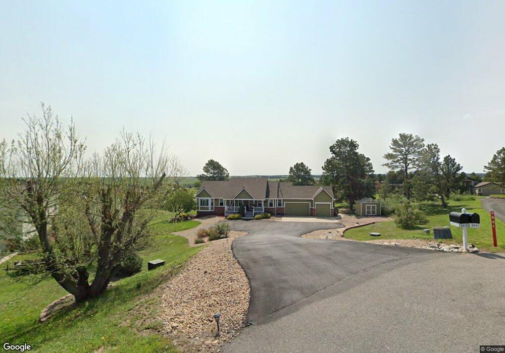
3419 Quail Ridge Cir Parker, CO 80138
Estimated Value: $873,000 - $968,000
4
Beds
3
Baths
3,722
Sq Ft
$248/Sq Ft
Est. Value
About This Home
This home is located at 3419 Quail Ridge Cir, Parker, CO 80138 and is currently estimated at $924,274, approximately $248 per square foot. 3419 Quail Ridge Cir is a home located in Elbert County with nearby schools including Elizabeth High School.
Ownership History
Date
Name
Owned For
Owner Type
Purchase Details
Closed on
Jun 26, 2020
Sold by
Schiefelbein Edward A and Schiefelbein Kim F
Bought by
Anderson Jason R
Current Estimated Value
Home Financials for this Owner
Home Financials are based on the most recent Mortgage that was taken out on this home.
Original Mortgage
$437,000
Outstanding Balance
$388,222
Interest Rate
3.2%
Mortgage Type
New Conventional
Estimated Equity
$536,052
Purchase Details
Closed on
Oct 14, 2003
Sold by
Armstrong Deshler D and Armstrong Norma B
Bought by
Schiefelbein Edward A and Schiefelbein Kim F
Home Financials for this Owner
Home Financials are based on the most recent Mortgage that was taken out on this home.
Original Mortgage
$331,500
Interest Rate
4.5%
Mortgage Type
Unknown
Create a Home Valuation Report for This Property
The Home Valuation Report is an in-depth analysis detailing your home's value as well as a comparison with similar homes in the area
Home Values in the Area
Average Home Value in this Area
Purchase History
| Date | Buyer | Sale Price | Title Company |
|---|---|---|---|
| Anderson Jason R | $645,000 | Fidelity National Title | |
| Schiefelbein Edward A | $390,000 | -- |
Source: Public Records
Mortgage History
| Date | Status | Borrower | Loan Amount |
|---|---|---|---|
| Open | Anderson Jason R | $437,000 | |
| Previous Owner | Schiefelbein Edward A | $331,500 |
Source: Public Records
Tax History Compared to Growth
Tax History
| Year | Tax Paid | Tax Assessment Tax Assessment Total Assessment is a certain percentage of the fair market value that is determined by local assessors to be the total taxable value of land and additions on the property. | Land | Improvement |
|---|---|---|---|---|
| 2024 | $4,610 | $54,500 | $8,790 | $45,710 |
| 2023 | $4,610 | $54,500 | $8,790 | $45,710 |
| 2022 | $3,827 | $43,100 | $9,380 | $33,720 |
| 2021 | $3,923 | $44,340 | $9,650 | $34,690 |
| 2020 | $3,523 | $39,610 | $6,790 | $32,820 |
| 2019 | $3,531 | $39,610 | $6,790 | $32,820 |
| 2018 | $3,042 | $34,190 | $6,480 | $27,710 |
| 2017 | $3,044 | $34,190 | $6,480 | $27,710 |
| 2016 | $2,780 | $30,680 | $7,400 | $23,280 |
| 2015 | $2,467 | $30,680 | $7,400 | $23,280 |
| 2014 | $2,467 | $26,390 | $7,160 | $19,230 |
Source: Public Records
Map
Nearby Homes
- 3074 County Road 166
- 3672 Deer Creek Dr
- 41419 Deer Creek Cir
- 41504 Vista Ridge
- 41479 Countryside Cir
- 3560 Zane Gray Loop
- 40216 Margaret Dr
- 40305 Margaret Dr
- 2104 Helen Ct
- 39833 Transition Terrace
- 42146 Vista Ridge
- 1789 Joseph Cir
- 780 Mosquito Ct
- 39681 Swift Creek Cir
- 42313 Vista Ridge
- 42274 Thunder Hill Rd
- 2470 Driftwood
- 1740 Joseph Cir
- 40753 County Road 21
- 4580 Pleasant Valley Cir
- 3397 Quail Ridge Cir
- 3331 Meadowlark Ct
- 3441 Quail Ridge Cir
- 3320 Meadowlark Ct
- 3438 Quail Ridge Cir
- 3353 Meadowlark Ct
- 3375 Quail Ridge Cir
- 41324 Pine Meadow Cir
- 3342 Meadowlark Ct
- 3364 Quail Ridge Cir
- 41302 Pine Meadow Cir
- 41346 Pine Meadow Cir
- 41236 S Pinefield Cir
- 3430 Pine Meadow Ave
- 41214 S Pinefield Cir
- 3496 Pine Meadow Ave
- 3386 Deer Creek Dr
- 3397 Meadowlark Ct
- 3408 Deer Creek Dr
- 3518 Pine Meadow Ave