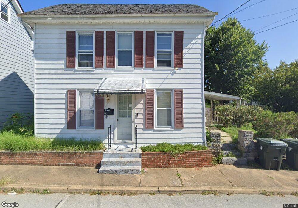
342 Liberty St Hagerstown, MD 21740
East End NeighborhoodEstimated Value: $210,000 - $248,000
3
Beds
2
Baths
1,418
Sq Ft
$160/Sq Ft
Est. Value
About This Home
This home is located at 342 Liberty St, Hagerstown, MD 21740 and is currently estimated at $227,172, approximately $160 per square foot. 342 Liberty St is a home located in Washington County with nearby schools including Pangborn Elementary School, Otsego West Campus High School, and Northern Middle School.
Ownership History
Date
Name
Owned For
Owner Type
Purchase Details
Closed on
Apr 1, 2011
Sold by
J Hunter Enterprises Llc
Bought by
Ryan Shawn D
Current Estimated Value
Home Financials for this Owner
Home Financials are based on the most recent Mortgage that was taken out on this home.
Original Mortgage
$120,856
Outstanding Balance
$85,468
Interest Rate
5.5%
Mortgage Type
FHA
Estimated Equity
$141,704
Purchase Details
Closed on
Feb 19, 2011
Sold by
J Hunter Enterprises Llc
Bought by
Ryan Shawn D
Home Financials for this Owner
Home Financials are based on the most recent Mortgage that was taken out on this home.
Original Mortgage
$120,856
Outstanding Balance
$85,468
Interest Rate
5.5%
Mortgage Type
FHA
Estimated Equity
$141,704
Purchase Details
Closed on
Nov 16, 2010
Sold by
Orellana Jose Roberto
Bought by
Bank Deutsche National Trust Co
Purchase Details
Closed on
Jan 11, 2006
Sold by
Blair Richard C and Blair Roslyn J
Bought by
Orellana Jose Roberto and Flores Concepcion
Home Financials for this Owner
Home Financials are based on the most recent Mortgage that was taken out on this home.
Original Mortgage
$31,980
Interest Rate
6.28%
Mortgage Type
Stand Alone Second
Purchase Details
Closed on
Dec 30, 2005
Sold by
Blair Richard C and Blair Roslyn J
Bought by
Orellana Jose Roberto and Flores Concepcion
Home Financials for this Owner
Home Financials are based on the most recent Mortgage that was taken out on this home.
Original Mortgage
$31,980
Interest Rate
6.28%
Mortgage Type
Stand Alone Second
Purchase Details
Closed on
Jul 10, 1997
Sold by
Hartman Margaretc
Bought by
Blair Richard C and Blair Roslyn J
Create a Home Valuation Report for This Property
The Home Valuation Report is an in-depth analysis detailing your home's value as well as a comparison with similar homes in the area
Home Values in the Area
Average Home Value in this Area
Purchase History
| Date | Buyer | Sale Price | Title Company |
|---|---|---|---|
| Ryan Shawn D | $124,000 | -- | |
| Ryan Shawn D | $124,000 | -- | |
| Bank Deutsche National Trust Co | $79,908 | -- | |
| Orellana Jose Roberto | $159,900 | -- | |
| Orellana Jose Roberto | $159,900 | -- | |
| Blair Richard C | $20,000 | -- |
Source: Public Records
Mortgage History
| Date | Status | Borrower | Loan Amount |
|---|---|---|---|
| Open | Ryan Shawn D | $120,856 | |
| Closed | Ryan Shawn D | $120,856 | |
| Previous Owner | Orellana Jose Roberto | $31,980 | |
| Previous Owner | Orellana Jose Roberto | $127,920 | |
| Previous Owner | Orellana Jose Roberto | $127,920 |
Source: Public Records
Tax History Compared to Growth
Tax History
| Year | Tax Paid | Tax Assessment Tax Assessment Total Assessment is a certain percentage of the fair market value that is determined by local assessors to be the total taxable value of land and additions on the property. | Land | Improvement |
|---|---|---|---|---|
| 2025 | $1,158 | $146,900 | $39,800 | $107,100 |
| 2024 | $1,158 | $137,133 | $0 | $0 |
| 2023 | $1,099 | $127,367 | $0 | $0 |
| 2022 | $1,043 | $117,600 | $39,800 | $77,800 |
| 2021 | $964 | $111,233 | $0 | $0 |
| 2020 | $964 | $104,867 | $0 | $0 |
| 2019 | $921 | $98,500 | $39,800 | $58,700 |
| 2018 | $921 | $98,500 | $39,800 | $58,700 |
| 2017 | $921 | $98,500 | $0 | $0 |
| 2016 | -- | $103,800 | $0 | $0 |
| 2015 | -- | $103,800 | $0 | $0 |
| 2014 | $1,531 | $103,800 | $0 | $0 |
Source: Public Records
Map
Nearby Homes
- 312 E Franklin St
- 338 Liberty St
- 351 Liberty St
- 136 N Cannon Ave
- 414 E Franklin St
- 51 N Cannon Ave
- 200 E Franklin St
- 35 N Cleveland Ave
- 440 Liberty St
- 228 E Washington St
- 207 N Mulberry St
- 142 East Ave
- 15 S Cannon Ave
- 115 East Ave
- 133 Randolph Ave
- 16 S Mulberry St
- 329 Antietam E
- 112 S Cannon Ave
- 227 N Locust St
- 200 E Antietam St
- 350 Liberty St
- 330 Liberty St
- 334 Liberty St
- 335 Liberty St
- 352 Liberty St
- 331 Liberty St
- 399 Liberty St
- 327 Liberty St
- 402 Liberty St
- 347 Musey Ave
- 322 Liberty St
- 325 Liberty St
- 401 Liberty St
- 321 Liberty St
- 350 E Franklin St
- 404 Liberty St
- 342 E Franklin St
- 405 Liberty St
- 316 Liberty St
- 406 Liberty St