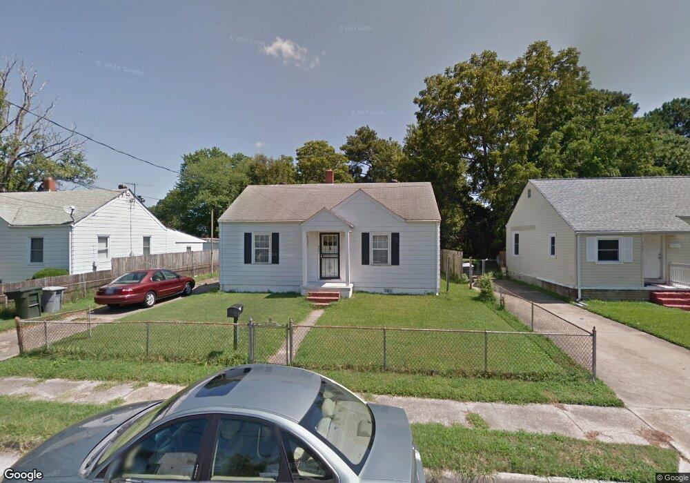
342 Wilton Ave Hampton, VA 23663
Buckroe Beach NeighborhoodEstimated Value: $202,000 - $246,000
2
Beds
1
Bath
1,224
Sq Ft
$180/Sq Ft
Est. Value
About This Home
This home is located at 342 Wilton Ave, Hampton, VA 23663 and is currently estimated at $220,842, approximately $180 per square foot. 342 Wilton Ave is a home located in Hampton City with nearby schools including Jane H. Bryan Elementary School, Benjamin Syms Middle School, and Phoebus High School.
Ownership History
Date
Name
Owned For
Owner Type
Purchase Details
Closed on
Mar 27, 2024
Sold by
Crum Mary L and Clemons Mary
Bought by
Clemons James and Clemons Mary
Current Estimated Value
Home Financials for this Owner
Home Financials are based on the most recent Mortgage that was taken out on this home.
Original Mortgage
$115,000
Outstanding Balance
$113,301
Interest Rate
6.94%
Mortgage Type
New Conventional
Estimated Equity
$107,541
Create a Home Valuation Report for This Property
The Home Valuation Report is an in-depth analysis detailing your home's value as well as a comparison with similar homes in the area
Home Values in the Area
Average Home Value in this Area
Purchase History
| Date | Buyer | Sale Price | Title Company |
|---|---|---|---|
| Clemons James | -- | Vylla Title |
Source: Public Records
Mortgage History
| Date | Status | Borrower | Loan Amount |
|---|---|---|---|
| Open | Clemons James | $115,000 |
Source: Public Records
Tax History
| Year | Tax Paid | Tax Assessment Tax Assessment Total Assessment is a certain percentage of the fair market value that is determined by local assessors to be the total taxable value of land and additions on the property. | Land | Improvement |
|---|---|---|---|---|
| 2025 | $2,207 | $184,800 | $60,000 | $124,800 |
| 2024 | $2,011 | $174,900 | $60,000 | $114,900 |
| 2023 | $1,917 | $153,000 | $55,000 | $98,000 |
| 2022 | $1,630 | $138,100 | $45,000 | $93,100 |
| 2021 | $1,628 | $120,800 | $36,400 | $84,400 |
| 2020 | $1,476 | $119,000 | $36,400 | $82,600 |
| 2019 | $1,380 | $111,300 | $36,400 | $74,900 |
| 2018 | $1,460 | $110,200 | $35,700 | $74,500 |
| 2017 | $1,460 | $0 | $0 | $0 |
| 2016 | $1,460 | $110,200 | $0 | $0 |
| 2015 | $1,460 | $0 | $0 | $0 |
| 2014 | $1,386 | $114,000 | $35,700 | $78,300 |
Source: Public Records
Map
Nearby Homes
- 604 Old Buckroe Rd
- 1527 Grove St
- 1510 Denton Dr
- 1642 N Mallory St
- 1938 Long Green Ln
- 438 Shelton Rd
- 2112 E Pembroke Ave
- 714 Grove St
- 17 Seaview Dr
- 1915 Long Green Ln
- 1909 Long Green Ln
- 6 Langille Ct
- 9 Bayview Ct
- 2051 Richard Ave
- 1333 N Mallory St
- 1923 Rawood Dr
- 1530 Morgan Dr
- 1904 Nickerson Blvd
- 1504 E Pembroke Ave
- 1622 Old Buckroe Rd
- 340 Wilton Ave
- 344 Wilton Ave
- 338 Wilton Ave
- 37 Harwood Ave
- 39 Harwood Ave
- 35 Harwood Ave
- 336 Wilton Ave
- 341 Wilton Ave
- 343 Wilton Ave
- 339 Wilton Ave
- 33 Harwood Ave
- 337 Wilton Ave
- 1367 Old Buckroe Rd
- 334 Wilton Ave
- 1371 Old Buckroe Rd
- 31 Harwood Ave
- 335 Wilton Ave
- 34 Harwood Ave
- 332 Wilton Ave
- 340 Darby Ave
Your Personal Tour Guide
Ask me questions while you tour the home.