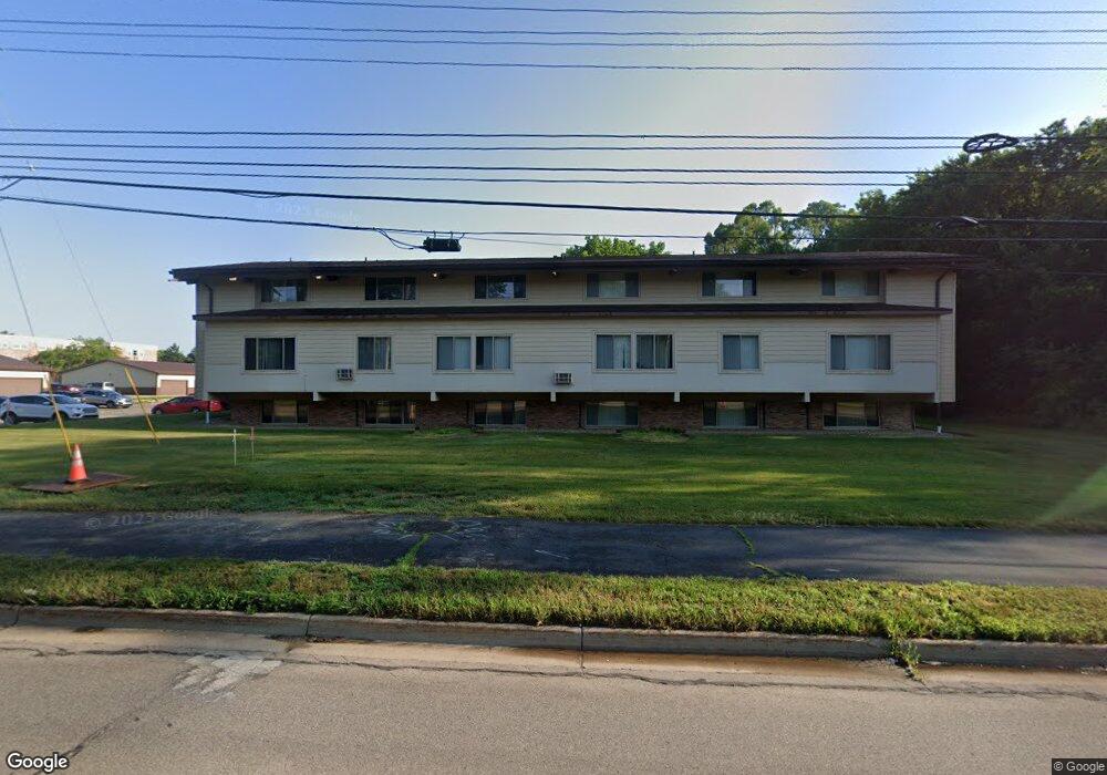
3420 W Main St Kalamazoo, MI 49006
Westwood Neighborhood
--
Bed
--
Bath
66,880
Sq Ft
3.65
Acres
About This Home
This home is located at 3420 W Main St, Kalamazoo, MI 49006. 3420 W Main St is a home located in Kalamazoo County with nearby schools including King-Westwood Elementary School, Hillside Middle School, and Kalamazoo Central High School.
Ownership History
Date
Name
Owned For
Owner Type
Purchase Details
Closed on
Sep 24, 2020
Sold by
Embassy Holdings Llc
Bought by
Tricap Embassy Terrace Apartments Llc
Purchase Details
Closed on
Oct 31, 2007
Sold by
Embassy Terrace Llc
Bought by
Embassy Holdings Llc
Purchase Details
Closed on
Jun 19, 2003
Sold by
Embassy Apartments Grantor Trust
Bought by
Embassy Terrace Llc
Home Financials for this Owner
Home Financials are based on the most recent Mortgage that was taken out on this home.
Original Mortgage
$1,600,000
Interest Rate
5.4%
Mortgage Type
Commercial
Create a Home Valuation Report for This Property
The Home Valuation Report is an in-depth analysis detailing your home's value as well as a comparison with similar homes in the area
Home Values in the Area
Average Home Value in this Area
Purchase History
| Date | Buyer | Sale Price | Title Company |
|---|---|---|---|
| Tricap Embassy Terrace Apartments Llc | -- | Chicago Title Of Mi Inc | |
| Embassy Holdings Llc | -- | Devon Title | |
| Embassy Terrace Llc | -- | Trans |
Source: Public Records
Mortgage History
| Date | Status | Borrower | Loan Amount |
|---|---|---|---|
| Previous Owner | Embassy Terrace Llc | $1,600,000 |
Source: Public Records
Tax History Compared to Growth
Tax History
| Year | Tax Paid | Tax Assessment Tax Assessment Total Assessment is a certain percentage of the fair market value that is determined by local assessors to be the total taxable value of land and additions on the property. | Land | Improvement |
|---|---|---|---|---|
| 2025 | $107,460 | $1,916,800 | $0 | $0 |
| 2024 | $16,039 | $1,961,000 | $0 | $0 |
| 2023 | $15,291 | $1,596,000 | $0 | $0 |
| 2022 | $97,384 | $1,429,300 | $0 | $0 |
| 2021 | $91,916 | $1,312,900 | $0 | $0 |
| 2020 | $65,003 | $1,176,100 | $0 | $0 |
| 2019 | $62,767 | $1,104,200 | $0 | $0 |
| 2018 | $61,308 | $1,038,600 | $0 | $0 |
| 2017 | $0 | $1,038,600 | $0 | $0 |
| 2016 | -- | $970,300 | $0 | $0 |
| 2015 | -- | $883,700 | $0 | $0 |
| 2014 | -- | $854,000 | $0 | $0 |
Source: Public Records
Map
Nearby Homes
- 4146 Corvo
- 3725 Olney Rd
- 325 N Kendall Ave
- 3503 Devonshire Ave
- 3104 Grace Rd
- 3317 Cranbrook Ave
- 1113 Nichols Rd
- 4021 Londonderry Ave
- 3326 Cranbrook Ave
- 3304 Cranbrook Ave
- 806 Northampton Rd
- 2727 Olney Rd
- 902 Coolidge Ave
- 141 Selkirk Ct Unit 103
- 213 Raintree Cir Unit 55
- 113 Inverness Ct
- 154 Carberry Hill Ct Unit 43
- 3526 Alianca Terrace
- 1361 Cherokee St
- 1314 Highgate Rd
- 3420 W Main St
- 4525 W Main St
- 3319 W Main St
- 409 Sabin St
- 3309 W Main St
- 612 Cherokee St
- 521 Cherokee St
- 3303 W Main St
- 412 Sabin St
- 323 Sabin St
- 616 Cherokee St Unit U-Com
- 616 Cherokee St Unit L-Com
- 616 Cherokee St
- 616 Cherokee St Unit L-2
- 616 Cherokee St Unit U-6
- 616 Cherokee St Unit 7-L
- 616 Cherokee St Unit L-3
- 616 Cherokee St Unit L-Comb
- 616 Cherokee St Unit U-Comb
- 616 Cherokee St Unit U-4