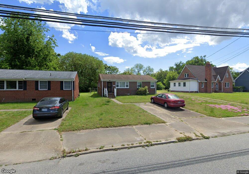
343 W Queen St Hampton, VA 23669
Olde Hampton NeighborhoodEstimated Value: $214,000 - $220,000
3
Beds
2
Baths
1,111
Sq Ft
$196/Sq Ft
Est. Value
About This Home
This home is located at 343 W Queen St, Hampton, VA 23669 and is currently estimated at $217,683, approximately $195 per square foot. 343 W Queen St is a home located in Hampton City with nearby schools including Bassette Elementary School, C. Alton Lindsay Middle School, and Phoebus High School.
Ownership History
Date
Name
Owned For
Owner Type
Purchase Details
Closed on
Oct 17, 2023
Sold by
Tynes James and Eley-Bond Regina V
Bought by
Carter Angelina
Current Estimated Value
Home Financials for this Owner
Home Financials are based on the most recent Mortgage that was taken out on this home.
Original Mortgage
$127,100
Outstanding Balance
$124,634
Interest Rate
7.19%
Mortgage Type
New Conventional
Estimated Equity
$93,049
Create a Home Valuation Report for This Property
The Home Valuation Report is an in-depth analysis detailing your home's value as well as a comparison with similar homes in the area
Home Values in the Area
Average Home Value in this Area
Purchase History
| Date | Buyer | Sale Price | Title Company |
|---|---|---|---|
| Carter Angelina | $181,000 | Chicago Title |
Source: Public Records
Mortgage History
| Date | Status | Borrower | Loan Amount |
|---|---|---|---|
| Open | Carter Angelina | $127,100 |
Source: Public Records
Tax History
| Year | Tax Paid | Tax Assessment Tax Assessment Total Assessment is a certain percentage of the fair market value that is determined by local assessors to be the total taxable value of land and additions on the property. | Land | Improvement |
|---|---|---|---|---|
| 2025 | $2,590 | $225,200 | $55,000 | $170,200 |
| 2024 | $2,316 | $201,400 | $45,000 | $156,400 |
| 2023 | $2,182 | $188,100 | $45,000 | $143,100 |
| 2022 | $1,703 | $144,300 | $45,000 | $99,300 |
| 2021 | $1,908 | $143,400 | $37,800 | $105,600 |
| 2020 | $1,684 | $135,800 | $37,800 | $98,000 |
| 2019 | $1,684 | $135,800 | $37,800 | $98,000 |
| 2018 | $1,601 | $135,800 | $37,800 | $98,000 |
| 2017 | $1,778 | $0 | $0 | $0 |
| 2016 | $1,778 | $135,800 | $0 | $0 |
| 2015 | $1,423 | $0 | $0 | $0 |
| 2014 | $1,413 | $107,200 | $37,800 | $69,400 |
Source: Public Records
Map
Nearby Homes
- 357 W Queen St
- 363 W Queen St
- 373 W Queen St
- 381 W Queen St
- 358 Lincoln St
- 27 Bacon St
- 28 Maplewood St
- 415 Lee St
- 19 Maplewood St
- 382 Union St
- 430 Newport News Ave
- 241 Newport News Ave
- 622 Chapel St
- 144 Meredith St
- 460 England Ave
- 50 Settlers Landing Rd
- 116 Linden Ave
- 4408 Victoria Blvd
- 416 Worster Ave
- 710 N Back River Rd
- 339 W Queen St
- 351 W Queen St
- 333 W Queen St
- 331 W Queen St
- 327 W Queen St
- 342 W Queen St
- 325 W Queen St
- 334 W Queen St
- 227 Settlers Landing Rd
- 231 Settlers Landing Rd
- 225 Settlers Landing Rd
- 344 W Queen St
- 235 Settlers Landing Rd
- 221 Settlers Landing Rd
- 18 Stewart St
- 237 Settlers Landing Rd
- 315 W Queen St
- 350 W Queen St
- 217 Settlers Landing Rd
- 20 Stewart St
Your Personal Tour Guide
Ask me questions while you tour the home.