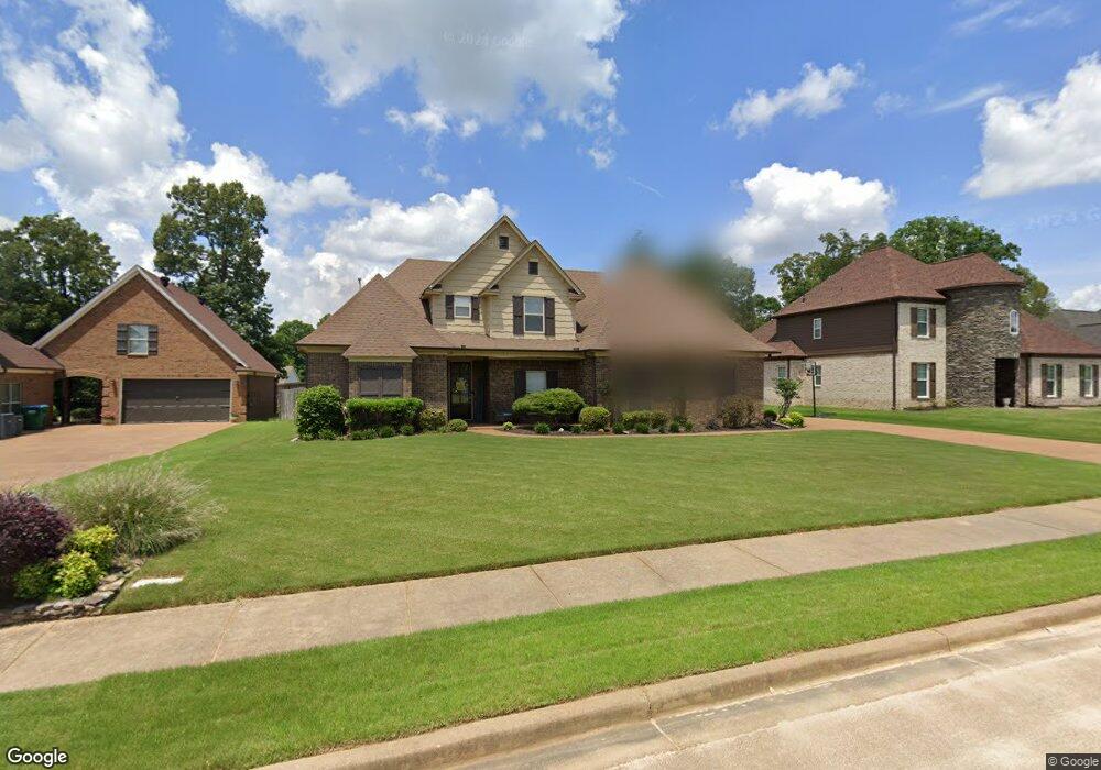
3432 Delaney Dr Nesbit, MS 38651
Pleasant Hill NeighborhoodEstimated Value: $405,000 - $453,000
4
Beds
3
Baths
2,676
Sq Ft
$160/Sq Ft
Est. Value
About This Home
This home is located at 3432 Delaney Dr, Nesbit, MS 38651 and is currently estimated at $427,187, approximately $159 per square foot. 3432 Delaney Dr is a home located in DeSoto County with nearby schools including DeSoto Central Primary School, DeSoto Central Elementary School, and DeSoto Central Middle School.
Ownership History
Date
Name
Owned For
Owner Type
Purchase Details
Closed on
Aug 31, 2018
Sold by
Faulkner James S and Faulkner Kristi T
Bought by
Spencer Michael and Spencer Lindsay
Current Estimated Value
Home Financials for this Owner
Home Financials are based on the most recent Mortgage that was taken out on this home.
Original Mortgage
$208,800
Outstanding Balance
$124,465
Interest Rate
4.6%
Mortgage Type
New Conventional
Estimated Equity
$302,722
Purchase Details
Closed on
Mar 29, 2013
Sold by
Pratt Larry Joe and Pratt Denise M
Bought by
Faulkner James S and Faulkner Kristi T
Home Financials for this Owner
Home Financials are based on the most recent Mortgage that was taken out on this home.
Original Mortgage
$189,050
Interest Rate
3.57%
Mortgage Type
New Conventional
Purchase Details
Closed on
Sep 29, 2010
Sold by
First Security Bank
Bought by
Pratt Larry Joe and Pratt Denise M
Home Financials for this Owner
Home Financials are based on the most recent Mortgage that was taken out on this home.
Original Mortgage
$165,496
Interest Rate
4.42%
Mortgage Type
Seller Take Back
Purchase Details
Closed on
May 26, 2010
Sold by
Residential Building Assistance Llc
Bought by
First Security Bank
Create a Home Valuation Report for This Property
The Home Valuation Report is an in-depth analysis detailing your home's value as well as a comparison with similar homes in the area
Home Values in the Area
Average Home Value in this Area
Purchase History
| Date | Buyer | Sale Price | Title Company |
|---|---|---|---|
| Spencer Michael | -- | First National Financial Tit | |
| Faulkner James S | -- | None Available | |
| Pratt Larry Joe | -- | None Available | |
| First Security Bank | $180,820 | None Available |
Source: Public Records
Mortgage History
| Date | Status | Borrower | Loan Amount |
|---|---|---|---|
| Open | Spencer Michael | $208,800 | |
| Previous Owner | Faulkner James S | $189,050 | |
| Previous Owner | Pratt Larry Joe | $165,496 |
Source: Public Records
Tax History
| Year | Tax Paid | Tax Assessment Tax Assessment Total Assessment is a certain percentage of the fair market value that is determined by local assessors to be the total taxable value of land and additions on the property. | Land | Improvement |
|---|---|---|---|---|
| 2025 | $2,258 | $27,371 | $3,200 | $24,171 |
| 2024 | $1,990 | $19,906 | $3,200 | $16,706 |
| 2023 | $1,990 | $19,906 | $0 | $0 |
| 2022 | $1,990 | $19,906 | $3,200 | $16,706 |
| 2021 | $1,990 | $19,906 | $3,200 | $16,706 |
| 2020 | $1,853 | $18,536 | $3,200 | $15,336 |
| 2019 | $1,853 | $18,536 | $3,200 | $15,336 |
| 2017 | $1,674 | $36,006 | $19,603 | $16,403 |
| 2016 | $1,674 | $19,603 | $3,200 | $16,403 |
| 2015 | $1,974 | $36,006 | $19,603 | $16,403 |
| 2014 | $1,674 | $19,603 | $0 | $0 |
| 2013 | $2,961 | $29,405 | $0 | $0 |
Source: Public Records
Map
Nearby Homes
- 3456 Susie Cir
- 4055 Bakersfield Dr
- 1835 Baisley Dr
- 1811 Baisley Dr
- 1721 Baisley Dr
- Lot 99 Baisley Dr
- 1722 Baisley Dr
- Lot 107 Brooke Dr
- 4232 Brooke Dr
- 4020 Maryan Ct
- 4209 Edison Dr
- 4276 Brooke Dr
- 1755 Bakersfield Way
- 1735 Bakersfield Way
- 1762 Bakersfield Way
- 1694 Bakersfield Way
- 3491 Hatton Dr
- 3770 Malone Rd
- 3771 Malone Rd
- 1789 Caribe Dr
Your Personal Tour Guide
Ask me questions while you tour the home.