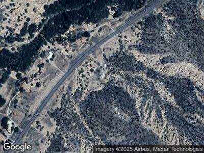
34398 Us Highway 285 Ojo Caliente, NM 87549
Estimated Value: $508,000 - $632,548
3
Beds
2
Baths
2,000
Sq Ft
$289/Sq Ft
Est. Value
About This Home
This home is located at 34398 Us Highway 285, Ojo Caliente, NM 87549 and is currently estimated at $578,516, approximately $289 per square foot. 34398 Us Highway 285 is a home located in Rio Arriba County with nearby schools including Mesa Vista High School.
Ownership History
Date
Name
Owned For
Owner Type
Purchase Details
Closed on
Oct 30, 2020
Sold by
Pierson Michael and Butler Miriam
Bought by
Gonzales Andrew Geronimo
Current Estimated Value
Home Financials for this Owner
Home Financials are based on the most recent Mortgage that was taken out on this home.
Original Mortgage
$355,000
Outstanding Balance
$321,408
Interest Rate
2.9%
Mortgage Type
VA
Estimated Equity
$210,343
Purchase Details
Closed on
Dec 27, 2012
Sold by
Nielsen Petra and Nielsen Larry
Bought by
Pierson Michael Edward and Butler Miriam
Home Financials for this Owner
Home Financials are based on the most recent Mortgage that was taken out on this home.
Original Mortgage
$287,000
Interest Rate
3.35%
Mortgage Type
VA
Create a Home Valuation Report for This Property
The Home Valuation Report is an in-depth analysis detailing your home's value as well as a comparison with similar homes in the area
Home Values in the Area
Average Home Value in this Area
Purchase History
| Date | Buyer | Sale Price | Title Company |
|---|---|---|---|
| Gonzales Andrew Geronimo | -- | Rio Arriba T&E Co Inc | |
| Pierson Michael Edward | -- | Fidelity National Title Of N |
Source: Public Records
Mortgage History
| Date | Status | Borrower | Loan Amount |
|---|---|---|---|
| Open | Gonzales Andrew Geronimo | $355,000 | |
| Previous Owner | Pierson Michael Edward | $287,000 | |
| Previous Owner | Pierson Michael Edward | $287,000 | |
| Previous Owner | Sandia J Elizabeth | $225,250 |
Source: Public Records
Tax History Compared to Growth
Tax History
| Year | Tax Paid | Tax Assessment Tax Assessment Total Assessment is a certain percentage of the fair market value that is determined by local assessors to be the total taxable value of land and additions on the property. | Land | Improvement |
|---|---|---|---|---|
| 2024 | $3,051 | $124,856 | $28,162 | $96,694 |
| 2023 | $3,051 | $121,220 | $27,545 | $93,675 |
| 2022 | $2,901 | $120,663 | $25,958 | $94,705 |
| 2021 | $2,527 | $117,149 | $25,203 | $91,946 |
| 2020 | $0 | $131,396 | $27,281 | $104,115 |
| 2019 | $0 | $127,569 | $26,486 | $101,083 |
| 2018 | $0 | $128,584 | $26,486 | $102,098 |
| 2017 | $0 | $109,225 | $44,667 | $64,558 |
| 2016 | $0 | $120,817 | $50,273 | $70,544 |
| 2015 | -- | $117,299 | $48,809 | $68,490 |
| 2014 | -- | $113,882 | $47,387 | $66,495 |
| 2011 | -- | $99,127 | $0 | $0 |
Source: Public Records
Map
Nearby Homes
- 35295 Us Highway 285
- 087 Hwy 111
- TBD Nm Hwy 554
- 00 Us Highway 285
- 0 TBD Us Hwy 285
- 408 Nm Highway 111
- TBD Pd 1684 A
- 0 New Mexico 215
- 144 Hwy 341
- 0 Wild Onion Rd
- TBD Nm State Rd 554
- 0 1101
- 98 Nm 215
- 00 Tract 122 El Rito Estates
- 0.6 Acre Buffalo Trail
- 13/14 Lots Unit 15
- 13 14 Lots Unit 15
- 1.82 Acres Lots 7 8 9
- 59 Private Drive 1105
- Lot 16-B Laredowood Dr
- 34398 Us Highway 285 Unit 1
- 33973 Hwy 285 - Parcel E-1
- 33973 Hwy 285 - Parcel E-5
- 33973 Hwy 285 - Parcel E-3
- 33973 Hwy 285 - Parcel E-4
- 33973 Hwy 285 -Parcel E-2
- 33973 Highway 285 Parcel E-2-e5
- 34398 Us Highway 285
- 33743 Us Highway 285
- 33773 Us Highway 285
- 33770 Us Highway 285
- 35179 Us Highway 285
- 35163A Us Highway 285
- 7 County Road 176
- 7 Hwy 285 Mm 359
- 0 Highway 285 Unit 201104748
- 0 St Rd 285 Unit 201201382
- 0 Hwy 285 Unit 201202710
- 0 Hwy 285 Mile Marker 343 9 Unit 700038
- 0 Hwy 285 Cedar Ridge Sub Unit 701244
