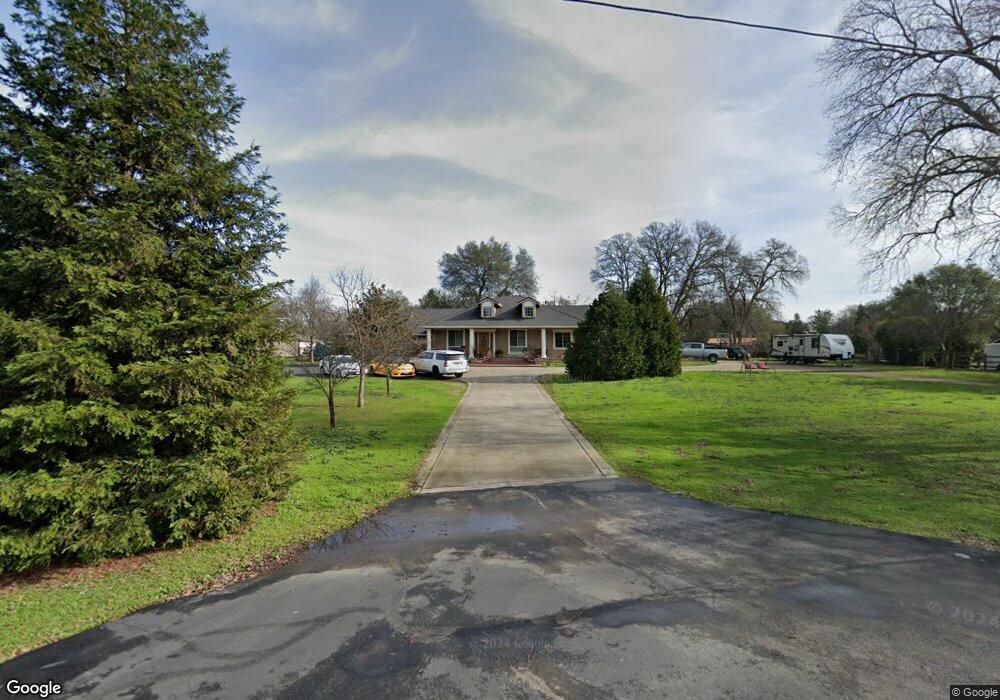
3445 Barker Rd Loomis, CA 95650
Estimated Value: $665,000 - $1,495,578
3
Beds
4
Baths
1,200
Sq Ft
$785/Sq Ft
Est. Value
About This Home
This home is located at 3445 Barker Rd, Loomis, CA 95650 and is currently estimated at $942,395, approximately $785 per square foot. 3445 Barker Rd is a home located in Placer County with nearby schools including Del Oro High School, Holy Cross Lutheran Academy, and Sierra Foothills Academy.
Ownership History
Date
Name
Owned For
Owner Type
Purchase Details
Closed on
Oct 20, 2021
Sold by
Bitner Steven D and Bitner Kathleen A
Bought by
Bitner Steven D and Bitner Kathy A
Current Estimated Value
Purchase Details
Closed on
Mar 3, 2003
Sold by
Picone John and Picone Glenda
Bought by
Bitner Steven D and Bitner Kathleen A
Home Financials for this Owner
Home Financials are based on the most recent Mortgage that was taken out on this home.
Original Mortgage
$360,000
Outstanding Balance
$154,425
Interest Rate
5.85%
Mortgage Type
Construction
Estimated Equity
$787,970
Create a Home Valuation Report for This Property
The Home Valuation Report is an in-depth analysis detailing your home's value as well as a comparison with similar homes in the area
Home Values in the Area
Average Home Value in this Area
Purchase History
| Date | Buyer | Sale Price | Title Company |
|---|---|---|---|
| Bitner Steven D | -- | None Available | |
| Bitner Steven D | $235,000 | Financial Title Company |
Source: Public Records
Mortgage History
| Date | Status | Borrower | Loan Amount |
|---|---|---|---|
| Open | Bitner Steven D | $360,000 |
Source: Public Records
Tax History
| Year | Tax Paid | Tax Assessment Tax Assessment Total Assessment is a certain percentage of the fair market value that is determined by local assessors to be the total taxable value of land and additions on the property. | Land | Improvement |
|---|---|---|---|---|
| 2023 | $14,378 | $1,258,305 | $333,336 | $924,969 |
| 2022 | $14,126 | $1,233,633 | $326,800 | $906,833 |
| 2021 | $13,762 | $1,209,445 | $320,393 | $889,052 |
| 2020 | $13,592 | $1,197,044 | $317,108 | $879,936 |
| 2019 | $13,357 | $1,173,574 | $310,891 | $862,683 |
| 2018 | $12,659 | $1,150,564 | $304,796 | $845,768 |
| 2017 | $12,431 | $1,128,005 | $298,820 | $829,185 |
| 2016 | $12,165 | $1,105,888 | $292,961 | $812,927 |
| 2015 | $11,912 | $1,089,278 | $288,561 | $800,717 |
| 2014 | $8,143 | $723,124 | $191,563 | $531,561 |
Source: Public Records
Map
Nearby Homes
- 3420 Grove Cir
- 3428 Colvin Dr
- 5567 Myrtle Dr
- 3890 Delmar Ave
- 0 Webb St
- 5760 Webb St
- 5932 Angelo Dr
- 3293 Stone Field Way
- 3301 Stone Field Way
- 5585 Tudor Way
- 4051 Pauline Cir
- 2615 Delmar Ave
- 3005 Chimney Ct
- 3955 Stonegate Ct
- 6154 S Walnut St Unit 40
- 0 Tracy Ln
- 4020 Silver Star Ct
- 4035 Coldwater Dr
- 3796 Coldwater Dr
- 4041 Coldwater Dr
Your Personal Tour Guide
Ask me questions while you tour the home.