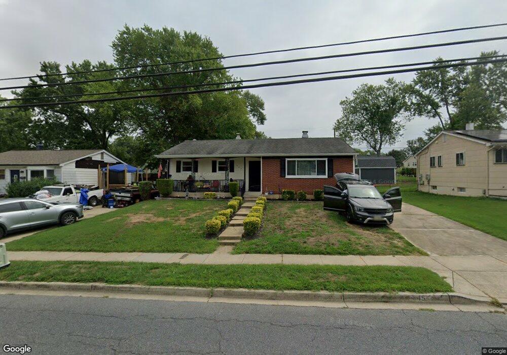
345 Brock Bridge Rd Laurel, MD 20724
Maryland City NeighborhoodEstimated Value: $384,000 - $432,679
Studio
3
Baths
1,262
Sq Ft
$325/Sq Ft
Est. Value
About This Home
This home is located at 345 Brock Bridge Rd, Laurel, MD 20724 and is currently estimated at $409,560, approximately $324 per square foot. 345 Brock Bridge Rd is a home located in Anne Arundel County with nearby schools including Brock Bridge Elementary School, Meade Middle School, and Meade High School.
Ownership History
Date
Name
Owned For
Owner Type
Purchase Details
Closed on
Jan 3, 1997
Sold by
Russo Elizabeth T
Bought by
Mason Thomas E and Alford Doloris J
Current Estimated Value
Purchase Details
Closed on
Feb 14, 1989
Sold by
Knotts Johnny W
Bought by
Russo Elizabeth T
Home Financials for this Owner
Home Financials are based on the most recent Mortgage that was taken out on this home.
Original Mortgage
$80,400
Interest Rate
10.56%
Create a Home Valuation Report for This Property
The Home Valuation Report is an in-depth analysis detailing your home's value as well as a comparison with similar homes in the area
Home Values in the Area
Average Home Value in this Area
Purchase History
| Date | Buyer | Sale Price | Title Company |
|---|---|---|---|
| Mason Thomas E | $125,000 | -- | |
| Russo Elizabeth T | $112,900 | -- |
Source: Public Records
Mortgage History
| Date | Status | Borrower | Loan Amount |
|---|---|---|---|
| Previous Owner | Russo Elizabeth T | $80,400 | |
| Closed | Mason Thomas E | -- |
Source: Public Records
Tax History
| Year | Tax Paid | Tax Assessment Tax Assessment Total Assessment is a certain percentage of the fair market value that is determined by local assessors to be the total taxable value of land and additions on the property. | Land | Improvement |
|---|---|---|---|---|
| 2025 | $502 | $342,700 | $196,800 | $145,900 |
| 2024 | $502 | $323,200 | $0 | $0 |
| 2023 | $474 | $303,700 | $0 | $0 |
| 2022 | $430 | $284,200 | $150,300 | $133,900 |
| 2021 | $222 | $277,267 | $0 | $0 |
| 2020 | $387 | $270,333 | $0 | $0 |
| 2019 | $387 | $263,400 | $145,300 | $118,100 |
| 2018 | $2,601 | $256,467 | $0 | $0 |
| 2017 | $383 | $249,533 | $0 | $0 |
| 2016 | -- | $242,600 | $0 | $0 |
| 2015 | -- | $235,267 | $0 | $0 |
| 2014 | -- | $227,933 | $0 | $0 |
Source: Public Records
Map
Nearby Homes
- 11 S Carol St
- 322 Old Line Ave
- 264 Old Line Ave
- 328 Vale Summit S
- 278 Brock Bridge Rd
- 237 Brock Bridge Rd
- 235 Brock Bridge Rd
- 342 Dameron S
- 341 Dameron S
- 3397 Fountain Green S
- 3338 Old Line Ave
- 3500 Old Annapolis Rd
- 6547 Clubhouse Dr
- 3321 Yellow Flower Rd
- 137 Collington Place
- 1810 Mill Branch Dr
- 1766 Mill Branch Dr
- 183 Lyons Creek Dr
- 136 Green Branch Rd
- 1729 Mill Branch Dr
- 347 Brock Bridge Rd
- 343 Brock Bridge Rd
- 342 Marganza S
- 349 Brock Bridge Rd
- 344 Marganza S
- 341 Brock Bridge Rd
- 340 Marganza S
- 346 Marganza S
- 338 Marganza S
- 351 Brock Bridge Rd
- 339 Brock Bridge Rd
- 348 Marganza S
- 336 Marganza S
- 5 N Bruce St
- 337 Brock Bridge Rd
- 7 N Bruce St
- 3420 Sudlersville S
- 341 Marganza S
- 343 Marganza S
- 350 Marganza S
Your Personal Tour Guide
Ask me questions while you tour the home.