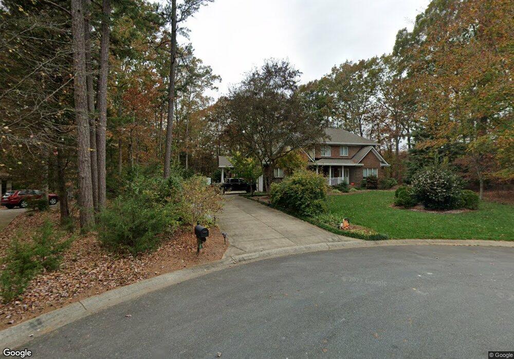
3459 Mayhew Forrest Ln Mint Hill, NC 28227
Estimated Value: $779,000 - $850,000
4
Beds
5
Baths
3,838
Sq Ft
$212/Sq Ft
Est. Value
About This Home
This home is located at 3459 Mayhew Forrest Ln, Mint Hill, NC 28227 and is currently estimated at $812,532, approximately $211 per square foot. 3459 Mayhew Forrest Ln is a home located in Mecklenburg County with nearby schools including Bain Elementary, Mint Hill Middle School, and Independence High.
Ownership History
Date
Name
Owned For
Owner Type
Purchase Details
Closed on
Mar 3, 2005
Sold by
Mack Randall A and Mack Carol G
Bought by
Mack Randall A and Mack Carol G
Current Estimated Value
Purchase Details
Closed on
Jul 22, 2004
Sold by
Mack Randall and Mack Carol
Bought by
Mack Randall A and Mack Carol G
Home Financials for this Owner
Home Financials are based on the most recent Mortgage that was taken out on this home.
Original Mortgage
$120,000
Outstanding Balance
$64,262
Interest Rate
6.24%
Mortgage Type
New Conventional
Estimated Equity
$748,270
Purchase Details
Closed on
Mar 1, 2004
Sold by
Flood Rory K and Flood Alyson C
Bought by
Mack Randall and Mack Carol
Purchase Details
Closed on
Nov 8, 2002
Sold by
Forrest Alfred C and Forrest Margie H
Bought by
Flood Rory K and Flood Alyson C
Home Financials for this Owner
Home Financials are based on the most recent Mortgage that was taken out on this home.
Original Mortgage
$40,500
Interest Rate
5.93%
Create a Home Valuation Report for This Property
The Home Valuation Report is an in-depth analysis detailing your home's value as well as a comparison with similar homes in the area
Home Values in the Area
Average Home Value in this Area
Purchase History
| Date | Buyer | Sale Price | Title Company |
|---|---|---|---|
| Mack Randall A | -- | -- | |
| Mack Randall A | -- | -- | |
| Mack Randall | $55,000 | -- | |
| Flood Rory K | $52,000 | -- |
Source: Public Records
Mortgage History
| Date | Status | Borrower | Loan Amount |
|---|---|---|---|
| Open | Mack Randall A | $120,000 | |
| Previous Owner | Flood Rory K | $40,500 |
Source: Public Records
Tax History Compared to Growth
Tax History
| Year | Tax Paid | Tax Assessment Tax Assessment Total Assessment is a certain percentage of the fair market value that is determined by local assessors to be the total taxable value of land and additions on the property. | Land | Improvement |
|---|---|---|---|---|
| 2025 | $4,588 | $641,000 | $120,000 | $521,000 |
| 2024 | $4,588 | $641,000 | $120,000 | $521,000 |
| 2023 | $4,519 | $641,000 | $120,000 | $521,000 |
| 2022 | $4,283 | $486,700 | $60,000 | $426,700 |
| 2021 | $4,283 | $486,700 | $60,000 | $426,700 |
| 2020 | $4,283 | $486,700 | $60,000 | $426,700 |
| 2019 | $4,277 | $486,700 | $60,000 | $426,700 |
| 2018 | $4,081 | $370,800 | $58,500 | $312,300 |
| 2017 | $4,050 | $370,800 | $58,500 | $312,300 |
| 2016 | -- | $368,500 | $58,500 | $310,000 |
| 2015 | $4,018 | $368,500 | $58,500 | $310,000 |
| 2014 | $4,016 | $368,500 | $58,500 | $310,000 |
Source: Public Records
Map
Nearby Homes
- 14916 Oregon Oak Ct
- 3985 Well Rd
- 5221 Blackjack Ln
- 13828 Lake Bluff Dr
- 4500 Matthews Mint Hill Rd
- 4401 Quail Ridge Dr
- 7407 Purple Martin Way
- 7407 Purple Martin Way Unit 50
- 7362 Purple Martin Way Unit 24
- 7400 Purple Martin Way Unit 25
- 13415 Idlefield Ln
- 13423 Idlefield Ln
- 3728 Piaffe Ave
- 00 Lake Bluff Dr
- 13446 Idlefield Ln
- 13517 Idlefield Ln
- 16542 Thompson Rd
- 13418 Castleford Dr
- 2336 Salute Blvd
- 13620 Castleford Dr
- 3453 Mayhew Forrest Ln
- 3916 Well Rd
- 3460 Mayhew Forrest Ln
- 5117 Apple Mint Ct
- 3452 Mayhew Forrest Ln
- 3439 Mayhew Forrest Ln
- 5107 Apple Mint Ct
- 3440 Mayhew Forrest Ln
- 3427 Mayhew Forrest Ln
- 5219 Mintridge Rd
- 5229 Mintridge Rd
- 3852 Well Rd
- 5209 Mintridge Rd
- 3920 Well Rd
- 3428 Mayhew Forrest Ln
- 5116 Apple Mint Ct
- 5237 Mintridge Rd
- 5106 Apple Mint Ct
- 3417 Mayhew Forrest Ln
- 3812 Well Rd