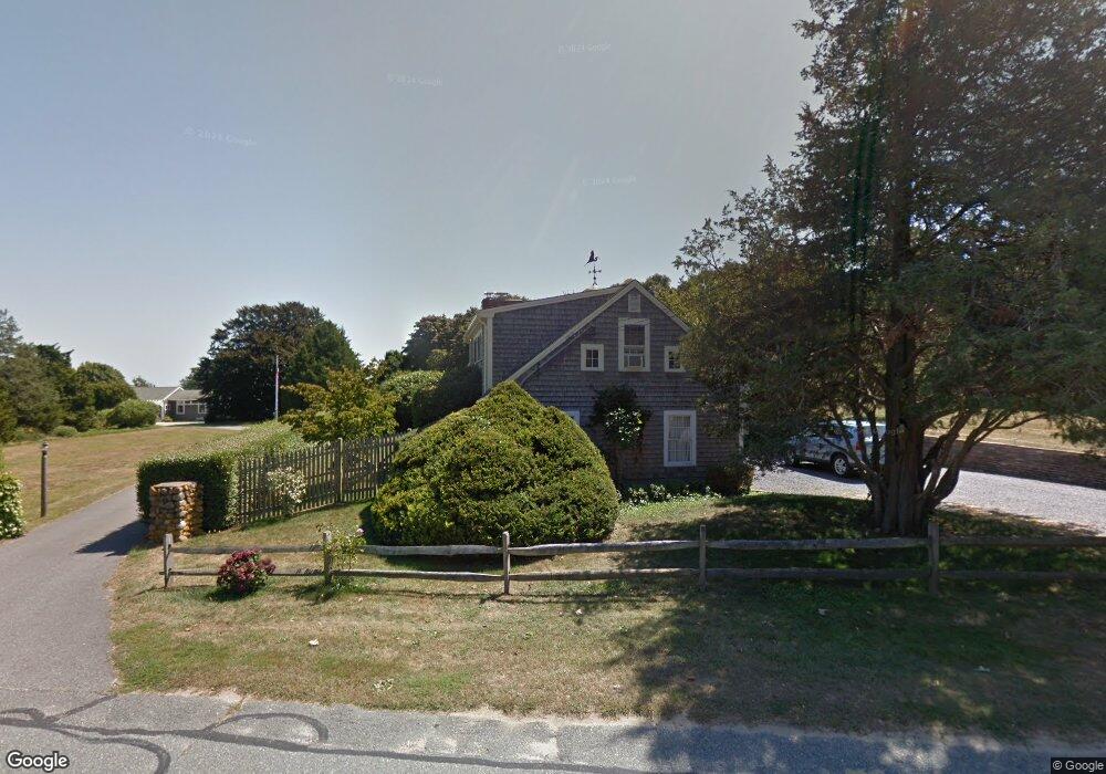
347 Tonset Rd Orleans, MA 02653
Estimated Value: $1,056,000 - $1,803,000
4
Beds
3
Baths
2,593
Sq Ft
$563/Sq Ft
Est. Value
About This Home
This home is located at 347 Tonset Rd, Orleans, MA 02653 and is currently estimated at $1,460,426, approximately $563 per square foot. 347 Tonset Rd is a home located in Barnstable County with nearby schools including Orleans Elementary School, Nauset Regional Middle School, and Nauset Regional High School.
Ownership History
Date
Name
Owned For
Owner Type
Purchase Details
Closed on
Dec 30, 2008
Sold by
Drew Sara J
Bought by
Drew Tonset Rt and Drew Sara J
Current Estimated Value
Home Financials for this Owner
Home Financials are based on the most recent Mortgage that was taken out on this home.
Original Mortgage
$625,500
Outstanding Balance
$415,786
Interest Rate
6.17%
Mortgage Type
Reverse Mortgage Home Equity Conversion Mortgage
Estimated Equity
$1,044,640
Purchase Details
Closed on
Feb 10, 2004
Sold by
Drew Sara J
Bought by
Tr Drew Tonset Rea and Drew Sara J
Create a Home Valuation Report for This Property
The Home Valuation Report is an in-depth analysis detailing your home's value as well as a comparison with similar homes in the area
Home Values in the Area
Average Home Value in this Area
Purchase History
| Date | Buyer | Sale Price | Title Company |
|---|---|---|---|
| Drew Tonset Rt | -- | -- | |
| Tr Drew Tonset Rea | -- | -- |
Source: Public Records
Mortgage History
| Date | Status | Borrower | Loan Amount |
|---|---|---|---|
| Open | Drew Tonset Rt | $625,500 |
Source: Public Records
Tax History Compared to Growth
Tax History
| Year | Tax Paid | Tax Assessment Tax Assessment Total Assessment is a certain percentage of the fair market value that is determined by local assessors to be the total taxable value of land and additions on the property. | Land | Improvement |
|---|---|---|---|---|
| 2025 | $7,345 | $1,177,100 | $525,100 | $652,000 |
| 2024 | $6,918 | $1,079,300 | $486,100 | $593,200 |
| 2023 | $6,013 | $965,200 | $397,200 | $568,000 |
| 2022 | $5,796 | $805,000 | $385,200 | $419,800 |
| 2021 | $6,702 | $731,700 | $381,400 | $350,300 |
| 2020 | $2,214 | $725,000 | $381,400 | $343,600 |
| 2019 | $5,191 | $701,500 | $370,700 | $330,800 |
| 2018 | $1,939 | $680,000 | $363,600 | $316,400 |
| 2017 | $4,223 | $667,200 | $363,600 | $303,600 |
| 2016 | $4,123 | $638,200 | $340,600 | $297,600 |
| 2015 | $4,000 | $623,100 | $333,900 | $289,200 |
Source: Public Records
Map
Nearby Homes
- 46 Freeman Ln
- 6 Snow Way
- 3 Bramblewood Ln
- 2 Seaview Rd
- 60 Smith Heights Way
- 25 Twin Rocks Dr
- 30 Cove Rd
- 6 Hathorne Ln
- 20 Kittiwake Ln
- 1061 State Hwy Unit 4
- 993 Intonti Way
- 995 Intonti Way
- 785 State Hwy Unit 9
- 330 Hay Rd
- 320 State Hwy
- 53 Great Oak Rd
- 1875 State Hwy
- 110 Beach Rd
- 20 White Pines Dr
- 150 Old State Hwy Unit Compound
- 345 Tonset Rd
- 350 Tonset Rd
- 351 Tonset Rd
- 349A Tonset Rd
- 349 Tonset Rd
- 349A Tonset Rd
- 343 Tonset Rd
- 342 Tonset Rd
- 353 Tonset Rd
- 356 Tonset Rd
- 28 Uncle Marks Way
- 28 Uncle Vicks Way
- 346 Tonset Rd
- 364 Tonset Rd
- 355 Tonset Rd
- 17 Uncle Vicks Way
- 9 Uncle Mark's Way
- 335 Tonset Rd
- 357 Tonset Rd
- 334 Tonset Rd