
Seller's Agent in 2021
Paul Tommey
Executive Group Realty LLC
(762) 822-6411
7 in this area
51 Total Sales


Estimated Value: $144,000 - $163,000
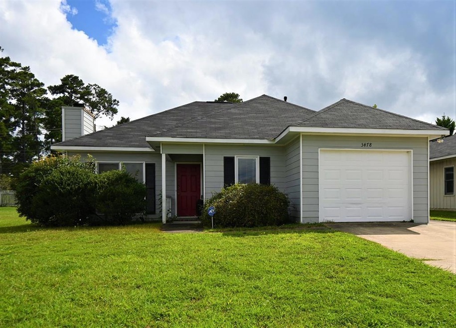
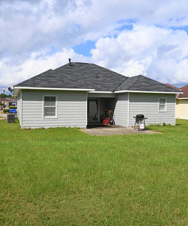
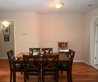
This 3 bedroom, 2 bath home is the perfect starter home or could be used as a rental property. As you walk into the home you find a family room/dining room combination. There is a kitchen that has direct access to the 1-car garage. This home features a split floor plan with 2 bedrooms sharing a 3 piece bathroom, then the Master Suite is on the other side. Flat backyard with partial fence as well as a small patio. This property is occupied and being shown by appointment only between 10AM - 6PM. Approximately 8-10 minutes to front gate of Ft Benning & 20-25 minutes to most any point in Columbus area.
Last Agent to Sell the Property
Executive Group Realty LLC Brokerage Phone: 7065071899 License #345478 Listed on: 09/18/2021
Last Buyer's Agent
Lanitra Sandifer Hicks
Waddell Haskin & Green Realty, LLC
| Date | Buyer | Sale Price | Title Company |
|---|---|---|---|
| Daw Property Of Columbus Llc | $113,000 | -- | |
| Mitchell Montavius D | $110,000 | None Available | |
| Hunsinger Renvia | -- | None Available | |
| Hunsinger Renvia | -- | None Available |
| Date | Status | Borrower | Loan Amount |
|---|---|---|---|
| Open | Daw Property Of Columbus Llc | $90,400 | |
| Previous Owner | Mitchell Montavius D | $108,033 |
| Date | Event | Price | List to Sale | Price per Sq Ft |
|---|---|---|---|---|
| 08/18/2024 08/18/24 | Off Market | $113,000 | -- | -- |
| 11/17/2021 11/17/21 | Sold | $113,000 | -4.2% | $91 / Sq Ft |
| 10/11/2021 10/11/21 | Pending | -- | -- | -- |
| 09/18/2021 09/18/21 | For Sale | $117,900 | -- | $95 / Sq Ft |
| Year | Tax Paid | Tax Assessment Tax Assessment Total Assessment is a certain percentage of the fair market value that is determined by local assessors to be the total taxable value of land and additions on the property. | Land | Improvement |
|---|---|---|---|---|
| 2025 | $1,767 | $54,644 | $8,596 | $46,048 |
| 2024 | $1,767 | $45,128 | $8,596 | $36,532 |
| 2023 | $1,778 | $45,128 | $8,596 | $36,532 |
| 2022 | $1,391 | $45,128 | $8,596 | $36,532 |
| 2021 | $1,233 | $34,060 | $8,596 | $25,464 |
| 2020 | $1,233 | $34,060 | $8,596 | $25,464 |
| 2019 | $1,239 | $34,060 | $8,596 | $25,464 |
| 2018 | $1,239 | $34,060 | $8,596 | $25,464 |
| 2017 | $1,245 | $34,060 | $8,596 | $25,464 |
| 2016 | $1,248 | $39,967 | $7,200 | $32,767 |
| 2015 | $1,252 | $39,967 | $7,200 | $32,767 |
| 2014 | $1,254 | $39,967 | $7,200 | $32,767 |
| 2013 | -- | $39,967 | $7,200 | $32,767 |
Seller's Agent in 2021
Paul Tommey
Executive Group Realty LLC
(762) 822-6411
7 in this area
51 Total Sales
L
Buyer's Agent in 2021
Lanitra Sandifer Hicks
Waddell Haskin & Green Realty, LLC
Source: Columbus Board of REALTORS® (GA)
MLS Number: 188285
APN: 113-023-034
Disclaimer: Certain information contained herein is derived from information provided by parties other than Homes.com. All information provided is deemed reliable, but is not guaranteed to be accurate and should be independently verified.
![]() IDX information is provided exclusively for personal, non-commercial use, and may not be used for any purpose other than to identify prospective properties consumers may be interested in purchasing. Information is deemed reliable but not guaranteed.
IDX information is provided exclusively for personal, non-commercial use, and may not be used for any purpose other than to identify prospective properties consumers may be interested in purchasing. Information is deemed reliable but not guaranteed.