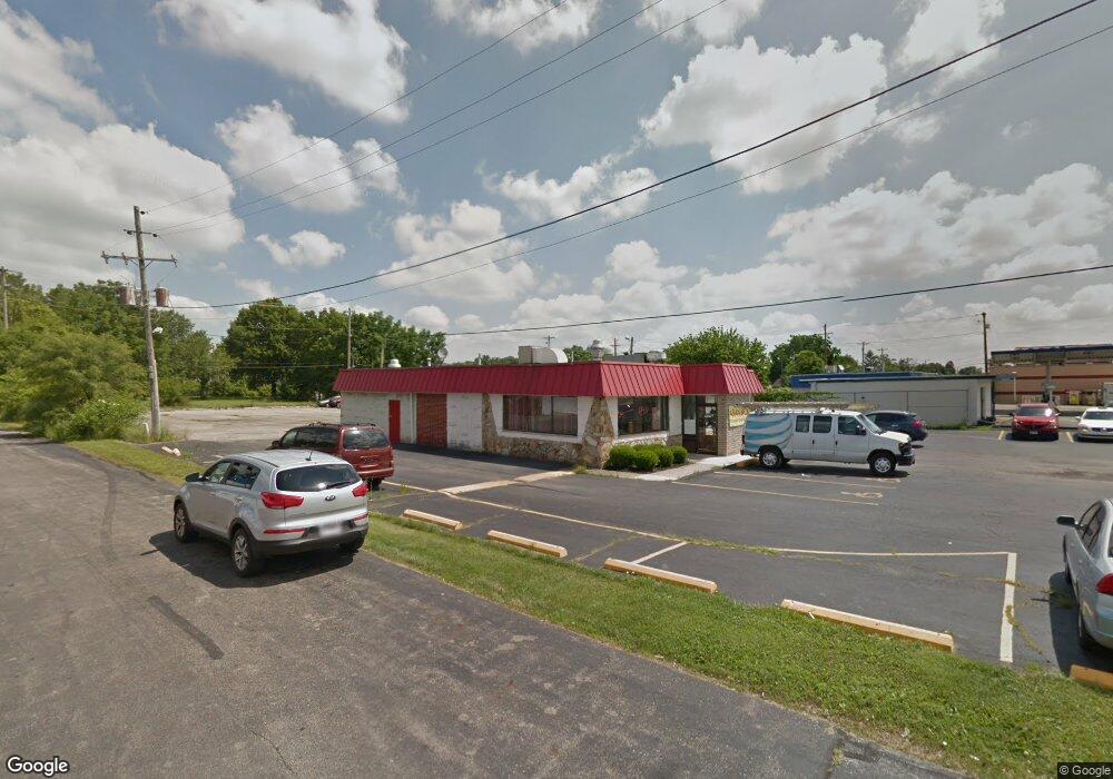
3482 Sullivant Ave Columbus, OH 43204
Westgate NeighborhoodEstimated Value: $428,013
--
Bed
--
Bath
2,517
Sq Ft
$170/Sq Ft
Est. Value
About This Home
This home is located at 3482 Sullivant Ave, Columbus, OH 43204 and is currently estimated at $428,013, approximately $170 per square foot. 3482 Sullivant Ave is a home located in Franklin County with nearby schools including Westgate Alternative Elementary School, Westmoor Middle School, and West High School.
Ownership History
Date
Name
Owned For
Owner Type
Purchase Details
Closed on
Oct 28, 2007
Sold by
Hupp Hee Development
Bought by
Lau Wai Yan and Liu Min
Current Estimated Value
Purchase Details
Closed on
Dec 18, 2000
Sold by
Hupp Hee Development
Bought by
City Of Columbus Ohio
Purchase Details
Closed on
Sep 7, 1990
Bought by
Hupp Hee Development
Purchase Details
Closed on
Dec 11, 1989
Purchase Details
Closed on
Apr 12, 1989
Create a Home Valuation Report for This Property
The Home Valuation Report is an in-depth analysis detailing your home's value as well as a comparison with similar homes in the area
Home Values in the Area
Average Home Value in this Area
Purchase History
| Date | Buyer | Sale Price | Title Company |
|---|---|---|---|
| Lau Wai Yan | $188,000 | Pillar Titl | |
| City Of Columbus Ohio | -- | Midland Celtic Title | |
| Hupp Hee Development | -- | -- | |
| -- | $140,000 | -- | |
| -- | $115,000 | -- |
Source: Public Records
Tax History Compared to Growth
Tax History
| Year | Tax Paid | Tax Assessment Tax Assessment Total Assessment is a certain percentage of the fair market value that is determined by local assessors to be the total taxable value of land and additions on the property. | Land | Improvement |
|---|---|---|---|---|
| 2024 | $5,474 | $73,750 | $40,220 | $33,530 |
| 2023 | $5,387 | $73,745 | $40,215 | $33,530 |
| 2022 | $6,864 | $91,530 | $42,250 | $49,280 |
| 2021 | $6,894 | $91,530 | $42,250 | $49,280 |
| 2020 | $6,846 | $91,530 | $42,250 | $49,280 |
| 2019 | $7,178 | $87,160 | $40,220 | $46,940 |
| 2018 | $6,901 | $87,160 | $40,220 | $46,940 |
| 2017 | $7,164 | $87,160 | $40,220 | $46,940 |
| 2016 | $7,159 | $82,260 | $40,220 | $42,040 |
| 2015 | $6,647 | $82,260 | $40,220 | $42,040 |
| 2014 | $6,643 | $82,260 | $40,220 | $42,040 |
| 2013 | $3,292 | $82,250 | $40,215 | $42,035 |
Source: Public Records
Map
Nearby Homes
- 585 Athens Ave
- 617 Athens St
- 695 Demorest Rd
- 3300-3302 Sullivant Ave
- 3276-3278 Sullivant Ave
- 756 Brixham Rd
- 328 S Southampton Ave
- 781 Stephen Dr W
- 253 Powhatan Ave
- 737 S Brinker Ave
- 195 S Sylvan Ave
- 840 Mark Place
- 0 S Brinker Ave
- 3874 Eakin Rd
- 3551 Glorious Rd
- 267 S Westgate Ave
- 3727-3729 Briggs Rd
- 79 S Southampton Ave
- 3318 Miriam Dr S
- 164 Alice Rita St
- 520 Josephine Ave
- 3528-3530 Sullivant Ave
- 483 Derrer Rd
- 510 Josephine Ave
- 3530 Sullivant Ave
- 0 Derrer Rd Unit 225007825
- 0 Derrer Rd Unit L210 2023696
- 0 Derrer Rd Unit L211 2023698
- 0 Derrer Rd Unit L209 2023694
- 0 Derrer Rd Unit L208 2023692
- 0 Derrer Rd Unit Lot 203 2925727
- 0 Derrer Rd
- 500 Josephine Ave
- 108 Derrer Rd
- 102 Derrer Rd
- 96 Derrer Rd
- 3434 Sullivant Ave
- 514 Derrer Rd
- 508 Derrer Rd
- 494 Josephine Ave