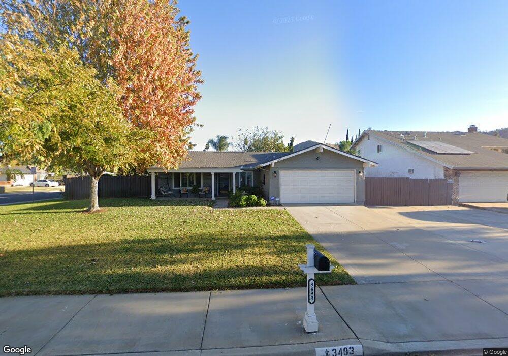
3493 Revere Rd Riverside, CA 92503
La Sierra South NeighborhoodEstimated Value: $619,655 - $637,000
3
Beds
2
Baths
1,533
Sq Ft
$410/Sq Ft
Est. Value
About This Home
This home is located at 3493 Revere Rd, Riverside, CA 92503 and is currently estimated at $628,664, approximately $410 per square foot. 3493 Revere Rd is a home located in Riverside County with nearby schools including Alan Orrenmaa Elementary School, Arizona Middle School, and Hillcrest High School.
Ownership History
Date
Name
Owned For
Owner Type
Purchase Details
Closed on
Nov 1, 2023
Sold by
Morales Joan M
Bought by
Joan Morales Family Trust and Morales
Current Estimated Value
Purchase Details
Closed on
Jul 2, 1996
Sold by
Maneri Thomas L and Maneri Peggy C
Bought by
Morales Joan M
Home Financials for this Owner
Home Financials are based on the most recent Mortgage that was taken out on this home.
Original Mortgage
$114,008
Interest Rate
8.32%
Mortgage Type
FHA
Create a Home Valuation Report for This Property
The Home Valuation Report is an in-depth analysis detailing your home's value as well as a comparison with similar homes in the area
Home Values in the Area
Average Home Value in this Area
Purchase History
| Date | Buyer | Sale Price | Title Company |
|---|---|---|---|
| Joan Morales Family Trust | -- | None Listed On Document | |
| Morales Joan M | $124,500 | Orange Coast Title |
Source: Public Records
Mortgage History
| Date | Status | Borrower | Loan Amount |
|---|---|---|---|
| Previous Owner | Morales Joan M | $114,008 |
Source: Public Records
Tax History Compared to Growth
Tax History
| Year | Tax Paid | Tax Assessment Tax Assessment Total Assessment is a certain percentage of the fair market value that is determined by local assessors to be the total taxable value of land and additions on the property. | Land | Improvement |
|---|---|---|---|---|
| 2025 | $2,381 | $202,410 | $81,416 | $120,994 |
| 2023 | $2,381 | $194,552 | $78,255 | $116,297 |
| 2022 | $2,202 | $190,738 | $76,721 | $114,017 |
| 2021 | $2,175 | $186,999 | $75,217 | $111,782 |
| 2020 | $2,140 | $185,082 | $74,446 | $110,636 |
| 2019 | $2,111 | $181,454 | $72,987 | $108,467 |
| 2018 | $2,081 | $177,897 | $71,556 | $106,341 |
| 2017 | $2,042 | $174,409 | $70,153 | $104,256 |
| 2016 | $2,007 | $170,990 | $68,778 | $102,212 |
| 2015 | $1,976 | $168,424 | $67,746 | $100,678 |
| 2014 | $1,968 | $165,126 | $66,420 | $98,706 |
Source: Public Records
Map
Nearby Homes
- 3579 Paine Dr
- 3517 Ganador Ct
- 11641 Hartford Ct
- 3701 Fillmore St Unit 36
- 3371 Amhurst Dr
- 11383 Millard Dr
- 3666 Ada Ct
- 0 Rancho Corto Dr
- 10997 Cedarhurst Way
- 11499 Bridgeway Dr
- 12149 Indiana Ave Unit 18
- 12149 Indiana Ave Unit 95
- 11230 Reliance Dr
- 3103 Eastman Ct
- 3663 Buchanan St Unit 112
- 3663 Buchanan St Unit 130
- 11390 Parkfield Ct
- 3883 Buchanan St Unit Space 17
- 3883 Buchanan St Unit 65
- 3883 Buchanan St Unit 3