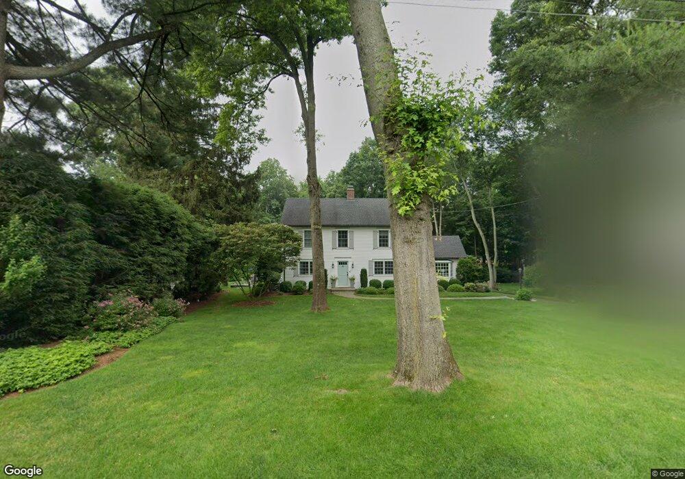
35 Briar Brae Rd Darien, CT 06820
Estimated Value: $2,354,000 - $2,589,000
4
Beds
3
Baths
3,409
Sq Ft
$728/Sq Ft
Est. Value
About This Home
This home is located at 35 Briar Brae Rd, Darien, CT 06820 and is currently estimated at $2,482,547, approximately $728 per square foot. 35 Briar Brae Rd is a home located in Fairfield County with nearby schools including Holmes Elementary School, Middlesex Middle School, and Darien High School.
Ownership History
Date
Name
Owned For
Owner Type
Purchase Details
Closed on
Aug 18, 2006
Sold by
Jr E Gerard Berrig and Berrigan Ann S J
Bought by
Firgeleski Michael and Firgeleski Alison
Current Estimated Value
Purchase Details
Closed on
Dec 15, 1995
Sold by
Foley Donald and Foley Lisa
Bought by
Berrigan E Gerard and Berrigan Ann
Purchase Details
Closed on
Oct 24, 1991
Sold by
Cortes Eduardo and Cortes Jean
Bought by
Foley Donald and Foley Lisa
Create a Home Valuation Report for This Property
The Home Valuation Report is an in-depth analysis detailing your home's value as well as a comparison with similar homes in the area
Home Values in the Area
Average Home Value in this Area
Purchase History
| Date | Buyer | Sale Price | Title Company |
|---|---|---|---|
| Firgeleski Michael | $927,000 | -- | |
| Berrigan E Gerard | $472,000 | -- | |
| Foley Donald | $385,000 | -- |
Source: Public Records
Mortgage History
| Date | Status | Borrower | Loan Amount |
|---|---|---|---|
| Open | Foley Donald | $969,000 |
Source: Public Records
Tax History Compared to Growth
Tax History
| Year | Tax Paid | Tax Assessment Tax Assessment Total Assessment is a certain percentage of the fair market value that is determined by local assessors to be the total taxable value of land and additions on the property. | Land | Improvement |
|---|---|---|---|---|
| 2025 | $19,919 | $1,286,740 | $648,340 | $638,400 |
| 2024 | $18,902 | $1,286,740 | $648,340 | $638,400 |
| 2023 | $17,634 | $1,001,350 | $463,050 | $538,300 |
| 2022 | $17,253 | $1,001,350 | $463,050 | $538,300 |
| 2021 | $16,863 | $1,001,350 | $463,050 | $538,300 |
| 2020 | $13,422 | $1,001,350 | $463,050 | $538,300 |
| 2019 | $0 | $1,001,350 | $463,050 | $538,300 |
| 2018 | $12,964 | $1,004,220 | $471,870 | $532,350 |
| 2017 | $16,228 | $1,004,220 | $471,870 | $532,350 |
| 2016 | $15,837 | $1,004,220 | $471,870 | $532,350 |
| 2015 | $15,415 | $1,004,220 | $471,870 | $532,350 |
| 2014 | $15,073 | $1,004,220 | $471,870 | $532,350 |
Source: Public Records
Map
Nearby Homes
- 825 Hope St Unit 4
- 11 Old Oak Rd
- 910 Hope St Unit 5B
- 900 Hope St Unit 8C
- 30 Lake Dr
- 970 Hope St Unit 4J
- 31 Chatfield St
- 76 Deepwood Rd
- 41 Wakemore St
- 143 Overbrook Dr
- 78 Elizabeth Ave
- 16 Columbus Place
- 31 Sussex Place
- 32 Kensett Ln Unit 32
- 72 Kensett Ln
- 95 Columbus Place Unit 6
- 172 Joffre Ave
- 23 Oenoke Place
- 17 Oenoke Place
- 44 Brundage St