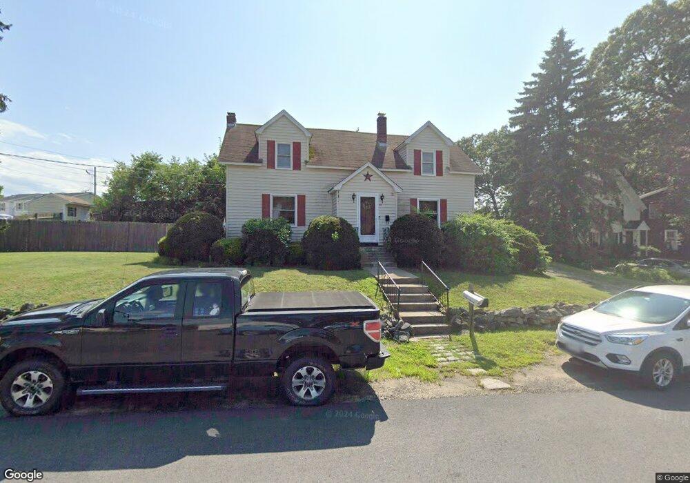
35 Furber St Lawrence, MA 01843
South West NeighborhoodEstimated Value: $531,000 - $595,000
3
Beds
2
Baths
1,368
Sq Ft
$420/Sq Ft
Est. Value
About This Home
This home is located at 35 Furber St, Lawrence, MA 01843 and is currently estimated at $575,146, approximately $420 per square foot. 35 Furber St is a home located in Essex County with nearby schools including South Terrace Elementary School, Olive Branch Elementary School, and John Breen School.
Ownership History
Date
Name
Owned For
Owner Type
Purchase Details
Closed on
Oct 22, 2020
Sold by
Furber Street Rt
Bought by
Berube Ronald J and Berube Diane
Current Estimated Value
Purchase Details
Closed on
May 22, 2013
Sold by
Berube Ronald J and Berube Diane
Bought by
Furber Street Rt and Berube Michelle R
Purchase Details
Closed on
Oct 14, 1981
Bought by
Furber St Rt
Create a Home Valuation Report for This Property
The Home Valuation Report is an in-depth analysis detailing your home's value as well as a comparison with similar homes in the area
Home Values in the Area
Average Home Value in this Area
Purchase History
| Date | Buyer | Sale Price | Title Company |
|---|---|---|---|
| Berube Ronald J | -- | None Available | |
| Furber Street Rt | -- | -- | |
| Furber St Rt | -- | -- |
Source: Public Records
Mortgage History
| Date | Status | Borrower | Loan Amount |
|---|---|---|---|
| Previous Owner | Furber St Rt | $150,000 | |
| Previous Owner | Furber St Rt | $35,000 | |
| Previous Owner | Furber St Rt | $30,000 | |
| Previous Owner | Furber St Rt | $90,000 |
Source: Public Records
Tax History Compared to Growth
Tax History
| Year | Tax Paid | Tax Assessment Tax Assessment Total Assessment is a certain percentage of the fair market value that is determined by local assessors to be the total taxable value of land and additions on the property. | Land | Improvement |
|---|---|---|---|---|
| 2025 | $4,650 | $528,400 | $190,300 | $338,100 |
| 2024 | $4,196 | $453,600 | $150,800 | $302,800 |
| 2023 | $4,434 | $436,400 | $150,800 | $285,600 |
| 2022 | $4,515 | $394,700 | $149,800 | $244,900 |
| 2021 | $4,302 | $350,600 | $147,700 | $202,900 |
| 2020 | $4,055 | $326,200 | $130,000 | $196,200 |
| 2019 | $3,975 | $290,600 | $109,200 | $181,400 |
| 2018 | $3,779 | $263,900 | $104,200 | $159,700 |
| 2017 | $3,654 | $238,200 | $98,000 | $140,200 |
| 2016 | $3,494 | $225,300 | $84,000 | $141,300 |
| 2015 | $3,387 | $224,000 | $84,000 | $140,000 |
Source: Public Records
Map
Nearby Homes
- 37 Tewksbury St Unit 39
- 8 Packard St
- 54 Amherst St
- 312 Water St Unit 36
- 4 Bourque St
- 15 Beaconsfield St
- 629 Andover St
- 18 Ames St
- 11 Devonshire St
- 91-93 Newton St
- 95 Hancock St
- 439-443 Riverside Dr
- 450 Riverside Dr Unit 1
- 12 Merrimack View Ct
- 42 Beresford St
- 55-59 Water St
- 49 Bowdoin St Unit 51
- 33 Jefferson St
- 41 Durham St
- 11 W Hawley St
- 123 Everett St
- 29 Furber St
- 23 Furber St
- 25 Furber St
- 41 Furber St
- 22 Furber St
- 125 Everett St
- 119 Everett St
- 28 Furber St
- 24 Furber St
- 24 Furber St Unit B
- 24 Furber St Unit B24
- 6 Andover Terrace
- 10 Andover Terrace
- 14 Andover Terrace
- 2 Andover Terrace
- 612 Andover St Unit 614
- 20 Furber St
- 18 Furber St
- 18 Furber St Unit 18,1