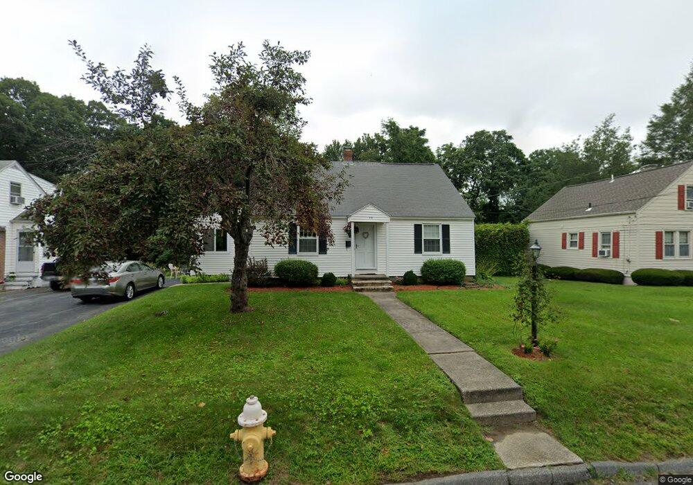
35 Hapgood Rd Worcester, MA 01605
Forest Grove NeighborhoodEstimated Value: $431,014 - $557,000
3
Beds
2
Baths
1,470
Sq Ft
$351/Sq Ft
Est. Value
About This Home
This home is located at 35 Hapgood Rd, Worcester, MA 01605 and is currently estimated at $515,754, approximately $350 per square foot. 35 Hapgood Rd is a home located in Worcester County with nearby schools including Nelson Place Elementary School, Jacob Hiatt Magnet School, and Chandler Magnet.
Create a Home Valuation Report for This Property
The Home Valuation Report is an in-depth analysis detailing your home's value as well as a comparison with similar homes in the area
Home Values in the Area
Average Home Value in this Area
Tax History
| Year | Tax Paid | Tax Assessment Tax Assessment Total Assessment is a certain percentage of the fair market value that is determined by local assessors to be the total taxable value of land and additions on the property. | Land | Improvement |
|---|---|---|---|---|
| 2025 | $4,822 | $365,600 | $123,600 | $242,000 |
| 2024 | $4,676 | $340,100 | $123,600 | $216,500 |
| 2023 | $4,335 | $302,300 | $106,400 | $195,900 |
| 2022 | $4,107 | $270,000 | $85,100 | $184,900 |
| 2021 | $3,552 | $218,200 | $68,100 | $150,100 |
| 2020 | $3,378 | $198,700 | $68,000 | $130,700 |
| 2019 | $3,524 | $195,800 | $65,500 | $130,300 |
| 2018 | $3,485 | $184,300 | $65,500 | $118,800 |
| 2017 | $3,337 | $173,600 | $65,500 | $108,100 |
| 2016 | $3,287 | $159,500 | $53,700 | $105,800 |
| 2015 | $3,201 | $159,500 | $53,700 | $105,800 |
| 2014 | $3,093 | $158,300 | $53,700 | $104,600 |
Source: Public Records
Map
Nearby Homes
Your Personal Tour Guide
Ask me questions while you tour the home.