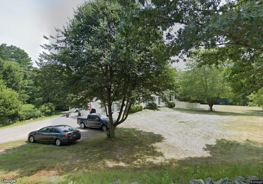
35 Thornton Ferry Road II Amherst, NH 03031
Estimated Value: $845,868 - $1,030,000
4
Beds
4
Baths
3,404
Sq Ft
$270/Sq Ft
Est. Value
About This Home
This home is located at 35 Thornton Ferry Road II, Amherst, NH 03031 and is currently estimated at $919,967, approximately $270 per square foot. 35 Thornton Ferry Road II is a home with nearby schools including Wilkins Elementary School, Amherst Middle School, and Souhegan Cooperative High School.
Ownership History
Date
Name
Owned For
Owner Type
Purchase Details
Closed on
Sep 1, 2004
Sold by
Quick Timothy W
Bought by
Mccarthy Daniel C and Mccarthy Loretta
Current Estimated Value
Home Financials for this Owner
Home Financials are based on the most recent Mortgage that was taken out on this home.
Original Mortgage
$412,400
Outstanding Balance
$206,083
Interest Rate
6.01%
Mortgage Type
Purchase Money Mortgage
Estimated Equity
$713,884
Purchase Details
Closed on
Aug 27, 1999
Sold by
Chur Amherst Christian
Bought by
Quick Timothy W and Quick Susan D
Home Financials for this Owner
Home Financials are based on the most recent Mortgage that was taken out on this home.
Original Mortgage
$314,100
Interest Rate
7.53%
Create a Home Valuation Report for This Property
The Home Valuation Report is an in-depth analysis detailing your home's value as well as a comparison with similar homes in the area
Home Values in the Area
Average Home Value in this Area
Purchase History
| Date | Buyer | Sale Price | Title Company |
|---|---|---|---|
| Mccarthy Daniel C | $515,000 | -- | |
| Quick Timothy W | $349,000 | -- |
Source: Public Records
Mortgage History
| Date | Status | Borrower | Loan Amount |
|---|---|---|---|
| Open | Quick Timothy W | $150,000 | |
| Closed | Quick Timothy W | $139,000 | |
| Open | Quick Timothy W | $412,400 | |
| Previous Owner | Quick Timothy W | $314,100 |
Source: Public Records
Tax History Compared to Growth
Tax History
| Year | Tax Paid | Tax Assessment Tax Assessment Total Assessment is a certain percentage of the fair market value that is determined by local assessors to be the total taxable value of land and additions on the property. | Land | Improvement |
|---|---|---|---|---|
| 2024 | $13,414 | $585,000 | $158,800 | $426,200 |
| 2023 | $12,798 | $584,900 | $158,800 | $426,100 |
| 2022 | $12,359 | $584,900 | $158,800 | $426,100 |
| 2021 | $12,464 | $584,900 | $158,800 | $426,100 |
| 2020 | $12,597 | $442,300 | $128,800 | $313,500 |
| 2019 | $11,924 | $442,300 | $128,800 | $313,500 |
| 2018 | $12,022 | $441,500 | $128,800 | $312,700 |
| 2017 | $11,483 | $441,500 | $128,800 | $312,700 |
| 2016 | $11,082 | $441,500 | $128,800 | $312,700 |
| 2015 | $11,596 | $437,900 | $132,800 | $305,100 |
| 2014 | $11,674 | $437,900 | $132,800 | $305,100 |
| 2013 | $11,582 | $437,900 | $132,800 | $305,100 |
Source: Public Records
Map
Nearby Homes
- 24 Deerwood Dr
- 1 County Rd
- 148 County Rd
- 150 County Rd Unit 4-142-8
- 150 County Rd
- 101-2 Seaverns Bridge Rd
- 105 Seaverns Bridge Rd
- 103 Seaverns Bridge Rd
- 80 Peaslee Rd
- 2 County Rd
- 12 Fairway Dr
- 6 Mason Rd
- 15 Four Winds Rd
- 25 Eastern Ave
- 6 Veterans Rd Unit 15
- 16 Captain Danforth Ln
- 11 Queens Way
- 1A Debbie Ln
- 9 Northfield Rd
- 2 Benning St
- 34 Thornton Ferry Road II
- 37 Thornton Ferry Road II
- 33 Thornton Ferry Road II
- 39 Thornton Ferry Road II
- 41 Thornton Ferry Road II
- 41 Thornton Ferry Road II
- 1 Danbury Cir
- 30 Thornton Ferry Road II
- 31 Danbury Cir
- 28 Danbury Cir
- 29 Danbury Cir
- 28 Thornton Ferry Road II
- 3 Danbury Cir
- 38 Thornton Ferry Road II
- 38 Thornton Ferry Road II
- 4 Danbury Cir
- 34 Simeon Wilson Rd
- 27 Danbury Cir
- 5 Danbury Cir
- 36 Simeon Wilson Rd